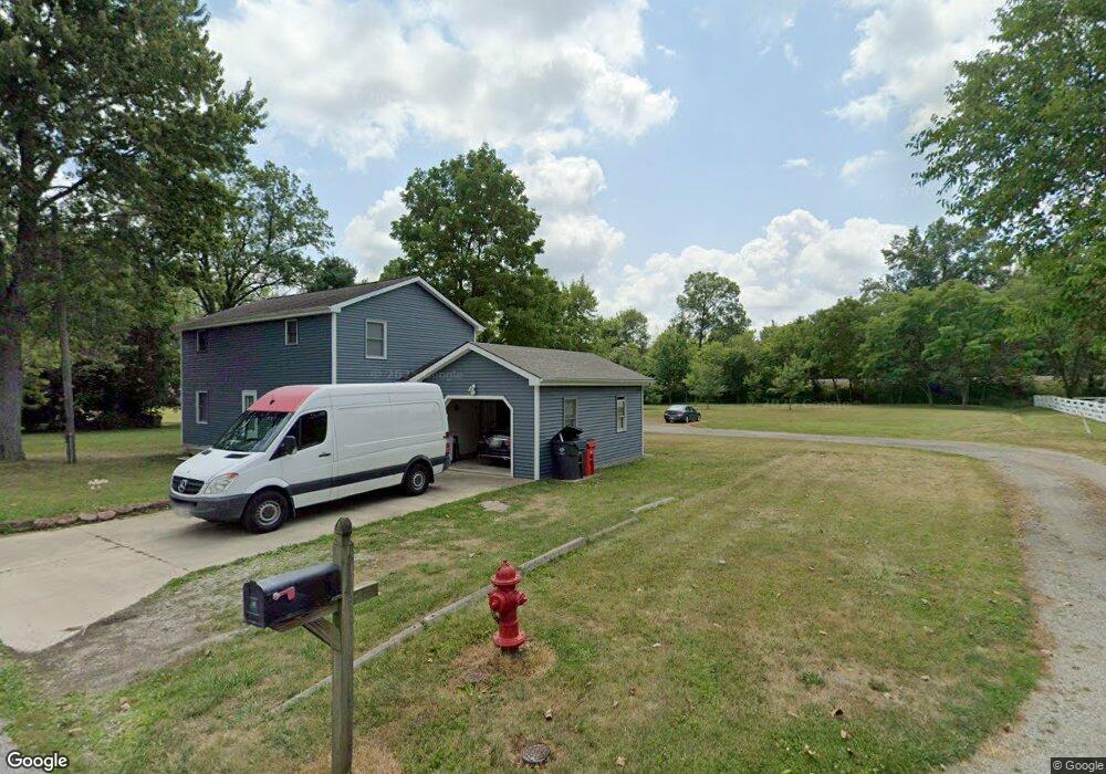
189 West St Pataskala, OH 43062
Estimated Value: $173,781 - $268,000
3
Beds
1
Bath
1,400
Sq Ft
$167/Sq Ft
Est. Value
About This Home
This home is located at 189 West St, Pataskala, OH 43062 and is currently estimated at $233,945, approximately $167 per square foot. 189 West St is a home located in Licking County with nearby schools including North Elementary School, Licking Heights Central, and Licking Heights High School.
Ownership History
Date
Name
Owned For
Owner Type
Purchase Details
Closed on
Apr 6, 1999
Sold by
Thomas Bessie L
Bought by
Maynard Jesse and Maynard Donna K
Current Estimated Value
Home Financials for this Owner
Home Financials are based on the most recent Mortgage that was taken out on this home.
Original Mortgage
$4,500
Outstanding Balance
$1,125
Interest Rate
6.89%
Mortgage Type
New Conventional
Estimated Equity
$232,820
Create a Home Valuation Report for This Property
The Home Valuation Report is an in-depth analysis detailing your home's value as well as a comparison with similar homes in the area
Home Values in the Area
Average Home Value in this Area
Purchase History
| Date | Buyer | Sale Price | Title Company |
|---|---|---|---|
| Maynard Jesse | $8,000 | -- |
Source: Public Records
Mortgage History
| Date | Status | Borrower | Loan Amount |
|---|---|---|---|
| Open | Maynard Jesse | $4,500 |
Source: Public Records
Tax History Compared to Growth
Tax History
| Year | Tax Paid | Tax Assessment Tax Assessment Total Assessment is a certain percentage of the fair market value that is determined by local assessors to be the total taxable value of land and additions on the property. | Land | Improvement |
|---|---|---|---|---|
| 2024 | $1,042 | $29,960 | $26,670 | $3,290 |
| 2023 | $1,114 | $29,960 | $26,670 | $3,290 |
| 2022 | $663 | $19,360 | $16,420 | $2,940 |
| 2021 | $676 | $19,360 | $16,420 | $2,940 |
| 2020 | $669 | $19,360 | $16,420 | $2,940 |
| 2019 | $497 | $16,040 | $13,690 | $2,350 |
| 2018 | $502 | $0 | $0 | $0 |
| 2017 | $514 | $0 | $0 | $0 |
| 2016 | $359 | $0 | $0 | $0 |
| 2015 | $172 | $0 | $0 | $0 |
| 2014 | $219 | $0 | $0 | $0 |
| 2013 | $5,986 | $0 | $0 | $0 |
Source: Public Records
Map
Nearby Homes
- 0 Mink St SW
- 0 Mink St SW Unit 13 225006231
- 23 1st St SW
- 11034 Broad St SW
- 55 1st St SW
- 5181 Mink St SW
- 211 Rona Blvd
- 209 Rona Blvd
- 7376 Mink St SW
- 220 Woodland Sky Dr
- 131 Broadmoore Blvd
- 507 Curry Dr
- 426 Waterlily Ln
- 413 Halton Dr
- 13771 Cleveland Rd SW
- 405 Waterlily Ln
- 13770 Cleveland Rd SW
- 372 Isaac Tharp St
- 368 Isaac Tharp St
- 342 Isaac Tharp St
- 65 West Ave SW
- 25 West Ave SW
- 70 West Ave SW
- 124 Connor Ave SW
- 54 West Ave SW
- 54 West Ave SW
- 69 East Ave SW
- 0 Connor Ave SW Unit 2721126
- 0 Connor Ave SW Unit 11816
- 0 Connor Ave SW Unit 9809026
- 0 Connor Ave SW Unit 2206530
- 0 Connor Ave SW Unit Lot 13 2834643
- 0 Connor Ave SW Unit Lot 12 2834637
- 0 Connor Ave SW Unit Lot 18 2834468
- 0 Connor Ave SW Unit 222032048
- 0 Connor Ave SW Unit 222022924
- 0 Connor Ave SW Unit Lt12&13 212027925
- 0 Connor Ave SW Unit 220019632
- 0 Connor Ave SW Unit 220016131
- 0 Connor Ave SW Unit 219036063