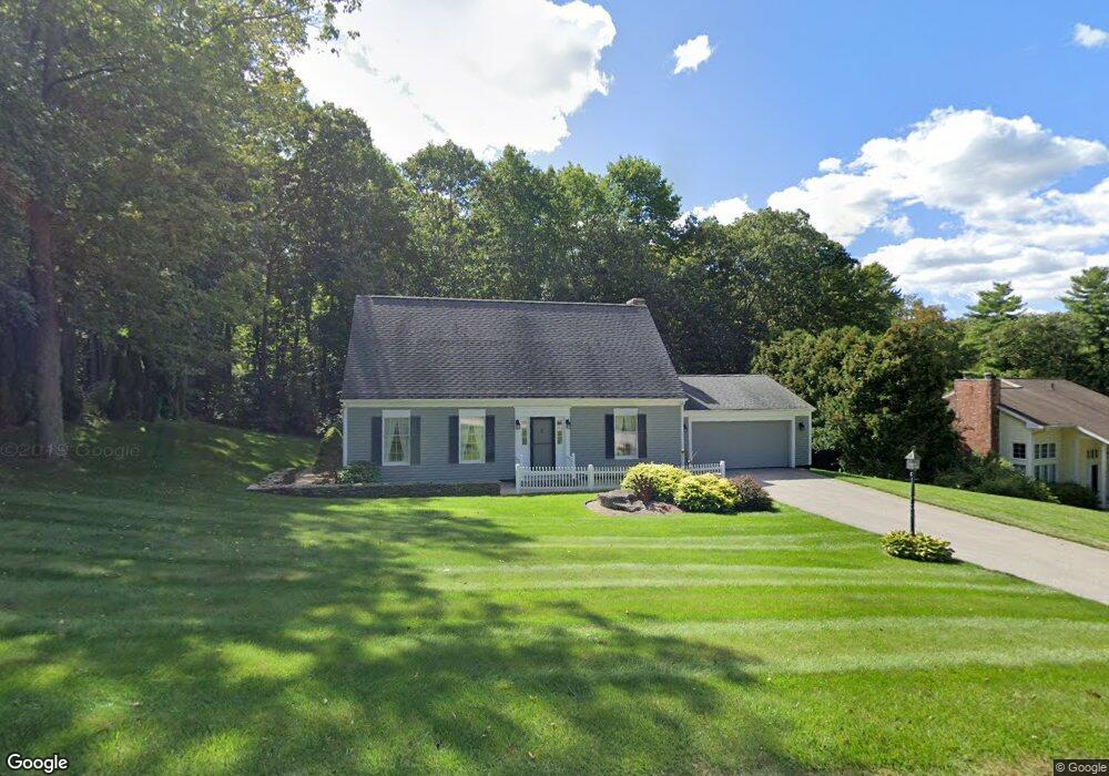
19 Deerwood Dr Danielson, CT 06239
Estimated Value: $429,275 - $533,000
3
Beds
3
Baths
1,911
Sq Ft
$255/Sq Ft
Est. Value
About This Home
This home is located at 19 Deerwood Dr, Danielson, CT 06239 and is currently estimated at $487,319, approximately $255 per square foot. 19 Deerwood Dr is a home located in Windham County with nearby schools including Killingly Central School, Killingly Memorial School, and Killingly Intermediate School.
Ownership History
Date
Name
Owned For
Owner Type
Purchase Details
Closed on
Aug 25, 2005
Sold by
Howard Michael A and Howard Kathleen K
Bought by
Gresh Richard H and Gresh Brenda J
Current Estimated Value
Home Financials for this Owner
Home Financials are based on the most recent Mortgage that was taken out on this home.
Original Mortgage
$272,000
Outstanding Balance
$143,963
Interest Rate
5.68%
Estimated Equity
$343,356
Create a Home Valuation Report for This Property
The Home Valuation Report is an in-depth analysis detailing your home's value as well as a comparison with similar homes in the area
Home Values in the Area
Average Home Value in this Area
Purchase History
| Date | Buyer | Sale Price | Title Company |
|---|---|---|---|
| Gresh Richard H | $357,000 | -- | |
| Gresh Richard H | $357,000 | -- |
Source: Public Records
Mortgage History
| Date | Status | Borrower | Loan Amount |
|---|---|---|---|
| Open | Gresh Richard H | $272,000 | |
| Closed | Gresh Richard H | $272,000 | |
| Previous Owner | Gresh Richard H | $100,000 |
Source: Public Records
Tax History Compared to Growth
Tax History
| Year | Tax Paid | Tax Assessment Tax Assessment Total Assessment is a certain percentage of the fair market value that is determined by local assessors to be the total taxable value of land and additions on the property. | Land | Improvement |
|---|---|---|---|---|
| 2025 | $5,779 | $246,460 | $37,580 | $208,880 |
| 2024 | $5,439 | $246,460 | $37,580 | $208,880 |
| 2023 | $4,581 | $159,880 | $30,940 | $128,940 |
| 2022 | $4,302 | $159,880 | $30,940 | $128,940 |
| 2021 | $4,302 | $159,880 | $30,940 | $128,940 |
| 2020 | $4,211 | $159,880 | $30,940 | $128,940 |
| 2019 | $4,294 | $159,880 | $30,940 | $128,940 |
| 2017 | $3,797 | $129,990 | $23,940 | $106,050 |
| 2016 | $3,784 | $129,990 | $23,940 | $106,050 |
| 2015 | $3,810 | $129,990 | $23,940 | $106,050 |
| 2014 | $3,706 | $129,990 | $23,940 | $106,050 |
Source: Public Records
Map
Nearby Homes
- 61 Deerwood Dr
- 14 Valley View Dr
- 18 Valley View Dr
- 16 Valley View Dr
- 842 Hartford Pike
- 10 Conrad's Park
- 1032 N Main St Unit 9
- 1067 N Main St
- 300 Valley Rd
- 860 N Main St
- 140 Woodward St
- 17 Hillside Terrace
- 165 Breakneck Hill Rd
- 333 Breakneck Hill Rd
- 65 Stone St
- 11 Kenneth Dr
- 69 Peckham Ln
- 85 Soap St
- 3 Ferland Dr
- 16 James St
- 15 Deerwood Dr
- 25 Deerwood Dr
- 51 Deerwood Dr
- 11 Deerwood Dr
- 18 Deerwood Dr
- 35 Deerwood Dr
- 22 Deerwood Dr
- 12 Deerwood Dr
- 26 Deerwood Dr
- 4 Deerwood Dr
- 28 Deerwood Dr
- 43 Deerwood Dr
- 109 Valley Rd
- 49 Deerwood Dr
- 825 Cook Hill Rd
- 30 Deerwood Dr
- 55 Deerwood Dr
- 831 Cook Hill Rd
- 56 Deerwood Dr
- 819 Cook Hill Rd