
19 Floyd Brown Dr Fargo, AR 72021
Estimated payment $2,111/month
About This Lot
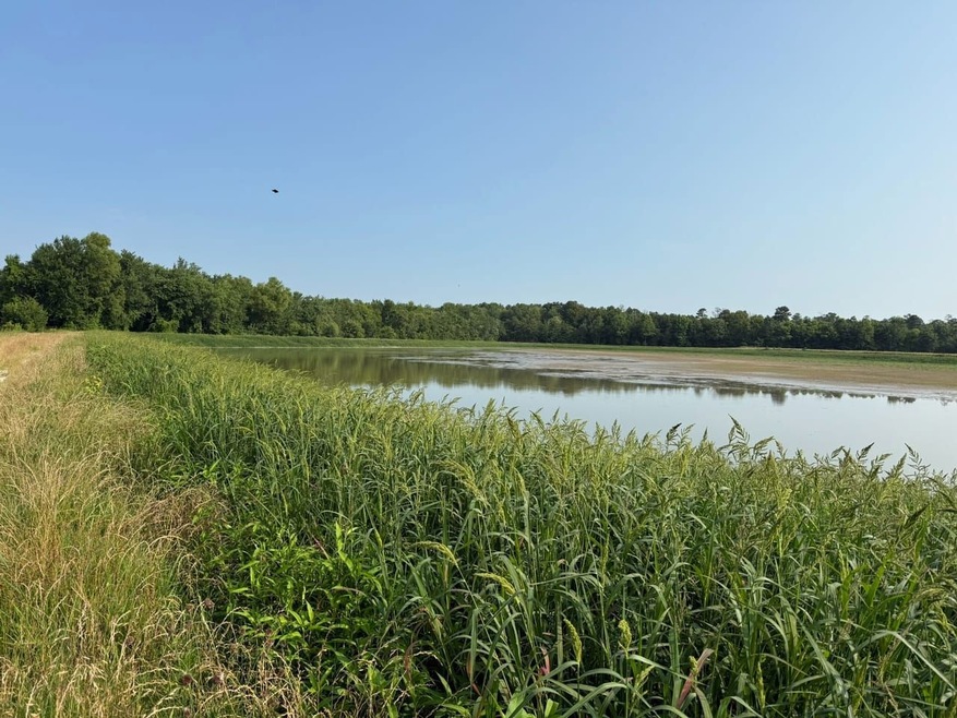
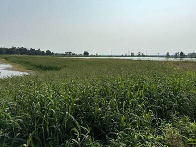
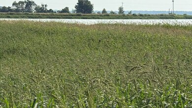
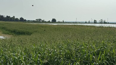
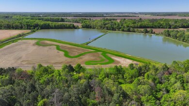
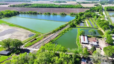
Located north of Brinkley and Interstate 40, near Fargo, Arkansas, the Files Farm includes two tracts totaling 86.7 surveyed acres. Tract 1 covers 46.53 acres and is located on Floyd Brown Road. This tract has a 2-acre shop area equipped for farming minnows, with a 1920 sqft shop, operational minnow vats, and 3 feed bins. The remaining acreage consists of various reservoirs, an irrigation well, and water control structures.
Tract 2 is 40.17 acres and is located half a mile southeast on Weaver Road. It features a small farm field in the southwest corner, with the rest comprising 3 shallow water reservoirs, all with water control systems and one electric irrigation well.
This farm has been a fully functioning minnow farm for over 30 years, consistently producing a good minnow crop annually. The current farm lease expires on December 31, 2024. Additionally, the farm is located in an area suitable for waterfowl hunting. Positioned 1.5 miles east of Bayou Deview, Benson Creek Natural Area, and the Cache River Refuge, the property is near known duck hunting areas. The property could potentially be managed for duck hunting purposes.
The seller's father previously ran a duck hunting camp on the land before it was leased to a minnow farmer.
For more information about the current farm lease or inquiries about this property, please contact Robert Eason at 501-416-6923 .

Property Details
Property Type
- Land
Est. Annual Taxes
- $410
Lot Details
- Waterfront
- Current uses include hunting/fishing, row crop
Property Views
- Water Views
Map
Home Values in the Area
Average Home Value in this Area
Tax History
| Year | Tax Paid | Tax Assessment Tax Assessment Total Assessment is a certain percentage of the fair market value that is determined by local assessors to be the total taxable value of land and additions on the property. | Land | Improvement |
|---|---|---|---|---|
| 2024 | $410 | $7,350 | $1,990 | $5,360 |
| 2023 | $355 | $7,350 | $1,990 | $5,360 |
| 2022 | $355 | $7,350 | $1,990 | $5,360 |
| 2021 | $355 | $7,350 | $1,990 | $5,360 |
| 2020 | $355 | $7,350 | $1,990 | $5,360 |
| 2019 | $305 | $6,580 | $1,620 | $4,960 |
| 2018 | $75 | $1,620 | $1,620 | $0 |
| 2017 | $0 | $1,620 | $1,620 | $0 |
| 2016 | -- | $1,620 | $1,620 | $0 |
Property History
| Date | Event | Price | Change | Sq Ft Price |
|---|---|---|---|---|
| 04/07/2025 04/07/25 | Price Changed | $375,000 | -6.0% | -- |
| 04/07/2025 04/07/25 | For Sale | $399,000 | 0.0% | -- |
| 04/01/2025 04/01/25 | Off Market | $399,000 | -- | -- |
| 12/30/2024 12/30/24 | Price Changed | $399,000 | -11.3% | -- |
| 10/03/2024 10/03/24 | For Sale | $450,000 | 0.0% | -- |
| 09/21/2024 09/21/24 | Off Market | $450,000 | -- | -- |
| 04/19/2024 04/19/24 | For Sale | $450,000 | -- | -- |
- 0 Chestnut St
- 1616 Sfc 935 Unit LotWP001
- 1616 Sfc 935
- 32518 Hwy 17
- 2328 N Main St
- Exit 216 I-40 8 75 Acres + - Dr
- Exit 216 I-40 25 Acres + - Dr
- TBD Broadmore Dr
- 0 Wood Fin Rd
- 0 Dixon St
- 1115 N Charlyne Ave
- TBD E Douglas Ave
- 407 N Rice St
- 0 Grand N
- 38 E Cypress St
- 606 Hazel Ave
- 511 S New Orleans Ave
- Lots 11-13 Winding Ave
- 808 S New Orleans Ave
- 416 Dial Cir