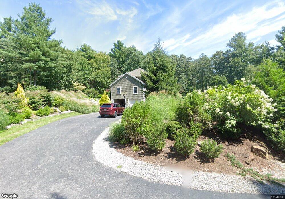
19 Lovett Rd Oxford, MA 01540
Estimated Value: $638,000 - $671,000
3
Beds
4
Baths
2,672
Sq Ft
$245/Sq Ft
Est. Value
About This Home
This home is located at 19 Lovett Rd, Oxford, MA 01540 and is currently estimated at $654,764, approximately $245 per square foot. 19 Lovett Rd is a home located in Worcester County with nearby schools including Alfred M Chaffee, Oxford High School, and Clara Barton Elementary School.
Ownership History
Date
Name
Owned For
Owner Type
Purchase Details
Closed on
May 13, 2004
Sold by
Davis Heather M and Davis Heather
Bought by
Mass Electric Co and Verizon Ne Inc
Current Estimated Value
Purchase Details
Closed on
Jul 30, 2003
Sold by
Trainor Elizabeth F
Bought by
Davis Heather M and Davis Jonathan E
Home Financials for this Owner
Home Financials are based on the most recent Mortgage that was taken out on this home.
Original Mortgage
$283,500
Interest Rate
5.28%
Mortgage Type
Purchase Money Mortgage
Create a Home Valuation Report for This Property
The Home Valuation Report is an in-depth analysis detailing your home's value as well as a comparison with similar homes in the area
Home Values in the Area
Average Home Value in this Area
Purchase History
| Date | Buyer | Sale Price | Title Company |
|---|---|---|---|
| Mass Electric Co | -- | -- | |
| Davis Heather M | $95,000 | -- |
Source: Public Records
Mortgage History
| Date | Status | Borrower | Loan Amount |
|---|---|---|---|
| Previous Owner | Davis Heather M | $283,500 |
Source: Public Records
Tax History Compared to Growth
Tax History
| Year | Tax Paid | Tax Assessment Tax Assessment Total Assessment is a certain percentage of the fair market value that is determined by local assessors to be the total taxable value of land and additions on the property. | Land | Improvement |
|---|---|---|---|---|
| 2025 | $73 | $578,100 | $133,000 | $445,100 |
| 2024 | $7,223 | $535,800 | $126,800 | $409,000 |
| 2023 | $6,696 | $490,900 | $121,300 | $369,600 |
| 2022 | $6,598 | $408,300 | $97,300 | $311,000 |
| 2021 | $6,376 | $385,700 | $93,000 | $292,700 |
| 2020 | $6,158 | $369,600 | $93,000 | $276,600 |
| 2019 | $5,986 | $351,500 | $93,000 | $258,500 |
| 2018 | $5,673 | $328,500 | $93,000 | $235,500 |
| 2017 | $5,608 | $332,800 | $89,100 | $243,700 |
| 2016 | $5,634 | $332,800 | $89,100 | $243,700 |
| 2015 | $5,255 | $332,800 | $89,100 | $243,700 |
| 2014 | $5,123 | $341,500 | $86,900 | $254,600 |
Source: Public Records
Map
Nearby Homes
- 11 Lovett Rd
- 35 &33 Sutton Ave
- 15 Lind St
- 0 Dana Rd
- 18 Sutton Ave
- 12 New St
- 11 Sutton Ave
- 5 Carlton Ct
- 397 Main St
- 8 Turk Hollow Rd
- 6 Rawson Ave
- L0T 11 History Dr
- L0T 3 History Dr
- 3 Rhonda Rheault Dr
- 7 Millbury Blvd
- L0T 12 History Dr
- 0 Federal Hill Rd Unit 73422286
- 7 Tower Hill Rd
- 36 Locust St
- 9 Howarth Rd