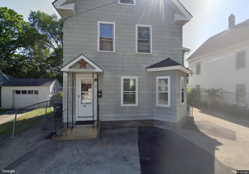
19 Perham St Nashua, NH 03064
North End Nashua NeighborhoodEstimated Value: $473,000 - $500,000
10
Beds
2
Baths
2,012
Sq Ft
$239/Sq Ft
Est. Value
About This Home
This home is located at 19 Perham St, Nashua, NH 03064 and is currently estimated at $480,044, approximately $238 per square foot. 19 Perham St is a home located in Hillsborough County with nearby schools including Mount Pleasant Elementary School, Pennichuck Middle School, and Nashua High School North.
Ownership History
Date
Name
Owned For
Owner Type
Purchase Details
Closed on
Nov 21, 2019
Sold by
Piper Alan W and Roberts Susan D
Bought by
Piper Alan
Current Estimated Value
Home Financials for this Owner
Home Financials are based on the most recent Mortgage that was taken out on this home.
Original Mortgage
$231,990
Outstanding Balance
$206,240
Interest Rate
4.25%
Mortgage Type
FHA
Estimated Equity
$273,804
Purchase Details
Closed on
May 25, 2001
Sold by
Ouellet Gervais Y and Ouellet Evelyn C
Bought by
Piper Alan W
Home Financials for this Owner
Home Financials are based on the most recent Mortgage that was taken out on this home.
Original Mortgage
$134,950
Interest Rate
7.05%
Mortgage Type
Purchase Money Mortgage
Create a Home Valuation Report for This Property
The Home Valuation Report is an in-depth analysis detailing your home's value as well as a comparison with similar homes in the area
Home Values in the Area
Average Home Value in this Area
Purchase History
| Date | Buyer | Sale Price | Title Company |
|---|---|---|---|
| Piper Alan | -- | -- | |
| Piper Alan W | $135,000 | -- |
Source: Public Records
Mortgage History
| Date | Status | Borrower | Loan Amount |
|---|---|---|---|
| Open | Piper Alan | $231,990 | |
| Previous Owner | Piper Alan W | $215,000 | |
| Previous Owner | Piper Alan W | $134,950 |
Source: Public Records
Tax History Compared to Growth
Tax History
| Year | Tax Paid | Tax Assessment Tax Assessment Total Assessment is a certain percentage of the fair market value that is determined by local assessors to be the total taxable value of land and additions on the property. | Land | Improvement |
|---|---|---|---|---|
| 2024 | $6,646 | $418,000 | $114,000 | $304,000 |
| 2023 | $6,240 | $342,300 | $91,200 | $251,100 |
| 2022 | $6,185 | $342,300 | $91,200 | $251,100 |
| 2021 | $5,252 | $226,200 | $60,800 | $165,400 |
| 2020 | $5,114 | $226,200 | $60,800 | $165,400 |
| 2019 | $4,922 | $226,200 | $60,800 | $165,400 |
| 2018 | $4,798 | $226,200 | $60,800 | $165,400 |
| 2017 | $4,952 | $192,000 | $70,900 | $121,100 |
| 2016 | $4,813 | $192,000 | $70,900 | $121,100 |
| 2015 | $4,710 | $192,000 | $70,900 | $121,100 |
| 2014 | $4,618 | $192,000 | $70,900 | $121,100 |
Source: Public Records
Map
Nearby Homes
- 46 Perham St Unit 214
- 15 Atherton Ave
- 19 Atherton Ave
- 13 Sapphire Ln
- 21 Edson St
- 36-38 Courtland St
- 71 Concord St
- 4 Chase St
- 434 Abbott Farm Ln
- 312 Abbott Farm Ln
- 18 Harbor Ave Unit 208
- 9 Doveton Ln Unit B
- 13 Mulvanity St
- 4 Reservoir St
- 73 Berkeley St
- 11 Charles St
- 5 Mulberry St
- 29 Derry St
- 19 Bartlett Ave
- 24 E Otterson St
- 17 Perham St
- 96 Lock St
- 9 Perham St Unit 15
- 26 Perham St Unit 28
- 10 Perham St Unit 16
- 92 Lock St Unit 92B
- 30 Perham St
- 35 Perham St
- 18 Perham St Unit 24
- 37 Perham St
- 94 Lock St
- 39 Perham St
- 38 Perham St
- 38 Perham St Unit F
- 38 Perham St Unit D
- 38 Perham St Unit E
- 38 Perham St Unit G
- 40 Perham St
- 88 1/2 Lock St Unit 229267
- 86 Lock St Unit 88