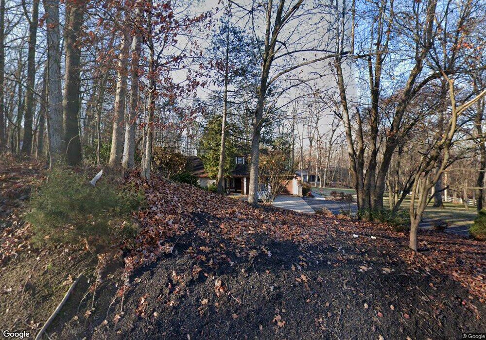
190 Ore Bank Rd Dillsburg, PA 17019
Estimated Value: $424,000 - $690,223
3
Beds
3
Baths
3,104
Sq Ft
$186/Sq Ft
Est. Value
About This Home
This home is located at 190 Ore Bank Rd, Dillsburg, PA 17019 and is currently estimated at $577,556, approximately $186 per square foot. 190 Ore Bank Rd is a home located in York County with nearby schools including Northern Middle School and Northern High School.
Ownership History
Date
Name
Owned For
Owner Type
Purchase Details
Closed on
Sep 20, 2021
Sold by
Stephenson Sandra M
Bought by
Stephenson Sandra M and Werner Tamela M
Current Estimated Value
Purchase Details
Closed on
Mar 16, 2019
Sold by
Stephenson Gomer L and Stephenson Sandra M
Bought by
Stephenson Gomer L and Stephenson Sandra M
Purchase Details
Closed on
Oct 20, 2015
Sold by
Stephenson Gomer L
Bought by
Stephenson Gomer L and Stephenson Sandra M
Purchase Details
Closed on
Dec 14, 2005
Sold by
Stephenson Sandra M
Bought by
Stephenson Gomer L
Purchase Details
Closed on
Jan 15, 1998
Sold by
Stephenson Iii Gomer L
Bought by
Stephenson Gomer L
Purchase Details
Closed on
Mar 1, 1981
Bought by
Stephenson Gomer L
Create a Home Valuation Report for This Property
The Home Valuation Report is an in-depth analysis detailing your home's value as well as a comparison with similar homes in the area
Home Values in the Area
Average Home Value in this Area
Purchase History
| Date | Buyer | Sale Price | Title Company |
|---|---|---|---|
| Stephenson Sandra M | -- | None Available | |
| Stephenson Gomer L | -- | None Available | |
| Stephenson Gomer L | -- | None Available | |
| Stephenson Gomer L | -- | None Available | |
| Stephenson Gomer L | -- | None Available | |
| Stephenson Gomer L | -- | None Available | |
| Stephenson Gomer L | -- | -- | |
| Stephenson Gomer L | $25,000 | -- |
Source: Public Records
Tax History Compared to Growth
Tax History
| Year | Tax Paid | Tax Assessment Tax Assessment Total Assessment is a certain percentage of the fair market value that is determined by local assessors to be the total taxable value of land and additions on the property. | Land | Improvement |
|---|---|---|---|---|
| 2025 | $10,942 | $361,780 | $62,750 | $299,030 |
| 2024 | $10,620 | $361,780 | $62,750 | $299,030 |
| 2023 | $10,425 | $361,780 | $62,750 | $299,030 |
| 2022 | $10,222 | $361,780 | $62,750 | $299,030 |
| 2021 | $9,612 | $361,780 | $62,750 | $299,030 |
| 2020 | $9,403 | $361,780 | $62,750 | $299,030 |
| 2019 | $9,211 | $362,630 | $63,600 | $299,030 |
| 2018 | $9,031 | $362,630 | $63,600 | $299,030 |
| 2017 | $9,031 | $362,630 | $63,600 | $299,030 |
| 2016 | $0 | $362,630 | $63,600 | $299,030 |
| 2015 | -- | $362,630 | $63,600 | $299,030 |
| 2014 | -- | $362,630 | $63,600 | $299,030 |
Source: Public Records
Map
Nearby Homes
- 0 Molly Plan at Logan Meadows Unit PAYK2092946
- 0 Blue Ridge Plan at Logan Meadows Unit PAYK2077754
- 0 Beacon Pointe Plan at Logan Meadows Unit PAYK2077894
- Molly Plan at Logan Meadows
- Brindlee Plan at Logan Meadows
- Blue Ridge Plan at Logan Meadows
- Georgia Mae Plan at Logan Meadows
- Copper Beech Plan at Logan Meadows
- Abbey Plan at Logan Meadows
- Beacon Pointe Plan at Logan Meadows
- 389 Santa Anita Dr
- 391 Santa Anita Dr
- 0 Abbey Plan at Logan Meadows Unit PAYK2077392
- 0 Brindlee Plan at Logan Meadows Unit PAYK2077764
- 0 Copper Beech Plan at Logan Meadows Unit PAYK2077756
- 394 Santa Anita Dr
- 112 Saratoga
- 104 Travers Dr
- 109 Saratoga
- 105 Saratoga Dr
- 254 Ore Bank Rd
- 185 Ore Bank Rd
- 189 Ore Bank Rd
- 180 Ore Bank Rd
- 193 Ore Bank Rd
- 441 Mumper Ln
- 181 Ore Bank Rd
- 170 Ore Bank Rd
- 197 Ore Bank Rd
- 433 Mumper Ln
- 431 Mumper Ln
- 160 Ore Bank Rd
- 501 Mumper Ln
- 434 Mumper Ln
- 158 Ore Bank Rd
- 427 Mumper Ln
- 500 Mumper Ln
- 1 Northern Dancer Dr
- 6 Emeraldew Ln
- 4 Emeraldew Ln