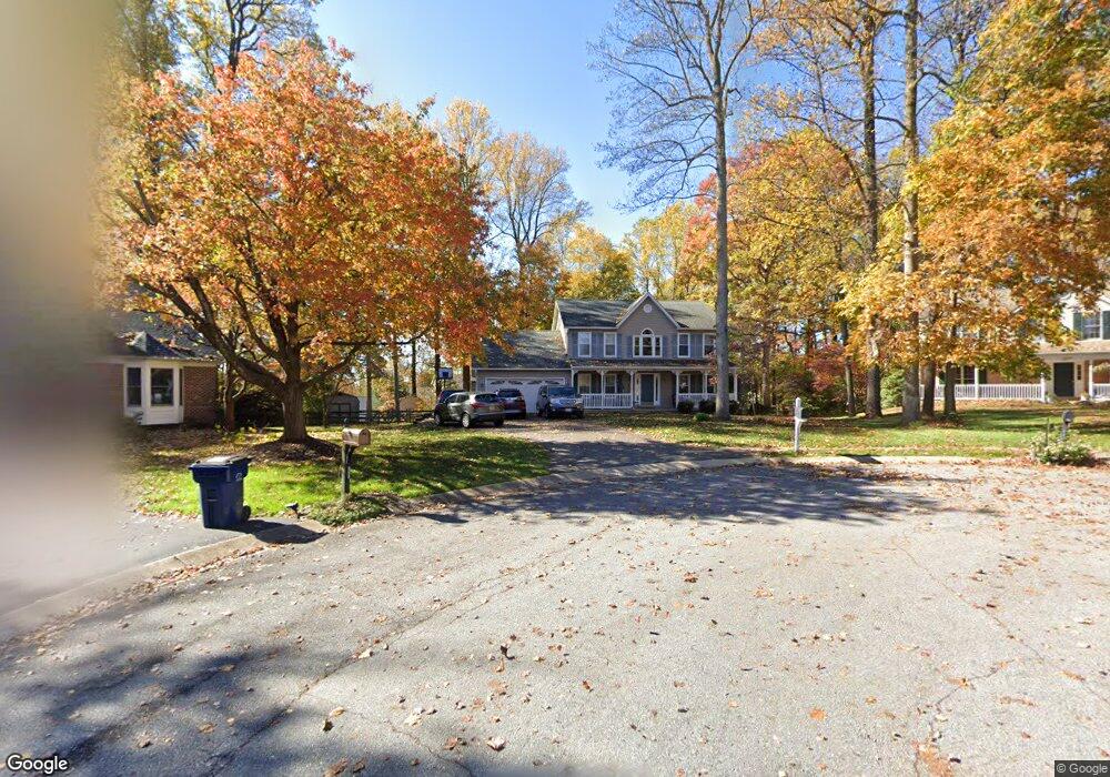
1901 Canter Ln Marriottsville, MD 21104
Estimated Value: $759,950 - $815,000
4
Beds
4
Baths
3,735
Sq Ft
$211/Sq Ft
Est. Value
About This Home
This home is located at 1901 Canter Ln, Marriottsville, MD 21104 and is currently estimated at $788,488, approximately $211 per square foot. 1901 Canter Ln is a home located in Carroll County with nearby schools including Carrolltowne Elementary School, Oklahoma Road Middle School, and Liberty High School.
Ownership History
Date
Name
Owned For
Owner Type
Purchase Details
Closed on
Oct 20, 2011
Sold by
Lorditch Karen A
Bought by
Dubell Matthew A and Dubell Carolyn J
Current Estimated Value
Home Financials for this Owner
Home Financials are based on the most recent Mortgage that was taken out on this home.
Original Mortgage
$485,100
Outstanding Balance
$329,418
Interest Rate
4.01%
Mortgage Type
VA
Estimated Equity
$459,070
Purchase Details
Closed on
Oct 29, 2004
Sold by
Scott Jones and Scott Rew
Bought by
Lorditch Karen A
Purchase Details
Closed on
Aug 12, 1993
Sold by
Patton Contractors Inc
Bought by
Jones Andrew Scott
Create a Home Valuation Report for This Property
The Home Valuation Report is an in-depth analysis detailing your home's value as well as a comparison with similar homes in the area
Home Values in the Area
Average Home Value in this Area
Purchase History
| Date | Buyer | Sale Price | Title Company |
|---|---|---|---|
| Dubell Matthew A | $474,900 | Sage Title Group Llc | |
| Lorditch Karen A | $489,900 | -- | |
| Jones Andrew Scott | $243,500 | -- |
Source: Public Records
Mortgage History
| Date | Status | Borrower | Loan Amount |
|---|---|---|---|
| Open | Dubell Matthew A | $485,100 |
Source: Public Records
Tax History Compared to Growth
Tax History
| Year | Tax Paid | Tax Assessment Tax Assessment Total Assessment is a certain percentage of the fair market value that is determined by local assessors to be the total taxable value of land and additions on the property. | Land | Improvement |
|---|---|---|---|---|
| 2025 | $6,168 | $579,100 | $0 | $0 |
| 2024 | $6,168 | $537,200 | $180,000 | $357,200 |
| 2023 | $5,981 | $520,467 | $0 | $0 |
| 2022 | $5,793 | $503,733 | $0 | $0 |
| 2021 | $11,555 | $487,000 | $160,000 | $327,000 |
| 2020 | $5,551 | $479,133 | $0 | $0 |
| 2019 | $5,463 | $471,267 | $0 | $0 |
| 2018 | $5,327 | $463,400 | $160,000 | $303,400 |
| 2017 | $5,125 | $445,367 | $0 | $0 |
| 2016 | -- | $427,333 | $0 | $0 |
| 2015 | -- | $409,300 | $0 | $0 |
| 2014 | -- | $389,967 | $0 | $0 |
Source: Public Records
Map
Nearby Homes
- 7025 Macbeth Way
- 7010 Macbeth Way
- 6819 Ridge Rd
- 1714 Botanical Ct Unit 23
- 1712 Botanical Ct Unit 22
- 7090 Saddle Dr
- 6670 Slacks Rd
- 1809 Fallstaff Ct
- 6565 Macbeth Way
- 6741 Quad Ln
- Lot 1 Carroll Highlands Rd
- 7140 Brangles Rd
- 2010 Rudy Serra Dr Unit C
- 2023 Rudy Serra Dr Unit 2D
- 1909 Lennox Dr Unit 90
- 2016 Rudy Serra Dr Unit A
- 2016 Rudy Serra Dr Unit C
- 6515 Dundee Dr Unit 240
- 1696 Gemini Dr
- 1900 Lennox Dr Unit 41
- 1900 Canter Ln
- 1903 Canter Ln
- 1974 Barley Rd
- 1972 Barley Rd
- 1978 Barley Rd
- 1902 Canter Ln
- 1905 Canter Ln
- 1904 Canter Ln
- 1980 Barley Rd
- 1873 Blacksmith Dr
- 1869 Blacksmith Dr
- 1875 Blacksmith Dr
- 1906 Canter Ln
- 1867 Blacksmith Dr
- 1877 Blacksmith Dr
- 1982 Barley Rd
- 1907 Canter Ln
- 1881 Blacksmith Dr
- 1975 Barley Rd
- 6618 Stirrup Ct