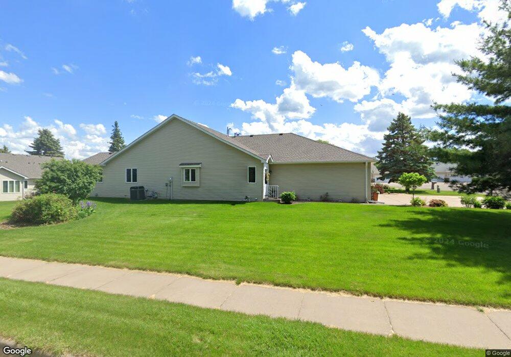
1901 Westridge Cir Stillwater, MN 55082
Estimated Value: $346,000 - $372,000
2
Beds
2
Baths
1,346
Sq Ft
$265/Sq Ft
Est. Value
About This Home
This home is located at 1901 Westridge Cir, Stillwater, MN 55082 and is currently estimated at $356,028, approximately $264 per square foot. 1901 Westridge Cir is a home located in Washington County with nearby schools including Lily Lake Elementary School, Stillwater Middle School, and Stillwater Area High School.
Ownership History
Date
Name
Owned For
Owner Type
Purchase Details
Closed on
Sep 28, 2017
Sold by
Stuart Margaret E
Bought by
Thibodeau Cynthia
Current Estimated Value
Home Financials for this Owner
Home Financials are based on the most recent Mortgage that was taken out on this home.
Original Mortgage
$204,000
Outstanding Balance
$170,580
Interest Rate
3.86%
Mortgage Type
New Conventional
Estimated Equity
$185,448
Purchase Details
Closed on
Mar 16, 2004
Sold by
Moelter Lavonne G
Bought by
Stuart Edwin E and Stuart Margaret E
Create a Home Valuation Report for This Property
The Home Valuation Report is an in-depth analysis detailing your home's value as well as a comparison with similar homes in the area
Home Values in the Area
Average Home Value in this Area
Purchase History
| Date | Buyer | Sale Price | Title Company |
|---|---|---|---|
| Thibodeau Cynthia | $255,000 | None Available | |
| Stuart Edwin E | $235,000 | -- |
Source: Public Records
Mortgage History
| Date | Status | Borrower | Loan Amount |
|---|---|---|---|
| Open | Thibodeau Cynthia | $204,000 |
Source: Public Records
Tax History Compared to Growth
Tax History
| Year | Tax Paid | Tax Assessment Tax Assessment Total Assessment is a certain percentage of the fair market value that is determined by local assessors to be the total taxable value of land and additions on the property. | Land | Improvement |
|---|---|---|---|---|
| 2024 | $3,996 | $331,500 | $140,000 | $191,500 |
| 2023 | $3,996 | $337,200 | $148,000 | $189,200 |
| 2022 | $3,028 | $302,500 | $137,000 | $165,500 |
| 2021 | $2,850 | $264,900 | $120,000 | $144,900 |
| 2020 | $2,970 | $258,200 | $120,000 | $138,200 |
| 2019 | $2,914 | $264,700 | $120,000 | $144,700 |
| 2018 | $2,248 | $247,700 | $120,000 | $127,700 |
| 2017 | $2,172 | $197,600 | $75,000 | $122,600 |
| 2016 | $2,048 | $184,700 | $65,000 | $119,700 |
| 2015 | $1,780 | $134,800 | $34,200 | $100,600 |
| 2013 | -- | $130,200 | $36,400 | $93,800 |
Source: Public Records
Map
Nearby Homes
- TBD Odell Ave N
- XXX Industrial Blvd
- 5835 Oakgreen Ct N
- 5675 Oak Cove N
- 5577 Oldfield Ave N
- 5520 Obrien Ave N
- 13796 55th St N
- 14812 58th St N Unit 5D
- 14824 58th St N Unit 6B
- 1112 4th St S
- 706 Holcombe St S
- 14861 58th St N Unit A2
- 5312 Ojibway Ave N
- 1119 Gilbert Ct
- 818 7th St S
- 14817 Upper 56th St N
- 5850 Oxboro Ave N
- 308 4th St S
- 14915 57th St N
- 833 Autumn Way
- 1901 W Ridge Cir
- 1905 W Ridge Cir
- 1915 W Ridge Cir
- 1915 Westridge Cir
- 1925 W Ridge Cir
- 1902 E Ridge Ct
- 1902 Eastridge Ct
- 1912 E Ridge Ct
- 1912 1912 E Ridge Ct
- 1912 Eastridge Ct
- 1935 W Ridge Cir
- 1932 E Ridge Ct
- 1900 W Ridge Cir
- 1910 Westridge Cir
- 1910 W Ridge Cir
- 1910 Westridge Cir S
- 1942 E Ridge Ct
- 1920 W Ridge Cir
- 1920 Westridge Cir
- 1945 W Ridge Cir