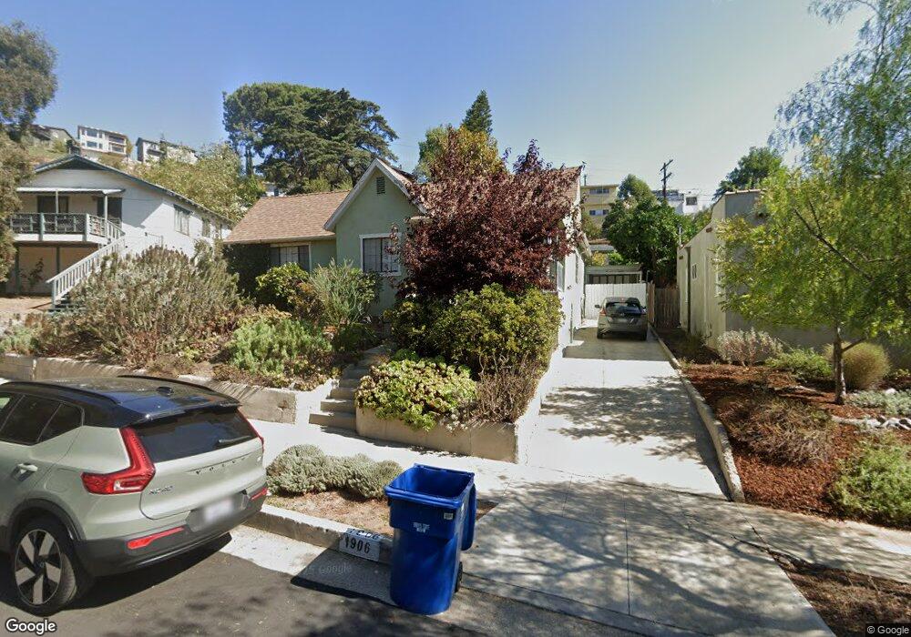
1906 North Avenue 52 Los Angeles, CA 90042
Eagle Rock NeighborhoodEstimated Value: $1,175,985 - $1,372,000
3
Beds
2
Baths
1,198
Sq Ft
$1,063/Sq Ft
Est. Value
About This Home
This home is located at 1906 North Avenue 52, Los Angeles, CA 90042 and is currently estimated at $1,273,496, approximately $1,063 per square foot. 1906 North Avenue 52 is a home located in Los Angeles County with nearby schools including Buchanan Street Elementary, Benjamin Franklin High School, and Luther Burbank Middle School.
Ownership History
Date
Name
Owned For
Owner Type
Purchase Details
Closed on
Mar 23, 2015
Sold by
Fobes Joan
Bought by
Ocean Development Inc
Current Estimated Value
Purchase Details
Closed on
Mar 4, 2003
Sold by
Rivera Eluterio G and Rivera Frances
Bought by
Braun Gregory U
Home Financials for this Owner
Home Financials are based on the most recent Mortgage that was taken out on this home.
Original Mortgage
$270,400
Interest Rate
4.25%
Mortgage Type
New Conventional
Create a Home Valuation Report for This Property
The Home Valuation Report is an in-depth analysis detailing your home's value as well as a comparison with similar homes in the area
Home Values in the Area
Average Home Value in this Area
Purchase History
| Date | Buyer | Sale Price | Title Company |
|---|---|---|---|
| Ocean Development Inc | $520,000 | Lawyers Title | |
| Braun Gregory U | $338,000 | Commonwealth Land Title Co |
Source: Public Records
Mortgage History
| Date | Status | Borrower | Loan Amount |
|---|---|---|---|
| Previous Owner | Braun Gregory U | $270,400 |
Source: Public Records
Tax History Compared to Growth
Tax History
| Year | Tax Paid | Tax Assessment Tax Assessment Total Assessment is a certain percentage of the fair market value that is determined by local assessors to be the total taxable value of land and additions on the property. | Land | Improvement |
|---|---|---|---|---|
| 2025 | $5,951 | $489,515 | $354,832 | $134,683 |
| 2024 | $5,951 | $479,918 | $347,875 | $132,043 |
| 2023 | $5,837 | $470,508 | $341,054 | $129,454 |
| 2022 | $5,567 | $461,283 | $334,367 | $126,916 |
| 2021 | $5,495 | $452,239 | $327,811 | $124,428 |
| 2019 | $5,331 | $438,828 | $318,089 | $120,739 |
| 2018 | $5,247 | $430,224 | $311,852 | $118,372 |
| 2016 | $5,009 | $413,520 | $299,744 | $113,776 |
| 2015 | $4,935 | $407,309 | $295,242 | $112,067 |
| 2014 | $4,958 | $399,331 | $289,459 | $109,872 |
Source: Public Records
Map
Nearby Homes
- 1915 N Avenue 52
- 1942 Phillips Way
- 1938 Phillips Way
- 1932 Phillips Way
- 5240 Barker Dr
- 1902 N Avenue 51
- 1333 Wildwood Dr
- 1813 N Avenue 53
- 4631 4637 Loleta Place
- 1813 N Avenue 55
- 1632 Oak Grove Dr
- 1800 N Avenue 55
- 1584 Oak Grove Place
- 1359 Wildwood Dr
- 5252 Range View Ave
- 1321 Wildwood Dr
- 1370 N Avenue 57
- 1913 Nolden St
- 1567 Fair Park Ave
- 1815 Nolden St
- 0 Barker Dr Unit 320001838
- 0 Barker Dr Unit 320000289
- 0 Barker Dr Unit 319002208
- 1910 North Avenue 52
- 1900 N Avenue 52
- 1900 North Avenue 52
- 1910 N Avenue 52
- 1914 N Avenue 52
- 1914 North Avenue 52
- 1886 North Avenue 52
- 1925 Phillips Way
- 1929 Phillips Way
- 1917 Phillips Way
- 1933 Phillips Way
- 1918 North Avenue 52
- 1913 Phillips Way
- 1882 N Ave 52
- 1882 N Avenue 52
- 1882 North Avenue 52
- 1924 North Avenue 52