Estimated Value: $419,976 - $444,000
3
Beds
2
Baths
1,743
Sq Ft
$248/Sq Ft
Est. Value
About This Home
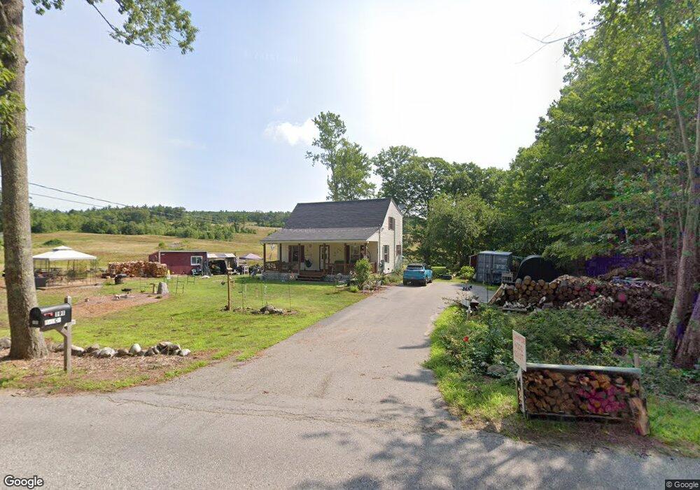
This home is located at 191 New Rye Rd, Epsom, NH 03234 and is currently estimated at $431,994, approximately $247 per square foot. 191 New Rye Rd is a home located in Merrimack County with nearby schools including Epsom Central School, Epsom Better Buddies, and Cornerstone Christian Academy.
Ownership History
Date
Name
Owned For
Owner Type
Purchase Details
Closed on
Aug 15, 2001
Sold by
Quiroga Oscar A and Quiroga Alexandra
Bought by
Bruce Ronald L and Bruce Mellisa K
Current Estimated Value
Home Financials for this Owner
Home Financials are based on the most recent Mortgage that was taken out on this home.
Original Mortgage
$120,000
Interest Rate
7.16%
Purchase Details
Closed on
Dec 9, 1999
Sold by
Tolken Steven J and Tolken Pamela J
Bought by
Quiroga Oscar A and Quiroga Alexandra
Home Financials for this Owner
Home Financials are based on the most recent Mortgage that was taken out on this home.
Original Mortgage
$108,630
Interest Rate
7.9%
Create a Home Valuation Report for This Property
The Home Valuation Report is an in-depth analysis detailing your home's value as well as a comparison with similar homes in the area
Home Values in the Area
Average Home Value in this Area
Purchase History
| Date | Buyer | Sale Price | Title Company |
|---|---|---|---|
| Bruce Ronald L | $152,500 | -- | |
| Quiroga Oscar A | $110,000 | -- |
Source: Public Records
Mortgage History
| Date | Status | Borrower | Loan Amount |
|---|---|---|---|
| Open | Quiroga Oscar A | $154,400 | |
| Closed | Quiroga Oscar A | $20,000 | |
| Closed | Quiroga Oscar A | $120,000 | |
| Previous Owner | Quiroga Oscar A | $108,630 |
Source: Public Records
Tax History Compared to Growth
Tax History
| Year | Tax Paid | Tax Assessment Tax Assessment Total Assessment is a certain percentage of the fair market value that is determined by local assessors to be the total taxable value of land and additions on the property. | Land | Improvement |
|---|---|---|---|---|
| 2024 | $6,154 | $231,000 | $96,800 | $134,200 |
| 2023 | $5,675 | $230,400 | $96,800 | $133,600 |
| 2022 | $5,493 | $230,400 | $96,800 | $133,600 |
| 2021 | $5,447 | $230,400 | $96,800 | $133,600 |
| 2020 | $5,034 | $230,600 | $96,800 | $133,800 |
| 2019 | $5,177 | $191,100 | $80,000 | $111,100 |
| 2018 | $4,963 | $191,100 | $80,000 | $111,100 |
| 2017 | $4,906 | $191,100 | $80,000 | $111,100 |
| 2016 | $4,783 | $191,100 | $80,000 | $111,100 |
| 2015 | $4,552 | $191,100 | $80,000 | $111,100 |
| 2014 | $4,247 | $190,800 | $75,000 | $115,800 |
| 2013 | $4,306 | $190,800 | $75,000 | $115,800 |
Source: Public Records
Map
Nearby Homes
- 14 Queens Ln
- 9 Princess Ln
- 370 River Rd
- 19 Silver Hill Dr
- 24 Towle Pasture Dr
- 0 Poor Town Rd Unit 4
- 42 Windymere Dr
- 43 Black Hall Rd Unit A2
- 0 Dover Unit 5027742
- 43 Catamount Hill Dr
- 8 Bush Ave
- 6 Jackson Ave
- 11 Presidential Dr
- 1 Jefferson Ave
- 5 Catamount Hill Dr
- 20 Mountain Rd
- 15 Fred Wood Dr
- 14 Short Falls Rd
- 9 Pine Acres Rd
- 101 4th Range Rd Unit 4