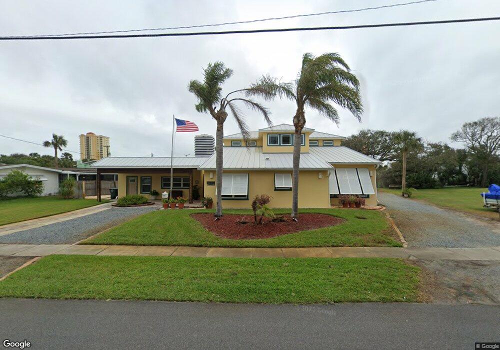
1910 N Oleander Ave Daytona Beach, FL 32118
Estimated Value: $495,000 - $837,000
4
Beds
5
Baths
3,036
Sq Ft
$221/Sq Ft
Est. Value
About This Home
This home is located at 1910 N Oleander Ave, Daytona Beach, FL 32118 and is currently estimated at $670,009, approximately $220 per square foot. 1910 N Oleander Ave is a home located in Volusia County with nearby schools including Campbell Middle School, Seabreeze High School, and Lourdes Academy.
Ownership History
Date
Name
Owned For
Owner Type
Purchase Details
Closed on
Nov 17, 1995
Sold by
Demyan James J and Demyan Elaine
Bought by
Cauble Robert and Cauble Diane
Current Estimated Value
Home Financials for this Owner
Home Financials are based on the most recent Mortgage that was taken out on this home.
Original Mortgage
$78,885
Outstanding Balance
$1,097
Interest Rate
7.54%
Mortgage Type
FHA
Estimated Equity
$668,912
Purchase Details
Closed on
Oct 15, 1986
Bought by
Cauble Robert and Cauble Diane
Purchase Details
Closed on
Dec 15, 1984
Bought by
Cauble Robert and Cauble Diane
Purchase Details
Closed on
Jun 15, 1982
Bought by
Cauble Robert and Cauble Diane
Purchase Details
Closed on
Mar 15, 1982
Bought by
Cauble Robert and Cauble Diane
Create a Home Valuation Report for This Property
The Home Valuation Report is an in-depth analysis detailing your home's value as well as a comparison with similar homes in the area
Home Values in the Area
Average Home Value in this Area
Purchase History
| Date | Buyer | Sale Price | Title Company |
|---|---|---|---|
| Cauble Robert | $79,000 | -- | |
| Cauble Robert | $74,500 | -- | |
| Cauble Robert | $59,000 | -- | |
| Cauble Robert | $57,500 | -- | |
| Cauble Robert | $59,900 | -- |
Source: Public Records
Mortgage History
| Date | Status | Borrower | Loan Amount |
|---|---|---|---|
| Open | Cauble Robert | $78,885 |
Source: Public Records
Tax History Compared to Growth
Tax History
| Year | Tax Paid | Tax Assessment Tax Assessment Total Assessment is a certain percentage of the fair market value that is determined by local assessors to be the total taxable value of land and additions on the property. | Land | Improvement |
|---|---|---|---|---|
| 2025 | $4,213 | $299,361 | -- | -- |
| 2024 | $4,213 | $290,925 | -- | -- |
| 2023 | $4,213 | $282,452 | $0 | $0 |
| 2022 | $4,121 | $274,225 | $0 | $0 |
| 2021 | $4,230 | $266,238 | $0 | $0 |
| 2020 | $4,165 | $262,562 | $0 | $0 |
| 2019 | $4,118 | $256,659 | $0 | $0 |
| 2018 | $4,165 | $251,873 | $0 | $0 |
| 2017 | $4,228 | $246,692 | $0 | $0 |
| 2016 | $4,032 | $228,370 | $0 | $0 |
| 2015 | $3,822 | $210,848 | $0 | $0 |
| 2014 | $3,248 | $184,912 | $0 | $0 |
Source: Public Records
Map
Nearby Homes
- 268 Hartford Ave
- 311 Pelican Ave
- 0 Pelican Ave
- 238 Morningside Ave
- 1608 N Halifax Ave
- 2101 N Atlantic Ave Unit 10
- 2101 N Atlantic Ave Unit 1
- 376 Williams Ave
- 1619 N Halifax Ave
- 2200 N Atlantic Ave Unit 1602
- 1900 N Atlantic Ave Unit 1603
- 424 Pelican Ave
- 1517 N Grandview Ave
- 2300 N Atlantic Ave Unit 203
- 2300 N Atlantic Ave Unit 1701
- 2300 N Atlantic Ave Unit 1402
- 2300 N Atlantic Ave Unit 303
- 1800 N Atlantic Ave
- 1517 N Halifax Ave
- 307 Manhattan Ave
- 1918 N Oleander Ave
- 301 Hartford Ave
- 318 Brookline Ave
- 295 Hartford Ave
- 1913 N Oleander Ave
- 322 Brookline Ave
- 1915 N Oleander Ave
- 2000 N Oleander Ave
- 1919 N Oleander Ave
- 325 Hartford Ave
- 309 Brookline Ave
- 326 Brookline Ave
- 1819 N Oleander Ave
- 317 Brookline Ave
- 2004 N Oleander Ave
- 321 Brookline Ave
- 300 Hartford Ave
- 330 Brookline Ave
- 291 Hartford Ave
- 1815 N Oleander Ave