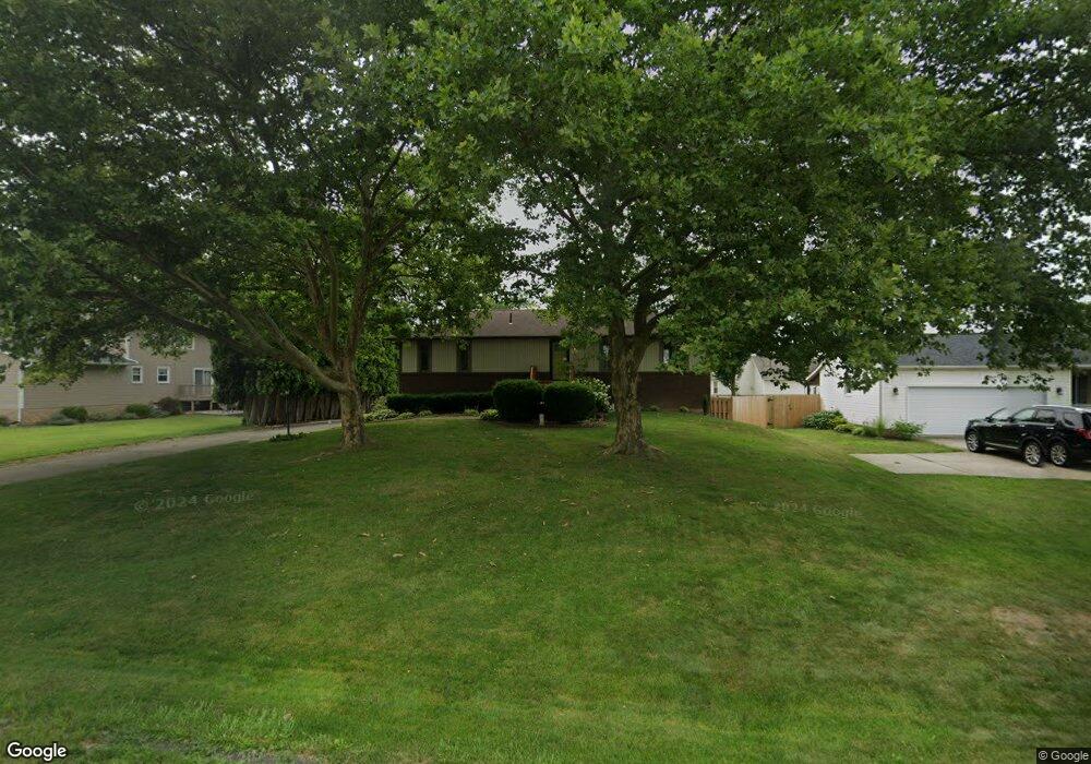
1914 Ravenna Ave Louisville, OH 44641
Estimated Value: $224,000 - $273,000
3
Beds
2
Baths
1,352
Sq Ft
$178/Sq Ft
Est. Value
About This Home
This home is located at 1914 Ravenna Ave, Louisville, OH 44641 and is currently estimated at $240,616, approximately $177 per square foot. 1914 Ravenna Ave is a home located in Stark County with nearby schools including Louisville High School and St. Thomas Aquinas High School & Middle School.
Ownership History
Date
Name
Owned For
Owner Type
Purchase Details
Closed on
Apr 7, 1997
Sold by
Nicol Daniel E
Bought by
Hoffman Richard L and Hoffman Irene
Current Estimated Value
Home Financials for this Owner
Home Financials are based on the most recent Mortgage that was taken out on this home.
Original Mortgage
$110,050
Outstanding Balance
$13,931
Interest Rate
7.65%
Mortgage Type
VA
Estimated Equity
$226,685
Purchase Details
Closed on
Mar 2, 1990
Create a Home Valuation Report for This Property
The Home Valuation Report is an in-depth analysis detailing your home's value as well as a comparison with similar homes in the area
Home Values in the Area
Average Home Value in this Area
Purchase History
| Date | Buyer | Sale Price | Title Company |
|---|---|---|---|
| Hoffman Richard L | $107,900 | -- | |
| -- | $79,500 | -- |
Source: Public Records
Mortgage History
| Date | Status | Borrower | Loan Amount |
|---|---|---|---|
| Open | Hoffman Richard L | $110,050 |
Source: Public Records
Tax History Compared to Growth
Tax History
| Year | Tax Paid | Tax Assessment Tax Assessment Total Assessment is a certain percentage of the fair market value that is determined by local assessors to be the total taxable value of land and additions on the property. | Land | Improvement |
|---|---|---|---|---|
| 2025 | -- | $68,150 | $17,750 | $50,400 |
| 2024 | -- | $68,150 | $17,750 | $50,400 |
| 2023 | $2,273 | $52,890 | $13,620 | $39,270 |
| 2022 | $2,279 | $52,890 | $13,620 | $39,270 |
| 2021 | $2,285 | $52,890 | $13,620 | $39,270 |
| 2020 | $1,881 | $47,290 | $12,250 | $35,040 |
| 2019 | $1,889 | $48,440 | $12,250 | $36,190 |
| 2018 | $1,928 | $48,440 | $12,250 | $36,190 |
| 2017 | $1,579 | $38,260 | $7,880 | $30,380 |
| 2016 | $1,611 | $38,260 | $7,880 | $30,380 |
| 2015 | $1,616 | $38,260 | $7,880 | $30,380 |
| 2014 | $1,847 | $40,680 | $8,370 | $32,310 |
| 2013 | $927 | $40,680 | $8,370 | $32,310 |
Source: Public Records
Map
Nearby Homes
- 1639 Horizon Dr
- 1702 View Pointe Ave
- 908 Sand Lot Cir
- 6969 Georgetown St NE
- 822 Sand Lot Cir
- 510 S Bauman Ct
- 204 E Broad St
- 107 E Broad St
- 4060 Hambleton Ave NE
- 728 E Broad St
- 201 Indiana Ave
- 520 S Silver St
- 641 S Nickelplate St
- 2425 Miday Ave NE
- 248 Menegay Rd
- 6416 15th St NE
- 8225 Georgetown St
- 308 Superior St
- 325 Lincoln Ave
- 1715 High St
- 1932 Ravenna Ave
- 1942 Liberty Dr NE
- 822 Overlook St
- Lot 2 Overlook Dr
- 1952 Liberty Dr NE
- 823 Overlook St
- 1944 Pleasure Ct Unit 9
- 1944 Pleasure Ct Unit 9
- 1962 Liberty Dr NE
- 1950 Pleasure Ct Unit 8
- 715 Overlook St
- 3492 Ravenna Ave
- 1956 Pleasure Ct Unit 7
- 1812 Ravenna Ave
- 1822 Ravenna Ave
- 1960 Pleasure Ct Unit 6
- 1947 Pleasure Ct
- 1972 Liberty Dr NE
- 1966 Pleasure Ct Unit 5
- 3495 Ravenna Ave