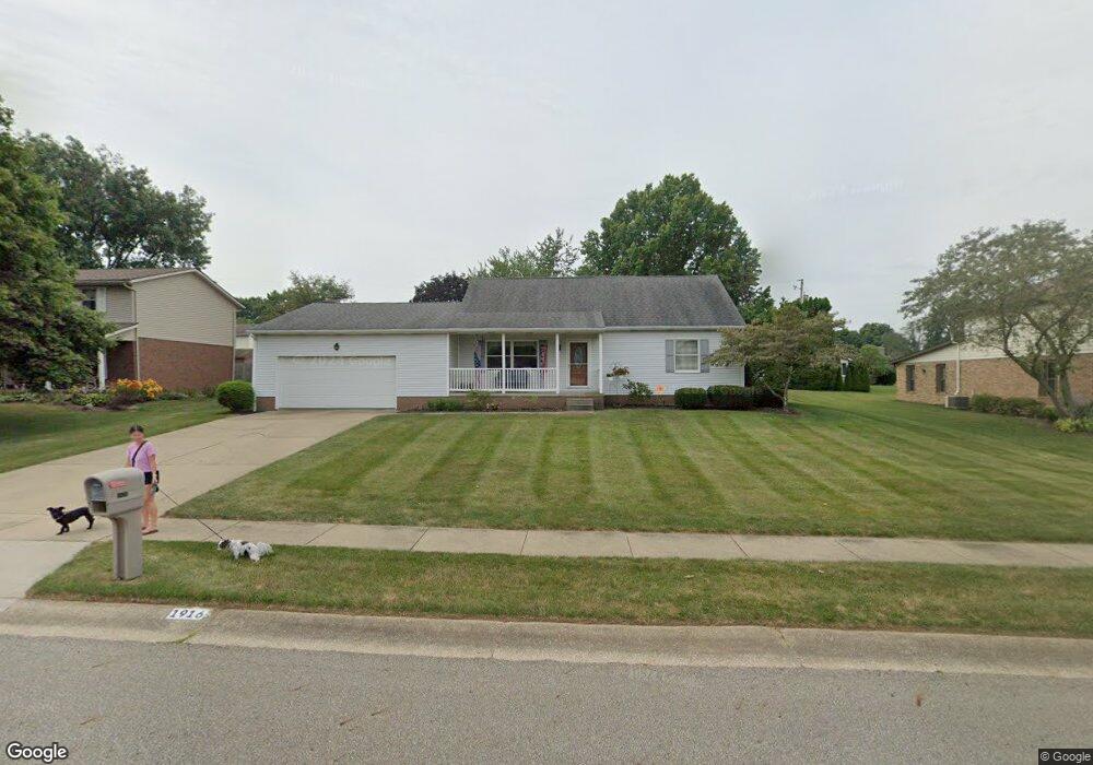
1916 Tanglewood Cir Louisville, OH 44641
Estimated Value: $222,000 - $306,000
4
Beds
3
Baths
2,128
Sq Ft
$122/Sq Ft
Est. Value
About This Home
This home is located at 1916 Tanglewood Cir, Louisville, OH 44641 and is currently estimated at $259,994, approximately $122 per square foot. 1916 Tanglewood Cir is a home located in Stark County with nearby schools including Louisville High School and St. Thomas Aquinas High School & Middle School.
Ownership History
Date
Name
Owned For
Owner Type
Purchase Details
Closed on
Jul 30, 2021
Sold by
Allison Gary W and Allison Sandra L
Bought by
Allison Michael C and Boles Megan D
Current Estimated Value
Purchase Details
Closed on
May 9, 2007
Sold by
Allison Gary W and Allison Sandra L
Bought by
Allison Gary W and Allison Sandra L
Purchase Details
Closed on
Mar 27, 1995
Sold by
Peters Richard C
Bought by
Allison Gary W and Allison Sandra
Home Financials for this Owner
Home Financials are based on the most recent Mortgage that was taken out on this home.
Original Mortgage
$90,000
Interest Rate
8.63%
Mortgage Type
New Conventional
Purchase Details
Closed on
Apr 25, 1990
Create a Home Valuation Report for This Property
The Home Valuation Report is an in-depth analysis detailing your home's value as well as a comparison with similar homes in the area
Home Values in the Area
Average Home Value in this Area
Purchase History
| Date | Buyer | Sale Price | Title Company |
|---|---|---|---|
| Allison Michael C | -- | None Available | |
| Allison Gary W | -- | Attorney | |
| Allison Gary W | $120,000 | -- | |
| -- | $15,000 | -- |
Source: Public Records
Mortgage History
| Date | Status | Borrower | Loan Amount |
|---|---|---|---|
| Closed | Allison Gary W | $90,000 |
Source: Public Records
Tax History Compared to Growth
Tax History
| Year | Tax Paid | Tax Assessment Tax Assessment Total Assessment is a certain percentage of the fair market value that is determined by local assessors to be the total taxable value of land and additions on the property. | Land | Improvement |
|---|---|---|---|---|
| 2025 | -- | $78,750 | $17,640 | $61,110 |
| 2024 | -- | $78,750 | $17,640 | $61,110 |
| 2023 | $2,816 | $65,530 | $16,630 | $48,900 |
| 2022 | $2,822 | $65,530 | $16,630 | $48,900 |
| 2021 | $2,830 | $65,530 | $16,630 | $48,900 |
| 2020 | $2,320 | $58,350 | $14,980 | $43,370 |
| 2019 | $2,264 | $56,700 | $14,980 | $41,720 |
| 2018 | $2,255 | $56,700 | $14,980 | $41,720 |
| 2017 | $2,092 | $50,750 | $13,160 | $37,590 |
| 2016 | $2,135 | $50,750 | $13,160 | $37,590 |
| 2015 | $2,141 | $50,750 | $13,160 | $37,590 |
| 2014 | $1,993 | $43,900 | $11,380 | $32,520 |
| 2013 | $1,000 | $43,900 | $11,380 | $32,520 |
Source: Public Records
Map
Nearby Homes
- 2110 Edmar St
- 1812 E Broad St
- 1715 High St
- 641 S Nickelplate St
- 2015 E Main St
- 3390 Meese Rd NE
- 308 Superior St
- 520 S Silver St
- 0 Michigan Blvd
- 728 E Broad St
- 908 Sand Lot Cir
- 510 S Bauman Ct
- 204 E Broad St
- 107 E Broad St
- 325 Lincoln Ave
- 8225 Georgetown St
- 1170 Winding Ridge Ave
- 1702 View Pointe Ave
- 910 Crosswyck Cir
- 1639 Horizon Dr
- 1913 Tanglewood Cir
- 1923 Tanglewood Cir
- 1926 Tanglewood Cir
- 1900 Tanglewood Cir
- 1931 Tanglewood Cir
- 1917 Opal St
- 1905 Tanglewood Cir
- 1927 Opal St
- 2006 Tanglewood Cir
- 1907 Opal St
- 1937 Opal St
- 2009 Tanglewood Cir
- 905 Bentwood Cir
- 910 Hillcliff St
- 2016 Tanglewood Cir
- 1021 Hillcliff St
- 1077 Hillcliff St
- 1947 Opal St
- 1011 Hillcliff St
- 2017 Tanglewood Cir