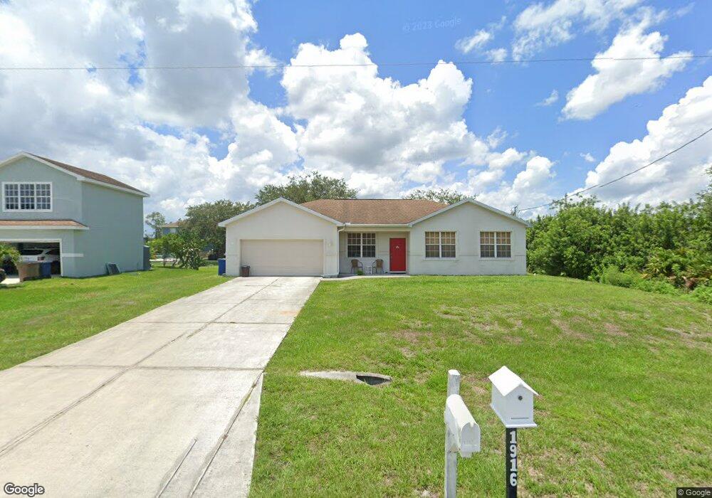
1917 Milstead Ave Lehigh Acres, FL 33972
Richmond NeighborhoodEstimated Value: $252,000 - $296,000
3
Beds
2
Baths
1,504
Sq Ft
$182/Sq Ft
Est. Value
About This Home
This home is located at 1917 Milstead Ave, Lehigh Acres, FL 33972 and is currently estimated at $273,604, approximately $181 per square foot. 1917 Milstead Ave is a home located in Lee County with nearby schools including Lehigh Elementary School, The Alva School, and Gateway Elementary School.
Ownership History
Date
Name
Owned For
Owner Type
Purchase Details
Closed on
Jun 19, 2009
Sold by
Federal Home Loan Mortgage Corporation
Bought by
Munoz Gladys
Current Estimated Value
Purchase Details
Closed on
Jun 8, 2009
Sold by
Suntrust Mortgage Inc
Bought by
Federal Home Loan Mortgage Corp
Purchase Details
Closed on
Apr 17, 2009
Sold by
Larman Denise Y
Bought by
Suntrust Mortgage Inc
Purchase Details
Closed on
Jun 21, 2006
Sold by
Mw Johnson Construction Of Florida Inc
Bought by
Larman Denise Y
Home Financials for this Owner
Home Financials are based on the most recent Mortgage that was taken out on this home.
Original Mortgage
$136,700
Interest Rate
8.5%
Mortgage Type
Unknown
Create a Home Valuation Report for This Property
The Home Valuation Report is an in-depth analysis detailing your home's value as well as a comparison with similar homes in the area
Home Values in the Area
Average Home Value in this Area
Purchase History
| Date | Buyer | Sale Price | Title Company |
|---|---|---|---|
| Munoz Gladys | $54,000 | Attorney | |
| Federal Home Loan Mortgage Corp | -- | Attorney | |
| Suntrust Mortgage Inc | -- | None Available | |
| Larman Denise Y | $170,900 | Title Group Fort Myers Ltd |
Source: Public Records
Mortgage History
| Date | Status | Borrower | Loan Amount |
|---|---|---|---|
| Previous Owner | Larman Denise Y | $136,700 |
Source: Public Records
Tax History Compared to Growth
Tax History
| Year | Tax Paid | Tax Assessment Tax Assessment Total Assessment is a certain percentage of the fair market value that is determined by local assessors to be the total taxable value of land and additions on the property. | Land | Improvement |
|---|---|---|---|---|
| 2025 | $2,984 | $166,014 | -- | -- |
| 2024 | $2,842 | $150,922 | -- | -- |
| 2023 | $2,842 | $137,202 | $0 | $0 |
| 2022 | $2,523 | $124,729 | $0 | $0 |
| 2021 | $2,149 | $140,815 | $3,900 | $136,915 |
| 2020 | $2,059 | $131,619 | $3,900 | $127,719 |
| 2019 | $2,026 | $125,972 | $4,500 | $121,472 |
| 2018 | $1,898 | $113,866 | $4,250 | $109,616 |
| 2017 | $1,803 | $107,393 | $3,700 | $103,693 |
| 2016 | $1,669 | $94,486 | $3,700 | $90,786 |
| 2015 | $1,489 | $75,201 | $2,640 | $72,561 |
| 2014 | -- | $75,800 | $2,540 | $73,260 |
| 2013 | -- | $59,396 | $2,000 | $57,396 |
Source: Public Records
Map
Nearby Homes
- 1909 Milstead Ave
- 1909 Vesper Ct
- 1917 Holyoke Ave Unit 11
- 1927 Holyoke Ave
- 480 Westchester Dr
- 446 Westchester Dr
- 454 Westchester Dr
- 1928 Vesper Ct
- 1918 Montero Ave
- 479 Windermere Dr
- 441 Thelma Ct
- 475 Westdale Ave
- 1922 Overland Ave
- 507 Woodman Dr
- 463 Woodman Dr Unit 3
- 451 Woodman Dr
- 514 Woodman Dr
- 457 Woodman Dr
- 490 Windermere Dr
- 507 Willowbrook Dr
- 1915 Milstead Ave Unit 15
- 1915 Milstead Ave
- 1916 Lemona Ave Unit 24
- 1914 Lemona Ave
- 1913 Milstead Ave
- 1916 Milstead Ave
- 1920 Lemona Ave Unit 24
- 1918 Lemona Ave
- 1918 Milstead Ave
- 1914 Milstead Ave
- 1924 Milstead Ave
- 1908 Milstead Ave
- 1923 Milstead Ave Unit 19
- 1923 Milstead Ave
- 1920 Milstead Ave
- 1912 Milstead Ave
- 1911 Milstead Ave
- 1922 Lemona Ave
- 1910 Lemona Ave
- 1919 Lemona Ave