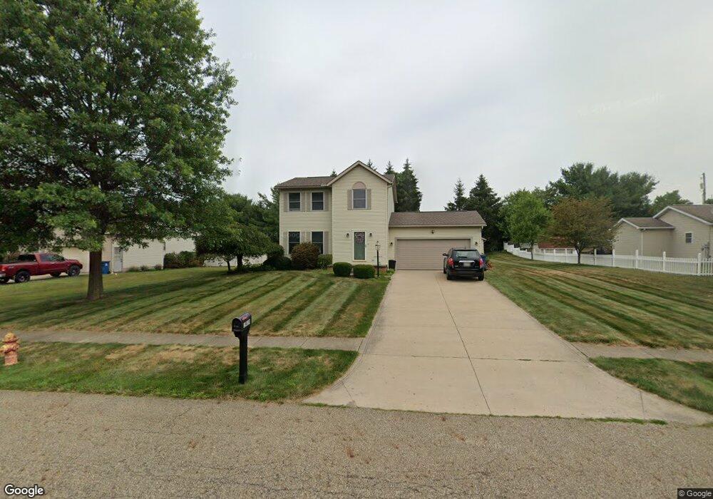
1919 Monter Ave Louisville, OH 44641
Estimated Value: $219,533 - $262,000
3
Beds
2
Baths
1,448
Sq Ft
$169/Sq Ft
Est. Value
About This Home
This home is located at 1919 Monter Ave, Louisville, OH 44641 and is currently estimated at $244,383, approximately $168 per square foot. 1919 Monter Ave is a home located in Stark County with nearby schools including Louisville High School and St. Thomas Aquinas High School & Middle School.
Ownership History
Date
Name
Owned For
Owner Type
Purchase Details
Closed on
Oct 26, 2011
Sold by
Estate Of Robert Brady
Bought by
Brady Heather
Current Estimated Value
Purchase Details
Closed on
Nov 2, 2000
Sold by
Architectural Building Inc
Bought by
Brady Robert
Home Financials for this Owner
Home Financials are based on the most recent Mortgage that was taken out on this home.
Original Mortgage
$81,000
Interest Rate
8.62%
Mortgage Type
Construction
Create a Home Valuation Report for This Property
The Home Valuation Report is an in-depth analysis detailing your home's value as well as a comparison with similar homes in the area
Home Values in the Area
Average Home Value in this Area
Purchase History
| Date | Buyer | Sale Price | Title Company |
|---|---|---|---|
| Brady Heather | -- | None Available | |
| Brady Robert | $30,000 | -- |
Source: Public Records
Mortgage History
| Date | Status | Borrower | Loan Amount |
|---|---|---|---|
| Previous Owner | Brady Robert | $81,000 |
Source: Public Records
Tax History Compared to Growth
Tax History
| Year | Tax Paid | Tax Assessment Tax Assessment Total Assessment is a certain percentage of the fair market value that is determined by local assessors to be the total taxable value of land and additions on the property. | Land | Improvement |
|---|---|---|---|---|
| 2025 | -- | $59,470 | $17,050 | $42,420 |
| 2024 | -- | $59,470 | $17,050 | $42,420 |
| 2023 | $2,416 | $56,210 | $16,100 | $40,110 |
| 2022 | $2,421 | $56,210 | $16,100 | $40,110 |
| 2021 | $2,428 | $56,210 | $16,100 | $40,110 |
| 2020 | $1,992 | $50,090 | $14,490 | $35,600 |
| 2019 | $2,001 | $52,080 | $14,490 | $37,590 |
| 2018 | $2,072 | $52,080 | $14,490 | $37,590 |
| 2017 | $1,873 | $45,430 | $12,740 | $32,690 |
| 2016 | $1,912 | $45,430 | $12,740 | $32,690 |
| 2015 | $1,917 | $45,430 | $12,740 | $32,690 |
| 2014 | $1,782 | $39,240 | $10,990 | $28,250 |
| 2013 | $894 | $39,240 | $10,990 | $28,250 |
Source: Public Records
Map
Nearby Homes
- 1812 E Broad St
- 2015 E Main St
- 1715 High St
- 0 Michigan Blvd
- 2110 Edmar St
- 308 Superior St
- 641 S Nickelplate St
- 520 S Silver St
- 728 E Broad St
- 1170 Winding Ridge Ave
- 325 Lincoln Ave
- 910 Crosswyck Cir
- 204 E Broad St
- 510 S Bauman Ct
- 3390 Meese Rd NE
- 107 E Broad St
- 908 Sand Lot Cir
- 5495 Meese Rd NE
- 316 E Reno Dr
- 428 Honeycrisp Dr NE
- 2007 Monter Ave
- 1909 Monter Ave
- 174 Beau Chemin Ave Unit 5B
- 170 Beau Chemin Ave
- 176 Beau Chemin Ave
- 172 Beau Chemin Ave
- 1827 Monter Ave
- 175 Beau Chemin Ave Unit 7D
- 171 Beau Chemin Ave Unit 7A
- 177 Beau Chemin Ave Unit 7C
- 173 Beau Chemin Ave Unit 7B
- 162 Beau Chemin Ave Unit 4D
- 166 Beau Chemin Ave Unit 4C
- 166 Beau Chemin Ave Unit 4C
- 166 Beau Chemin Ave
- 1816 Monter Ave
- 313 Brookfield St
- 313 Brookfield St
- 313 Brookfield St
- 313 Brookfield St