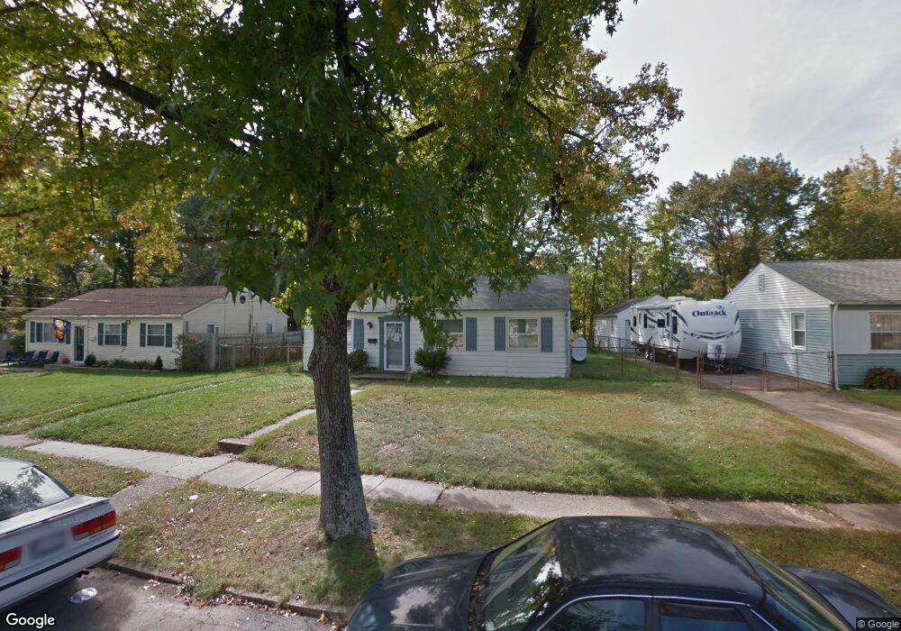
1919 Norwich Rd Glen Burnie, MD 21061
Estimated Value: $286,000 - $337,000
--
Bed
1
Bath
988
Sq Ft
$319/Sq Ft
Est. Value
About This Home
This home is located at 1919 Norwich Rd, Glen Burnie, MD 21061 and is currently estimated at $315,603, approximately $319 per square foot. 1919 Norwich Rd is a home located in Anne Arundel County with nearby schools including Woodside Elementary School, Corkran Middle School, and Glen Burnie High School.
Ownership History
Date
Name
Owned For
Owner Type
Purchase Details
Closed on
Feb 27, 2003
Sold by
Mayfield John D
Bought by
Kelly Phillip D
Current Estimated Value
Purchase Details
Closed on
Jan 15, 1998
Sold by
Fortney Robert B
Bought by
Mayfield John D
Purchase Details
Closed on
Aug 7, 1991
Sold by
Allen Robert C
Bought by
Fortney Robert B
Home Financials for this Owner
Home Financials are based on the most recent Mortgage that was taken out on this home.
Original Mortgage
$88,850
Interest Rate
9.44%
Create a Home Valuation Report for This Property
The Home Valuation Report is an in-depth analysis detailing your home's value as well as a comparison with similar homes in the area
Home Values in the Area
Average Home Value in this Area
Purchase History
| Date | Buyer | Sale Price | Title Company |
|---|---|---|---|
| Kelly Phillip D | $114,000 | -- | |
| Mayfield John D | $97,000 | -- | |
| Fortney Robert B | $89,700 | -- |
Source: Public Records
Mortgage History
| Date | Status | Borrower | Loan Amount |
|---|---|---|---|
| Previous Owner | Fortney Robert B | $88,850 | |
| Closed | Mayfield John D | -- |
Source: Public Records
Tax History Compared to Growth
Tax History
| Year | Tax Paid | Tax Assessment Tax Assessment Total Assessment is a certain percentage of the fair market value that is determined by local assessors to be the total taxable value of land and additions on the property. | Land | Improvement |
|---|---|---|---|---|
| 2025 | $2,156 | $229,100 | $144,000 | $85,100 |
| 2024 | $2,156 | $215,467 | $0 | $0 |
| 2023 | $2,080 | $201,833 | $0 | $0 |
| 2022 | $1,929 | $188,200 | $114,000 | $74,200 |
| 2021 | $3,798 | $184,167 | $0 | $0 |
| 2020 | $1,828 | $180,133 | $0 | $0 |
| 2019 | $1,801 | $176,100 | $104,000 | $72,100 |
| 2018 | $1,754 | $172,933 | $0 | $0 |
| 2017 | $1,707 | $169,767 | $0 | $0 |
| 2016 | -- | $166,600 | $0 | $0 |
| 2015 | -- | $159,467 | $0 | $0 |
| 2014 | -- | $152,333 | $0 | $0 |
Source: Public Records
Map
Nearby Homes
- 1731 Saunders Way
- 1702 Manning Rd
- 1612 Lorimer Rd
- 8903 Jeff Mar Dr
- 100 Sandsbury Ave
- 8906 Jeff Mar Dr
- 206 Sandsbury Ave
- 307 Norman Ave
- 180 Jessica Ln
- 7911 Ritchie Hwy
- 405 Morningside Dr
- 338 White Oak Way
- 7808 Five Oaks Ct
- 1318 Tarrant Rd
- 7677 Mueller Dr
- 1002 Lee Rd
- 251 Oakview Village Dr
- 0 Irene Dr
- 7818 Oakwood Rd
- 1016 Upton Rd
- 1915 Norwich Rd
- 1921 Norwich Rd
- 1913 Norwich Rd
- 1923 Norwich Rd
- 1918 Norwich Rd
- 1914 Norwich Rd
- 1912 Oakley Rd
- 1914 Oakley Rd
- 1911 Norwich Rd
- 1924 Norwich Rd
- 1920 Norwich Rd
- 1910 Oakley Rd
- 1922 Norwich Rd
- 1916 Oakley Rd
- 1910 Norwich Rd
- 1908 Oakley Rd
- 1909 Norwich Rd
- 1918 Oakley Rd
- 1906 Oakley Rd
- 1907 Norwich Rd