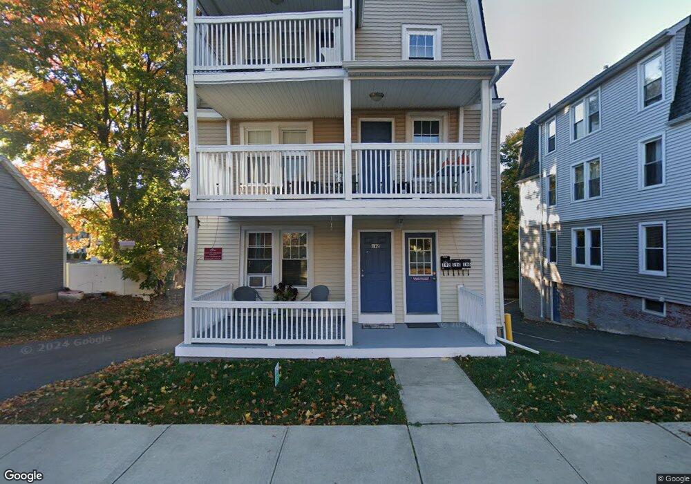
192 High St Bristol, CT 06010
Federal Hill NeighborhoodEstimated Value: $447,000 - $509,000
6
Beds
3
Baths
2,860
Sq Ft
$166/Sq Ft
Est. Value
About This Home
This home is located at 192 High St, Bristol, CT 06010 and is currently estimated at $474,000, approximately $165 per square foot. 192 High St is a home located in Hartford County with nearby schools including Ellen P. Hubbell School, Chippens Hill Middle School, and Bristol Eastern High School.
Ownership History
Date
Name
Owned For
Owner Type
Purchase Details
Closed on
Oct 5, 2010
Sold by
Flint Jason and Flint Paige
Bought by
Carrier Constr Inc
Current Estimated Value
Home Financials for this Owner
Home Financials are based on the most recent Mortgage that was taken out on this home.
Original Mortgage
$577,500
Outstanding Balance
$4,384
Interest Rate
4.44%
Estimated Equity
$469,616
Purchase Details
Closed on
May 15, 2008
Sold by
Dziadosz Marion and Dziadosz Sophie
Bought by
Flint Jason
Create a Home Valuation Report for This Property
The Home Valuation Report is an in-depth analysis detailing your home's value as well as a comparison with similar homes in the area
Home Values in the Area
Average Home Value in this Area
Purchase History
| Date | Buyer | Sale Price | Title Company |
|---|---|---|---|
| Carrier Constr Inc | $195,000 | -- | |
| Flint Jason | $85,000 | -- |
Source: Public Records
Mortgage History
| Date | Status | Borrower | Loan Amount |
|---|---|---|---|
| Open | Flint Jason | $577,500 |
Source: Public Records
Tax History Compared to Growth
Tax History
| Year | Tax Paid | Tax Assessment Tax Assessment Total Assessment is a certain percentage of the fair market value that is determined by local assessors to be the total taxable value of land and additions on the property. | Land | Improvement |
|---|---|---|---|---|
| 2025 | $8,160 | $241,780 | $26,460 | $215,320 |
| 2024 | $7,591 | $238,350 | $26,460 | $211,890 |
| 2023 | $7,234 | $238,350 | $26,460 | $211,890 |
| 2022 | $5,498 | $143,360 | $15,050 | $128,310 |
| 2021 | $5,498 | $143,360 | $15,050 | $128,310 |
| 2020 | $5,498 | $143,360 | $15,050 | $128,310 |
| 2019 | $5,455 | $143,360 | $15,050 | $128,310 |
| 2018 | $5,287 | $143,360 | $15,050 | $128,310 |
| 2017 | $4,984 | $138,320 | $28,630 | $109,690 |
| 2016 | $4,984 | $138,320 | $28,630 | $109,690 |
| 2015 | $4,787 | $138,320 | $28,630 | $109,690 |
| 2014 | $4,787 | $138,320 | $28,630 | $109,690 |
Source: Public Records
Map
Nearby Homes
- 157 High St
- 301 Queen St
- 309 Queen St
- 10 Henry St
- 35 Broadview St
- 5 Oakland St
- 111 Stearns St
- 11 Cawley Ct
- 220 Blakeslee St Unit 220
- 38 Prospect Place
- 510 South St
- 54 Downs St
- 62 Chatham Ln
- 207 Summer St
- 17 Grove St Unit 3RD
- 213 Summer St
- 109 Seymour St
- 36 Richmond Place
- 93 South St
- 29 Lincoln Place