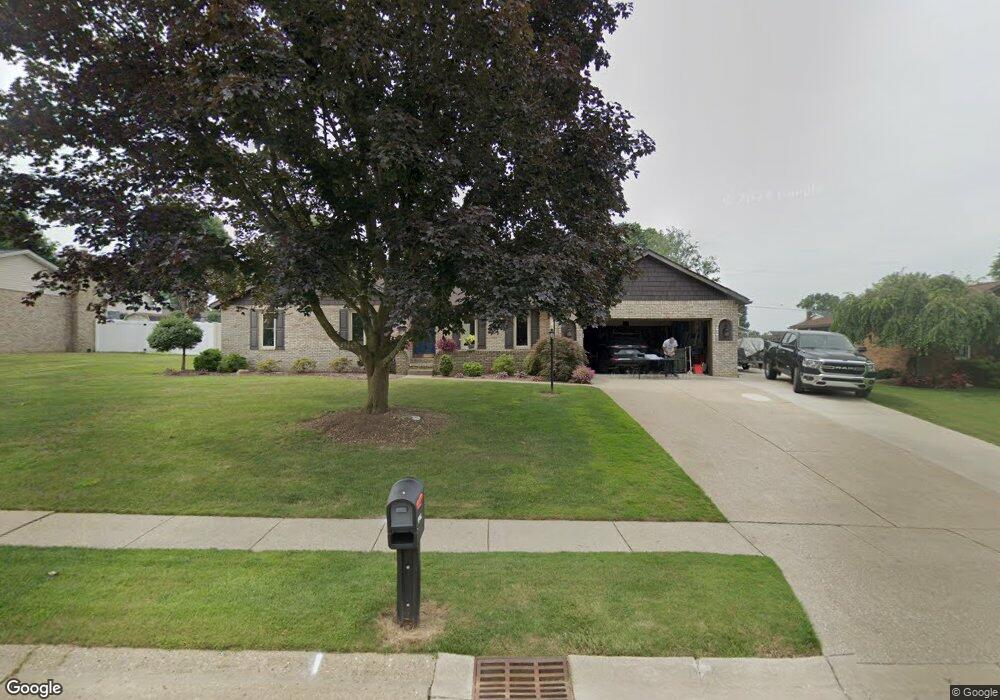
1926 Opal St Louisville, OH 44641
Estimated Value: $286,160 - $322,000
3
Beds
3
Baths
1,648
Sq Ft
$184/Sq Ft
Est. Value
About This Home
This home is located at 1926 Opal St, Louisville, OH 44641 and is currently estimated at $304,040, approximately $184 per square foot. 1926 Opal St is a home located in Stark County with nearby schools including Louisville High School and St. Thomas Aquinas High School & Middle School.
Ownership History
Date
Name
Owned For
Owner Type
Purchase Details
Closed on
Sep 26, 2014
Sold by
Myers Larry J and Myers Nancy J
Bought by
Warstler Jerri A and Stevens James L
Current Estimated Value
Home Financials for this Owner
Home Financials are based on the most recent Mortgage that was taken out on this home.
Original Mortgage
$95,000
Outstanding Balance
$72,858
Interest Rate
4.11%
Mortgage Type
New Conventional
Estimated Equity
$231,182
Purchase Details
Closed on
Apr 27, 2002
Sold by
Myers Nancy J
Bought by
Myers Lawrence J and Myers Nancy J
Purchase Details
Closed on
Feb 2, 2001
Sold by
Myers Larry J
Bought by
Myers Nancy J
Create a Home Valuation Report for This Property
The Home Valuation Report is an in-depth analysis detailing your home's value as well as a comparison with similar homes in the area
Home Values in the Area
Average Home Value in this Area
Purchase History
| Date | Buyer | Sale Price | Title Company |
|---|---|---|---|
| Warstler Jerri A | $190,000 | None Available | |
| Myers Lawrence J | -- | -- | |
| Myers Nancy J | -- | -- |
Source: Public Records
Mortgage History
| Date | Status | Borrower | Loan Amount |
|---|---|---|---|
| Open | Warstler Jerri A | $95,000 |
Source: Public Records
Tax History Compared to Growth
Tax History
| Year | Tax Paid | Tax Assessment Tax Assessment Total Assessment is a certain percentage of the fair market value that is determined by local assessors to be the total taxable value of land and additions on the property. | Land | Improvement |
|---|---|---|---|---|
| 2025 | -- | $84,390 | $18,030 | $66,360 |
| 2024 | -- | $84,390 | $18,030 | $66,360 |
| 2023 | $3,161 | $73,540 | $17,010 | $56,530 |
| 2022 | $3,168 | $73,540 | $17,010 | $56,530 |
| 2021 | $3,176 | $73,540 | $17,010 | $56,530 |
| 2020 | $2,631 | $66,150 | $15,330 | $50,820 |
| 2019 | $2,635 | $65,990 | $15,160 | $50,830 |
| 2018 | $2,625 | $65,990 | $15,160 | $50,830 |
| 2017 | $2,426 | $58,840 | $13,300 | $45,540 |
| 2016 | $2,476 | $58,840 | $13,300 | $45,540 |
| 2015 | $2,483 | $58,840 | $13,300 | $45,540 |
| 2014 | $1,620 | $44,390 | $11,520 | $32,870 |
| 2013 | $814 | $44,390 | $11,520 | $32,870 |
Source: Public Records
Map
Nearby Homes
- 2110 Edmar St
- 1812 E Broad St
- 1715 High St
- 3390 Meese Rd NE
- 641 S Nickelplate St
- 2015 E Main St
- 308 Superior St
- 520 S Silver St
- 908 Sand Lot Cir
- 0 Michigan Blvd
- 728 E Broad St
- 510 S Bauman Ct
- 204 E Broad St
- 107 E Broad St
- 8225 Georgetown St
- 325 Lincoln Ave
- 1170 Winding Ridge Ave
- 1702 View Pointe Ave
- 910 Crosswyck Cir
- 1639 Horizon Dr