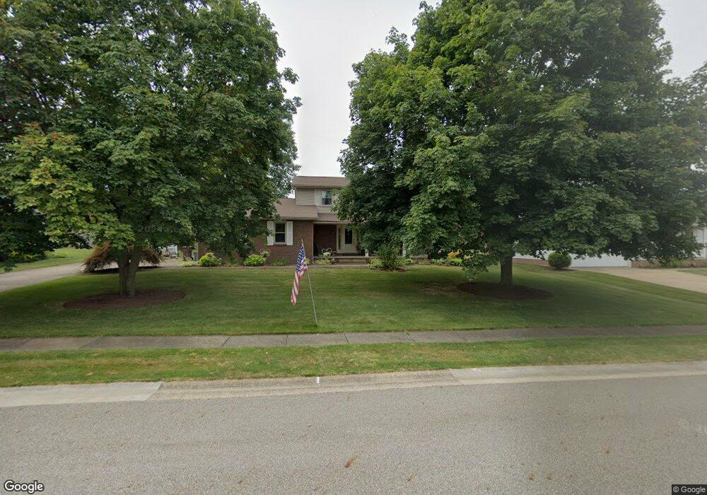
1926 Tanglewood Cir Louisville, OH 44641
Estimated Value: $292,690 - $342,000
3
Beds
3
Baths
2,306
Sq Ft
$138/Sq Ft
Est. Value
About This Home
This home is located at 1926 Tanglewood Cir, Louisville, OH 44641 and is currently estimated at $317,923, approximately $137 per square foot. 1926 Tanglewood Cir is a home located in Stark County with nearby schools including Louisville High School and St. Thomas Aquinas High School & Middle School.
Ownership History
Date
Name
Owned For
Owner Type
Purchase Details
Closed on
Jun 18, 2009
Sold by
Harrison Danny C and Matthews Linda J
Bought by
Harrison Danny C and Harrison Lindy J A
Current Estimated Value
Purchase Details
Closed on
Nov 19, 1993
Purchase Details
Closed on
Mar 17, 1992
Purchase Details
Closed on
May 4, 1988
Create a Home Valuation Report for This Property
The Home Valuation Report is an in-depth analysis detailing your home's value as well as a comparison with similar homes in the area
Home Values in the Area
Average Home Value in this Area
Purchase History
| Date | Buyer | Sale Price | Title Company |
|---|---|---|---|
| Harrison Danny C | -- | Attorney | |
| -- | $127,000 | -- | |
| -- | $107,500 | -- | |
| -- | $76,000 | -- |
Source: Public Records
Tax History Compared to Growth
Tax History
| Year | Tax Paid | Tax Assessment Tax Assessment Total Assessment is a certain percentage of the fair market value that is determined by local assessors to be the total taxable value of land and additions on the property. | Land | Improvement |
|---|---|---|---|---|
| 2025 | -- | $86,070 | $17,640 | $68,430 |
| 2024 | -- | $86,070 | $17,640 | $68,430 |
| 2023 | $2,423 | $65,560 | $16,630 | $48,930 |
| 2022 | $1,224 | $65,560 | $16,630 | $48,930 |
| 2021 | $2,454 | $65,560 | $16,630 | $48,930 |
| 2020 | $2,055 | $60,410 | $14,980 | $45,430 |
| 2019 | $1,988 | $58,520 | $14,980 | $43,540 |
| 2018 | $1,980 | $58,520 | $14,980 | $43,540 |
| 2017 | $1,799 | $52,360 | $13,160 | $39,200 |
| 2016 | $1,836 | $52,360 | $13,160 | $39,200 |
| 2015 | $1,841 | $52,360 | $13,160 | $39,200 |
| 2014 | $1,658 | $45,260 | $11,380 | $33,880 |
| 2013 | $833 | $45,260 | $11,380 | $33,880 |
Source: Public Records
Map
Nearby Homes
- 2110 Edmar St
- 1812 E Broad St
- 1715 High St
- 2015 E Main St
- 3390 Meese Rd NE
- 641 S Nickelplate St
- 308 Superior St
- 520 S Silver St
- 0 Michigan Blvd
- 728 E Broad St
- 908 Sand Lot Cir
- 510 S Bauman Ct
- 204 E Broad St
- 107 E Broad St
- 325 Lincoln Ave
- 8225 Georgetown St
- 1170 Winding Ridge Ave
- 1702 View Pointe Ave
- 910 Crosswyck Cir
- 1639 Horizon Dr
- 1923 Tanglewood Cir
- 1931 Tanglewood Cir
- 2006 Tanglewood Cir
- 1916 Tanglewood Cir
- 1913 Tanglewood Cir
- 2009 Tanglewood Cir
- 1927 Opal St
- 1937 Opal St
- 2016 Tanglewood Cir
- 1900 Tanglewood Cir
- 1917 Opal St
- 1947 Opal St
- 2017 Tanglewood Cir
- 905 Bentwood Cir
- 1905 Tanglewood Cir
- 906 Bentwood Cir
- 1907 Opal St
- 1957 Opal St
- 2020 Tanglewood Cir
- 2027 Tanglewood Cir