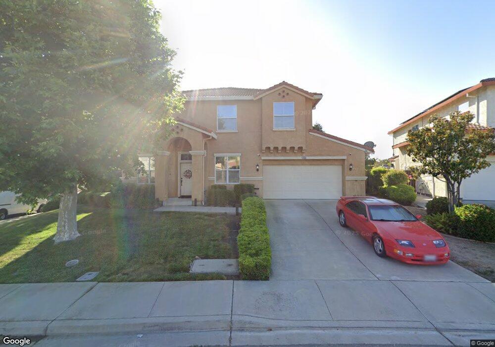
1928 Kern Mountain Way Antioch, CA 94531
Lone Tree Valley NeighborhoodEstimated Value: $642,000 - $734,868
4
Beds
3
Baths
2,364
Sq Ft
$293/Sq Ft
Est. Value
About This Home
This home is located at 1928 Kern Mountain Way, Antioch, CA 94531 and is currently estimated at $691,967, approximately $292 per square foot. 1928 Kern Mountain Way is a home located in Contra Costa County with nearby schools including Lone Tree Elementary School, Dallas Ranch Middle School, and Deer Valley High School.
Ownership History
Date
Name
Owned For
Owner Type
Purchase Details
Closed on
Sep 22, 2025
Sold by
Mitchell Preston Thomas and Mitchell Rebekah M
Bought by
Mitchell Family Living Trust and Mitchell
Current Estimated Value
Purchase Details
Closed on
Jan 15, 2008
Sold by
Brown Audrey M
Bought by
Mitchell Preston Thomas and Mitchell Rebekah Marie
Purchase Details
Closed on
Jan 3, 2008
Sold by
Brown Audrey M
Bought by
Mitchell Preston T and Mitchell Rebekah M
Purchase Details
Closed on
Jul 22, 2005
Sold by
Mitchell Preston T and Mitchell Rebekah M
Bought by
Mitchell Preston T and Mitchell Rebekah M
Home Financials for this Owner
Home Financials are based on the most recent Mortgage that was taken out on this home.
Original Mortgage
$414,955
Interest Rate
5.62%
Mortgage Type
Purchase Money Mortgage
Purchase Details
Closed on
May 12, 2003
Sold by
Mitchell Preston T and Mitchell Rebekah M
Bought by
Mitchell Preston T and Mitchell Rebekah M
Home Financials for this Owner
Home Financials are based on the most recent Mortgage that was taken out on this home.
Original Mortgage
$273,800
Interest Rate
4.37%
Mortgage Type
Purchase Money Mortgage
Purchase Details
Closed on
Mar 1, 2001
Sold by
Brown Fred E and Brown Audrey M
Bought by
Mitchell Preston T and Mitchell Rebekah M
Home Financials for this Owner
Home Financials are based on the most recent Mortgage that was taken out on this home.
Original Mortgage
$272,000
Interest Rate
7.12%
Mortgage Type
Purchase Money Mortgage
Purchase Details
Closed on
Dec 11, 1998
Sold by
Black Diamond Knolls Ltd
Bought by
Brown Fred E and Brown Audrey M
Home Financials for this Owner
Home Financials are based on the most recent Mortgage that was taken out on this home.
Original Mortgage
$238,348
Interest Rate
10.75%
Mortgage Type
Purchase Money Mortgage
Create a Home Valuation Report for This Property
The Home Valuation Report is an in-depth analysis detailing your home's value as well as a comparison with similar homes in the area
Home Values in the Area
Average Home Value in this Area
Purchase History
| Date | Buyer | Sale Price | Title Company |
|---|---|---|---|
| Mitchell Family Living Trust | -- | None Listed On Document | |
| Mitchell Preston Thomas | -- | Titleserv Inc | |
| Mitchell Preston T | -- | Accommodation | |
| Mitchell Preston T | -- | -- | |
| Mitchell Preston T | -- | Chicago Title Co | |
| Mitchell Preston T | -- | Old Republic Title Company | |
| Brown Fred E | $238,500 | Old Republic Title Company |
Source: Public Records
Mortgage History
| Date | Status | Borrower | Loan Amount |
|---|---|---|---|
| Previous Owner | Mitchell Preston T | $414,955 | |
| Previous Owner | Mitchell Preston T | $273,800 | |
| Previous Owner | Mitchell Preston T | $272,000 | |
| Previous Owner | Brown Fred E | $238,348 |
Source: Public Records
Tax History Compared to Growth
Tax History
| Year | Tax Paid | Tax Assessment Tax Assessment Total Assessment is a certain percentage of the fair market value that is determined by local assessors to be the total taxable value of land and additions on the property. | Land | Improvement |
|---|---|---|---|---|
| 2025 | $4,898 | $421,377 | $78,374 | $343,003 |
| 2024 | $4,721 | $413,116 | $76,838 | $336,278 |
| 2023 | $4,721 | $405,017 | $75,332 | $329,685 |
| 2022 | $4,648 | $397,076 | $73,855 | $323,221 |
| 2021 | $4,508 | $389,291 | $72,407 | $316,884 |
| 2019 | $4,404 | $377,746 | $70,260 | $307,486 |
| 2018 | $4,237 | $370,340 | $68,883 | $301,457 |
| 2017 | $4,149 | $363,080 | $67,533 | $295,547 |
| 2016 | $4,047 | $355,961 | $66,209 | $289,752 |
| 2015 | $4,331 | $350,615 | $65,215 | $285,400 |
| 2014 | $5,040 | $343,748 | $63,938 | $279,810 |
Source: Public Records
Map
Nearby Homes
- 1879 Mount Conness Way
- 1928 Badger Pass Way
- 2344 Forty Niner Ct
- 2401 Silveria Way
- 4604 Coal Hill Place
- 5243 Delta View Way
- 1525 Barkley Mountain Way
- 1333 Mokelumne Dr
- 2133 Bamboo Way
- 4528 Fallow Way
- 5488 Southwood Ct
- 1157 Rockspring Way
- 4529 Pronghorn Way
- 5448 Southwood Way
- 4925 Cache Peak Dr
- 2101 Asilomar Dr
- 2721 Vallejo Ct
- 4836 Belford Peak Way
- 5023 Vesteny Ct
- 4959 Star Mine Ct
- 1924 Kern Mountain Way
- 1932 Kern Mountain Way
- 1920 Kern Mountain Way
- 1925 Kern Mountain Way
- 1936 Kern Mountain Way
- 1921 Kern Mountain Way
- 1929 Kern Mountain Way
- 1916 Kern Mountain Way
- 1933 Kern Mountain Way
- 1940 Kern Mountain Way
- 1912 Kern Mountain Way
- 1917 Kern Mountain Way
- 1937 Kern Mountain Way
- 5217 Kelsey Peak Way
- 5213 Kelsey Peak Way
- 1944 Kern Mountain Way
- 1922 Mount Conness Way
- 1908 Kern Mountain Way
- 1929 Tioga Pass Way
- 5209 Kelsey Peak Way