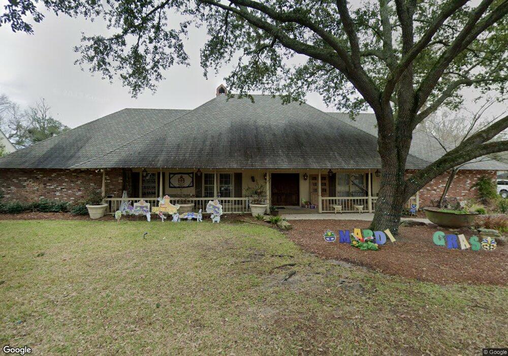
1929 Woodland Dr Baton Rouge, LA 70808
Mid City South NeighborhoodEstimated Value: $484,000 - $820,273
--
Bed
--
Bath
3,664
Sq Ft
$185/Sq Ft
Est. Value
About This Home
This home is located at 1929 Woodland Dr, Baton Rouge, LA 70808 and is currently estimated at $679,568, approximately $185 per square foot. 1929 Woodland Dr is a home located in East Baton Rouge Parish with nearby schools including Bernard Terrace Elementary School, Westdale Middle School, and Tara High School.
Ownership History
Date
Name
Owned For
Owner Type
Purchase Details
Closed on
Dec 28, 2015
Sold by
Harvey Henry Brook and Harvey Anne E
Bought by
Aycock Charles W and Aycock Mary R
Current Estimated Value
Home Financials for this Owner
Home Financials are based on the most recent Mortgage that was taken out on this home.
Original Mortgage
$417,000
Outstanding Balance
$332,407
Interest Rate
4.03%
Mortgage Type
New Conventional
Estimated Equity
$347,161
Purchase Details
Closed on
Jul 2, 2004
Sold by
Providence Partners
Bought by
Harvey Henry
Create a Home Valuation Report for This Property
The Home Valuation Report is an in-depth analysis detailing your home's value as well as a comparison with similar homes in the area
Home Values in the Area
Average Home Value in this Area
Purchase History
| Date | Buyer | Sale Price | Title Company |
|---|---|---|---|
| Aycock Charles W | $550,000 | Attorney | |
| Harvey Henry | $130,000 | -- |
Source: Public Records
Mortgage History
| Date | Status | Borrower | Loan Amount |
|---|---|---|---|
| Open | Aycock Charles W | $417,000 |
Source: Public Records
Tax History Compared to Growth
Tax History
| Year | Tax Paid | Tax Assessment Tax Assessment Total Assessment is a certain percentage of the fair market value that is determined by local assessors to be the total taxable value of land and additions on the property. | Land | Improvement |
|---|---|---|---|---|
| 2024 | $6,351 | $60,960 | $3,000 | $57,960 |
| 2023 | $6,351 | $54,960 | $3,000 | $51,960 |
| 2022 | $6,562 | $54,960 | $3,000 | $51,960 |
| 2021 | $6,412 | $54,960 | $3,000 | $51,960 |
| 2020 | $6,370 | $54,960 | $3,000 | $51,960 |
| 2019 | $6,328 | $52,250 | $3,000 | $49,250 |
| 2018 | $6,250 | $52,250 | $3,000 | $49,250 |
| 2017 | $6,250 | $52,250 | $3,000 | $49,250 |
| 2016 | $5,317 | $52,250 | $3,000 | $49,250 |
| 2015 | $2,445 | $27,600 | $3,000 | $24,600 |
| 2014 | $2,436 | $27,600 | $3,000 | $24,600 |
| 2013 | -- | $27,600 | $3,000 | $24,600 |
Source: Public Records
Map
Nearby Homes
- 4624 Wells St
- 4936 Abelia Dr
- 4352 Woodside Dr
- 1958 Ingleside Dr
- 1547 Avondale Dr
- 5065 Bardwell Dr
- 4956 Bawell St
- 2165 Glenmore Ave
- 1932 Glenmore Ave
- 1758 Marshall Dr
- 1667 Ormandy Dr
- 2100 College Dr Unit 63
- 2100 College Dr Unit 98
- 2100 College Dr Unit 186
- 2100 College Dr Unit 97
- 2100 College Dr Unit 174
- 1454 Ormandy Dr
- 3151 College Dr
- 2027 Richland Ave
- 4044 S Ramsey Dr
- 1939 Woodland Dr
- 1946 Avondale Dr
- 1928 Avondale Dr
- 1919 Woodland Dr
- 1919 Woodland Dr
- 4645 Woodland Dr
- 18269 Woodland Dr
- 0 Woodland Dr
- 1970 Avondale Dr
- 1944 Woodland Dr
- 1912 Avondale Dr
- 1949 Woodland Dr
- 2014 Avondale Dr
- 1950 Woodland Dr
- 1866 Avondale Dr
- 1925 Country Club Dr
- 1913 Country Club Dr
- 2026 Avondale Dr
- 1929 Avondale Dr
- 1971 Woodland Dr