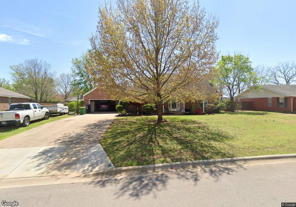
193 Countryside Dr Farmington, AR 72730
Estimated Value: $380,387 - $421,000
--
Bed
2
Baths
2,198
Sq Ft
$181/Sq Ft
Est. Value
About This Home
This home is located at 193 Countryside Dr, Farmington, AR 72730 and is currently estimated at $398,847, approximately $181 per square foot. 193 Countryside Dr is a home located in Washington County with nearby schools including Randall G. Lynch Middle School, Bob Folsom Elementary School, and Farmington Jr. High.
Ownership History
Date
Name
Owned For
Owner Type
Purchase Details
Closed on
Oct 29, 2013
Sold by
Hawkins Roy G and Hawkins Patricia A
Bought by
Hawkins Roy G and Hawkins Patricia Ann
Current Estimated Value
Purchase Details
Closed on
Aug 4, 1997
Bought by
Hawkins Roy G and Hawkins Patricia A
Purchase Details
Closed on
May 30, 1995
Bought by
Carle Construction Co Inc
Create a Home Valuation Report for This Property
The Home Valuation Report is an in-depth analysis detailing your home's value as well as a comparison with similar homes in the area
Home Values in the Area
Average Home Value in this Area
Purchase History
| Date | Buyer | Sale Price | Title Company |
|---|---|---|---|
| Hawkins Roy G | -- | None Available | |
| Hawkins Roy G | $124,000 | -- | |
| Carle Construction Co Inc | $21,000 | -- |
Source: Public Records
Tax History Compared to Growth
Tax History
| Year | Tax Paid | Tax Assessment Tax Assessment Total Assessment is a certain percentage of the fair market value that is determined by local assessors to be the total taxable value of land and additions on the property. | Land | Improvement |
|---|---|---|---|---|
| 2025 | $1,165 | $66,590 | $13,500 | $53,090 |
| 2024 | $1,282 | $66,590 | $13,500 | $53,090 |
| 2023 | $1,433 | $66,590 | $13,500 | $53,090 |
| 2022 | $1,483 | $39,220 | $9,000 | $30,220 |
| 2021 | $1,494 | $39,220 | $9,000 | $30,220 |
| 2020 | $1,494 | $39,220 | $9,000 | $30,220 |
| 2019 | $1,501 | $36,640 | $9,000 | $27,640 |
| 2018 | $1,526 | $36,640 | $9,000 | $27,640 |
| 2017 | $151 | $36,640 | $9,000 | $27,640 |
| 2016 | $1,508 | $36,640 | $9,000 | $27,640 |
| 2015 | $1,508 | $36,640 | $9,000 | $27,640 |
| 2014 | $1,508 | $34,668 | $8,018 | $26,650 |
Source: Public Records
Map
Nearby Homes
- 201 Countryside Dr
- 237 Briarhill Dr
- 285 Briarhill Dr
- Rye 1903 Plan at The Grove at Engles Mill
- Ouachita 1669 Plan at The Grove at Engles Mill
- Cache 1788 Plan at The Grove at Engles Mill
- Degray 1757 Plan at The Grove at Engles Mill
- Stella 1848 Plan at The Grove at Engles Mill
- Millwood 1862 Plan at The Grove at Engles Mill
- Magnolia 1556 Plan at The Grove at Engles Mill
- Eureka 1536 Plan at The Grove at Engles Mill
- Springs 1445 Plan at The Grove at Engles Mill
- Piper 2064 Plan at The Grove at Engles Mill
- Oak 1463 Plan at The Grove at Engles Mill
- Daisy 2147 Plan at The Grove at Engles Mill
- Ashton 1496 Plan at The Grove at Engles Mill
- Hendrix 1983 Plan at The Grove at Engles Mill
- Osage 1567 Plan at The Grove at Engles Mill
- Maple 1659 Plan at The Grove at Engles Mill
- 275 S Nightfall Ave
- 187 Countryside Dr
- 190 Applewood Ave
- 184 Applewood Ave
- 209 Countryside Dr
- 190 Countryside Dr
- 176 Applewood Ave
- 179 Countryside Dr
- 207 Briarhill Dr
- 202 Countryside Dr
- 170 Applewood Ave
- 184 Countryside Dr
- 208 Countryside Dr
- 217 Countryside Dr
- 219 Briarhill Dr
- 218 Briarhill Dr
- 164 Applewood Ave
- 167 Countryside Dr
- 177 Applewood Ave
- 170 Countryside Dr
- 193 Cedar Brook Place