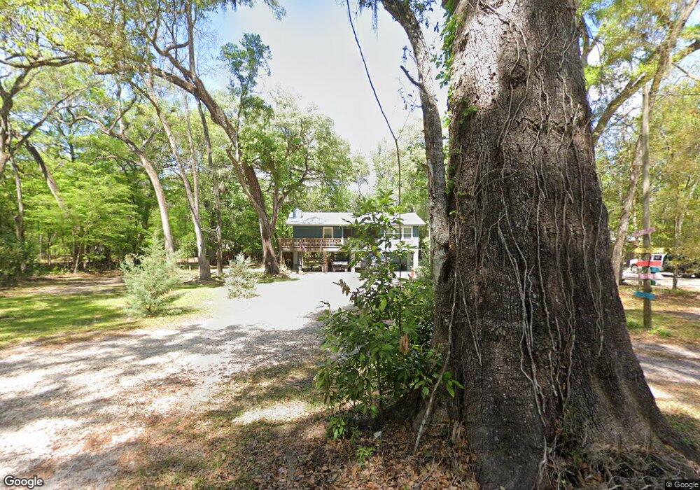
1930 NE 127th Ln Branford, FL 32008
Estimated Value: $245,000
2
Beds
1
Bath
788
Sq Ft
$311/Sq Ft
Est. Value
About This Home
This home is located at 1930 NE 127th Ln, Branford, FL 32008 and is currently priced at $245,000, approximately $310 per square foot. 1930 NE 127th Ln is a home located in Gilchrist County.
Ownership History
Date
Name
Owned For
Owner Type
Purchase Details
Closed on
Nov 23, 2020
Sold by
Cromwell Jeffery D and Cromwell Stacia J
Bought by
Harris Joseph and Harris Kimberly J
Current Estimated Value
Home Financials for this Owner
Home Financials are based on the most recent Mortgage that was taken out on this home.
Original Mortgage
$93,547
Outstanding Balance
$29,253
Interest Rate
2.8%
Mortgage Type
Future Advance Clause Open End Mortgage
Purchase Details
Closed on
Aug 31, 2016
Sold by
Nettles Larry and Nettles Theresa
Bought by
Proactive Investments Inc
Purchase Details
Closed on
Feb 18, 2004
Sold by
Nettles Marcia M
Bought by
Nettles Ronald E
Create a Home Valuation Report for This Property
The Home Valuation Report is an in-depth analysis detailing your home's value as well as a comparison with similar homes in the area
Home Values in the Area
Average Home Value in this Area
Purchase History
| Date | Buyer | Sale Price | Title Company |
|---|---|---|---|
| Harris Joseph | $112,000 | Bankers Ttl Of Nature Coast | |
| Proactive Investments Inc | $20,000 | None Available | |
| Nettles Ronald E | -- | -- |
Source: Public Records
Mortgage History
| Date | Status | Borrower | Loan Amount |
|---|---|---|---|
| Open | Harris Joseph | $93,547 |
Source: Public Records
Tax History Compared to Growth
Tax History
| Year | Tax Paid | Tax Assessment Tax Assessment Total Assessment is a certain percentage of the fair market value that is determined by local assessors to be the total taxable value of land and additions on the property. | Land | Improvement |
|---|---|---|---|---|
| 2020 | $1,090 | $55,162 | $13,775 | $41,387 |
| 2019 | $1,068 | $54,294 | $13,775 | $40,519 |
| 2018 | $1,027 | $54,284 | $13,775 | $40,509 |
| 2017 | $921 | $43,426 | $0 | $0 |
| 2016 | $943 | $43,783 | $0 | $0 |
| 2015 | $435 | $40,008 | $0 | $0 |
| 2013 | -- | $39,103 | $0 | $0 |
Source: Public Records
Map
Nearby Homes
- 1759 NE 127th St
- 12890 NE 120 Loop
- 0 NE 127th St
- 0 SW Bumble St Unit 128719
- 158 SW Bumble St
- lot 36 SW Bumble St
- 498 SW Manatee Terrace
- 0 NE 120th Loop
- TBD SW Reno Way
- 1521 SW Central Terrace
- 960 SW Iowa Dr
- TBD SW Boston Terrace
- 843 SW Illinois St
- 00 SW Newark Dr Unit 3
- 0 SW Newark Dr Unit MFRGC535738
- 0 SW Newark Dr Unit MFRR4908315
- 0 SW Newark Dr Unit MFRR4908314
- 1745 SW Newark Dr
- 1965 SW Newark Dr
- 135 SW Virginia Way
- 1890 NE 127th Ln
- 1949 NE 127th Ln
- 1979 NE 127th Ln
- 1869 NE 127th Ln
- 1879 NE 128th Place
- 1880 NE 128th Place
- 1840 NE 127th Ln
- 1960 NE 128th Place
- 1930 NE 128th Place
- 1940 NE 127th St
- 1920 NE 128th Place
- 1850 NE 127th St
- 1949 NE 127th St
- 1850 NE 128th Place
- 1909 NE 127th St
- 1910 NE 128th Place
- 1819 NE 127th Ln
- 12700 NE 2nd Way
- 2030 NE 128th Place
- 12810 NE 20th Ct