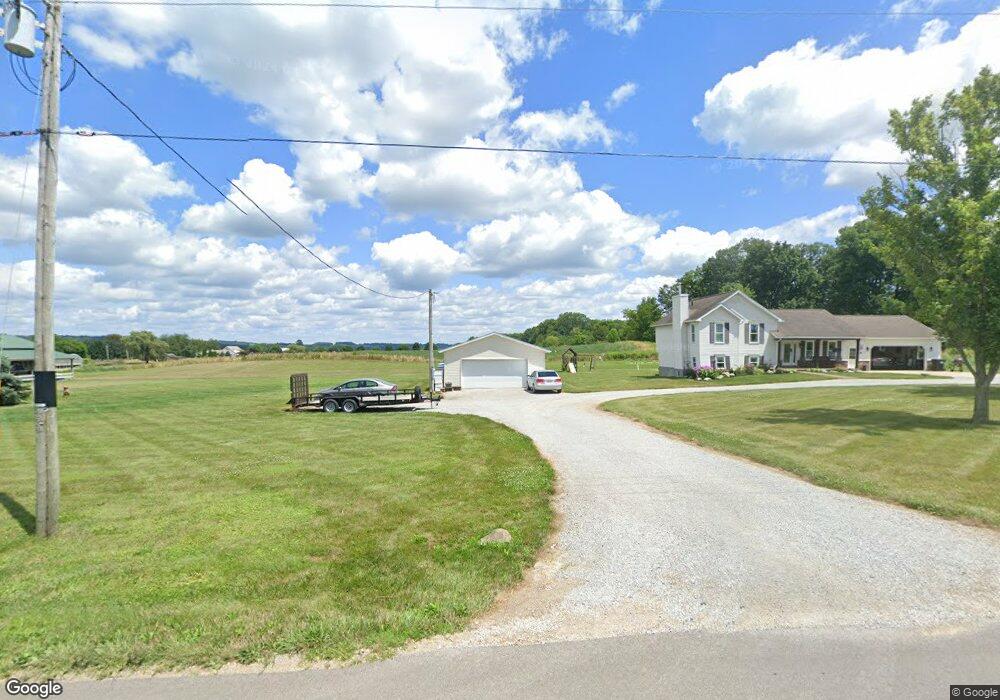
1931 Township Road 405 Jeromesville, OH 44840
Estimated Value: $284,949 - $353,000
3
Beds
2
Baths
1,232
Sq Ft
$252/Sq Ft
Est. Value
About This Home
This home is located at 1931 Township Road 405, Jeromesville, OH 44840 and is currently estimated at $310,737, approximately $252 per square foot. 1931 Township Road 405 is a home located in Ashland County with nearby schools including Hillsdale Elementary School, Hillsdale Middle School, and Hillsdale High School.
Ownership History
Date
Name
Owned For
Owner Type
Purchase Details
Closed on
Jan 12, 2006
Sold by
Hurst Matthew M
Bought by
Coblentz Davin T
Current Estimated Value
Purchase Details
Closed on
Jun 3, 2003
Sold by
Shafer Esther L
Bought by
Hurst Matthew M
Purchase Details
Closed on
Feb 12, 1999
Sold by
Dague Tracy L
Bought by
Shafer Esther L
Purchase Details
Closed on
Jan 6, 1997
Bought by
Dague Tracy L
Create a Home Valuation Report for This Property
The Home Valuation Report is an in-depth analysis detailing your home's value as well as a comparison with similar homes in the area
Home Values in the Area
Average Home Value in this Area
Purchase History
| Date | Buyer | Sale Price | Title Company |
|---|---|---|---|
| Coblentz Davin T | $56,000 | -- | |
| Hurst Matthew M | $50,000 | -- | |
| Shafer Esther L | $17,500 | -- | |
| Dague Tracy L | -- | -- |
Source: Public Records
Tax History Compared to Growth
Tax History
| Year | Tax Paid | Tax Assessment Tax Assessment Total Assessment is a certain percentage of the fair market value that is determined by local assessors to be the total taxable value of land and additions on the property. | Land | Improvement |
|---|---|---|---|---|
| 2024 | $2,536 | $73,990 | $11,520 | $62,470 |
| 2023 | $2,536 | $73,990 | $11,520 | $62,470 |
| 2022 | $2,486 | $56,920 | $8,860 | $48,060 |
| 2021 | $2,490 | $56,920 | $8,860 | $48,060 |
| 2020 | $2,340 | $56,920 | $8,860 | $48,060 |
| 2019 | $2,182 | $52,020 | $8,680 | $43,340 |
| 2018 | $2,117 | $52,020 | $8,680 | $43,340 |
| 2017 | $1,865 | $52,020 | $8,680 | $43,340 |
| 2016 | $1,865 | $46,030 | $7,680 | $38,350 |
| 2015 | $1,842 | $46,030 | $7,680 | $38,350 |
| 2013 | $608 | $13,740 | $7,820 | $5,920 |
Source: Public Records
Map
Nearby Homes
- 2057 State Route 89
- 14 E South St
- 0 Ashland County Road 2175
- 0 Ashland County Road 2175
- 1845 County Road 655
- 150 E Main St
- 112 Ohio 95
- 144 Township Road 1650
- 820 County Road 30a
- 10610 W Old Lincoln Way Unit 6201 Newkirk Rd.
- 0 Twp Rd 1806 Unit 11591470
- 560 Township Road 2402
- 2289 N Reedsburg Rd
- 1653 State Route 60
- 1653 Ohio 60
- 609 Ohio 95
- 156 U S 250
- 1346 Ohio 89
- 2445 S Elyria Rd
- 1346 State Route 89
- 1927 405
- 1927 Township Road 405 Unit 405
- 1927 Township Road 405
- 1939 Township Road 405
- 1945 405
- 373 Township Road 1922
- 1945 Township Road 405
- 1915 Township Road 405
- 1913 Township Road 405
- 1935 Township Road 405
- 358 Township Road 1922
- 0 Township Road 1922
- 1990 Township Road 405
- 388 County Road 2000
- 388 County Road 2000
- 356 County Road 2000
- 348 County Road 2000
- 0 County Road 2000
- 1865 County Road 2175
- 402 County Road 2000