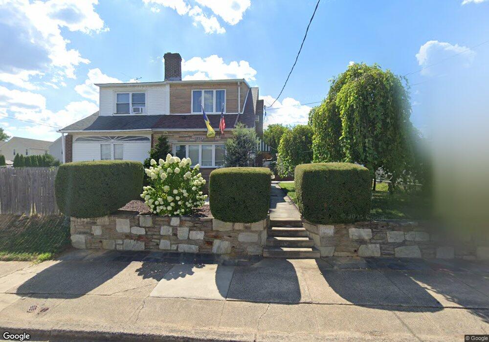
1934 Foster St Philadelphia, PA 19116
Somerton NeighborhoodEstimated Value: $348,072 - $418,000
--
Bed
--
Bath
1,408
Sq Ft
$267/Sq Ft
Est. Value
About This Home
This home is located at 1934 Foster St, Philadelphia, PA 19116 and is currently estimated at $375,268, approximately $266 per square foot. 1934 Foster St is a home located in Philadelphia County with nearby schools including Frank Anne School, CCA Baldi Middle School, and George Washington High School.
Ownership History
Date
Name
Owned For
Owner Type
Purchase Details
Closed on
Oct 31, 2012
Sold by
Gallina Sandra L
Bought by
Dmytriv Ihor and Dmytriv Iryna
Current Estimated Value
Home Financials for this Owner
Home Financials are based on the most recent Mortgage that was taken out on this home.
Original Mortgage
$137,500
Outstanding Balance
$92,322
Interest Rate
2.8%
Mortgage Type
Adjustable Rate Mortgage/ARM
Estimated Equity
$282,946
Purchase Details
Closed on
Apr 28, 2011
Sold by
Gallina Sandra L and Gallina Jeanette R
Bought by
Gallina Sandra L
Create a Home Valuation Report for This Property
The Home Valuation Report is an in-depth analysis detailing your home's value as well as a comparison with similar homes in the area
Home Values in the Area
Average Home Value in this Area
Purchase History
| Date | Buyer | Sale Price | Title Company |
|---|---|---|---|
| Dmytriv Ihor | $171,900 | None Available | |
| Gallina Sandra L | -- | None Available |
Source: Public Records
Mortgage History
| Date | Status | Borrower | Loan Amount |
|---|---|---|---|
| Open | Dmytriv Ihor | $137,500 |
Source: Public Records
Tax History Compared to Growth
Tax History
| Year | Tax Paid | Tax Assessment Tax Assessment Total Assessment is a certain percentage of the fair market value that is determined by local assessors to be the total taxable value of land and additions on the property. | Land | Improvement |
|---|---|---|---|---|
| 2025 | $3,301 | $339,900 | $67,980 | $271,920 |
| 2024 | $3,301 | $339,900 | $67,980 | $271,920 |
| 2023 | $3,301 | $235,800 | $47,160 | $188,640 |
| 2022 | $3,049 | $235,800 | $47,160 | $188,640 |
| 2021 | $3,049 | $0 | $0 | $0 |
| 2020 | $3,049 | $0 | $0 | $0 |
| 2019 | $2,871 | $0 | $0 | $0 |
| 2018 | $2,636 | $0 | $0 | $0 |
| 2017 | $2,636 | $0 | $0 | $0 |
| 2016 | $2,636 | $0 | $0 | $0 |
| 2015 | $2,523 | $0 | $0 | $0 |
| 2014 | -- | $188,300 | $136,688 | $51,612 |
| 2012 | -- | $22,112 | $5,758 | $16,354 |
Source: Public Records
Map
Nearby Homes
- 1912 Tomlinson Rd
- 1829 Tomlinson Rd
- 10123 Alexandra Ln
- 2044 Gorman St
- 1724 Nathaniel Dr
- 9990 Sandy Rd
- 9987 Hardy Rd
- 1112 Selmer Rd
- 859 Selmer Rd
- 11003 Stevens Rd
- 9926 00 Haldeman Ave
- 9926 Haldeman Unit#133 Ave
- 831 Lawler St
- 9839 Haldeman Ave
- 9837 Haldeman Ave
- 9926 Haldeman Ave
- 9921 Bustleton Ave Unit K11
- 9921 Bustleton Ave Unit P3
- 9823 Bonner St
- 2841 Comly Rd
- 1940 Foster St
- 1930 Foster St
- 1924 Foster St
- 1921 Sanford St
- 1923 Sanford St
- 1919 Foster St
- 1919 Sanford St
- 1925 Foster St
- 1936 Foster St
- 1916 Foster St
- 2000 Foster St
- 1917 Foster St
- 1917 Sanford St
- 1915 Foster St
- 2001 Foster St
- 2001 Sanford St Unit 5
- 2006 Foster St
- 1915 Sanford St
- 2003 Sanford St
- 1913 Foster St