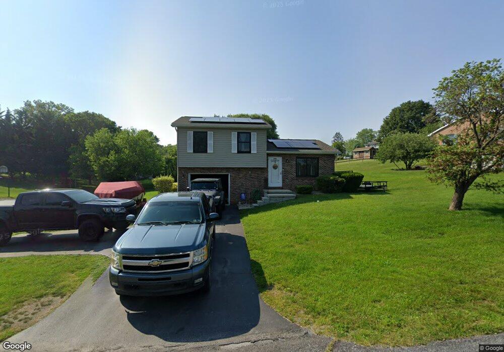
1935 Maylinn Dr Chambersburg, PA 17202
Estimated Value: $247,000 - $289,130
--
Bed
1
Bath
956
Sq Ft
$272/Sq Ft
Est. Value
About This Home
This home is located at 1935 Maylinn Dr, Chambersburg, PA 17202 and is currently estimated at $259,783, approximately $271 per square foot. 1935 Maylinn Dr is a home located in Franklin County with nearby schools including Chambersburg Area Middle School - North, Chambersburg Area Senior High School, and Cumberland Valley Christian School.
Ownership History
Date
Name
Owned For
Owner Type
Purchase Details
Closed on
Apr 21, 2006
Sold by
Hughes Barbara J
Bought by
Carpenter Brooke M
Current Estimated Value
Home Financials for this Owner
Home Financials are based on the most recent Mortgage that was taken out on this home.
Original Mortgage
$30,780
Interest Rate
6.34%
Mortgage Type
Stand Alone Second
Purchase Details
Closed on
Jul 20, 2005
Sold by
Nickey Robert S and Nickey Donna F
Bought by
Rzomp Michael and Clugston Bonnie
Create a Home Valuation Report for This Property
The Home Valuation Report is an in-depth analysis detailing your home's value as well as a comparison with similar homes in the area
Home Values in the Area
Average Home Value in this Area
Purchase History
| Date | Buyer | Sale Price | Title Company |
|---|---|---|---|
| Carpenter Brooke M | $153,900 | None Available | |
| Rzomp Michael | $175,000 | None Available |
Source: Public Records
Mortgage History
| Date | Status | Borrower | Loan Amount |
|---|---|---|---|
| Closed | Carpenter Brooke M | $30,780 |
Source: Public Records
Tax History Compared to Growth
Tax History
| Year | Tax Paid | Tax Assessment Tax Assessment Total Assessment is a certain percentage of the fair market value that is determined by local assessors to be the total taxable value of land and additions on the property. | Land | Improvement |
|---|---|---|---|---|
| 2025 | $2,433 | $14,900 | $2,900 | $12,000 |
| 2024 | $2,357 | $14,900 | $2,900 | $12,000 |
| 2023 | $2,284 | $14,900 | $2,900 | $12,000 |
| 2022 | $2,231 | $14,900 | $2,900 | $12,000 |
| 2021 | $2,231 | $14,900 | $2,900 | $12,000 |
| 2020 | $2,173 | $14,900 | $2,900 | $12,000 |
| 2019 | $2,089 | $14,900 | $2,900 | $12,000 |
| 2018 | $2,011 | $14,900 | $2,900 | $12,000 |
| 2017 | $1,943 | $14,900 | $2,900 | $12,000 |
| 2016 | $427 | $14,900 | $2,900 | $12,000 |
| 2015 | $398 | $14,900 | $2,900 | $12,000 |
| 2014 | $398 | $14,900 | $2,900 | $12,000 |
Source: Public Records
Map
Nearby Homes
- 1920 Maylinn Dr
- 0 Theodore Dr
- 0 Fern Ln
- 1539 Lakeshore Dr
- 1401 Pleasantview Dr
- 71 Obsidian Dr
- 292 Cherry Lane Dr
- 51 Diopside Dr
- 1164 Paper Mill Rd
- 38 Diopside Dr
- 601 Kittatinny Dr
- 64 Flourite Dr
- 33 Diopside Dr
- 736 Cresson Dr
- Lots 1-7 and 6.3 Acr Flourite Dr
- Lots 1-7 Flourite Dr
- 0 Mahantango Dr Unit PAFL2030056
- 161 Zircon Dr
- 1728 Old Kiln Dr
- 1126 Crottlestown Rd
- 1945 Maylinn Dr
- 1930 Maylinn Dr
- 1940 Maylinn Dr
- 1925 Maylinn Dr
- 1950 Maylinn Dr
- 1930 Quigley Dr
- 1955 Maylinn Dr
- 1920 Quigley Dr
- 1960 Maylinn Dr
- 1940 Quigley Dr
- 1965 Maylinn Dr
- 29 Jameslee Dr
- 1945 Maraposa Dr
- 1925 Quigley Dr
- 39 Jameslee Dr
- 1955 Maraposa Dr
- 1935 Maraposa Dr
- 1935 Quigley Dr
- 1950 Quigley Dr
- 1965 Maraposa Dr