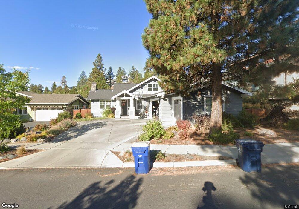
1935 NW Shevlin Crest Dr Bend, OR 97703
Summit West NeighborhoodEstimated Value: $1,382,000 - $1,576,000
3
Beds
2
Baths
2,170
Sq Ft
$684/Sq Ft
Est. Value
About This Home
This home is located at 1935 NW Shevlin Crest Dr, Bend, OR 97703 and is currently estimated at $1,485,151, approximately $684 per square foot. 1935 NW Shevlin Crest Dr is a home with nearby schools including William E. Miller Elementary School, Pacific Crest Middle School, and Summit High School.
Ownership History
Date
Name
Owned For
Owner Type
Purchase Details
Closed on
Aug 29, 2014
Sold by
Tennant Family Limited Partnership
Bought by
Frazier Jon and Frazier Shaylin
Current Estimated Value
Home Financials for this Owner
Home Financials are based on the most recent Mortgage that was taken out on this home.
Original Mortgage
$140,360
Interest Rate
4.12%
Mortgage Type
Balloon
Purchase Details
Closed on
Jul 15, 2014
Sold by
Tennant Family Limited Partnership
Bought by
Tennant Family Limited Partnership
Home Financials for this Owner
Home Financials are based on the most recent Mortgage that was taken out on this home.
Original Mortgage
$140,360
Interest Rate
4.12%
Mortgage Type
Balloon
Create a Home Valuation Report for This Property
The Home Valuation Report is an in-depth analysis detailing your home's value as well as a comparison with similar homes in the area
Home Values in the Area
Average Home Value in this Area
Purchase History
| Date | Buyer | Sale Price | Title Company |
|---|---|---|---|
| Frazier Jon | $175,450 | Amerititle | |
| Tennant Family Limited Partnership | -- | None Available |
Source: Public Records
Mortgage History
| Date | Status | Borrower | Loan Amount |
|---|---|---|---|
| Closed | Frazier Jon | $140,360 |
Source: Public Records
Tax History Compared to Growth
Tax History
| Year | Tax Paid | Tax Assessment Tax Assessment Total Assessment is a certain percentage of the fair market value that is determined by local assessors to be the total taxable value of land and additions on the property. | Land | Improvement |
|---|---|---|---|---|
| 2025 | $9,763 | $577,800 | -- | -- |
| 2024 | $9,393 | $560,980 | -- | -- |
| 2023 | $8,707 | $544,650 | $0 | $0 |
| 2022 | $8,124 | $513,390 | $0 | $0 |
| 2021 | $8,136 | $498,440 | $0 | $0 |
| 2020 | $7,719 | $498,440 | $0 | $0 |
| 2019 | $7,504 | $483,930 | $0 | $0 |
| 2018 | $7,292 | $469,840 | $0 | $0 |
| 2017 | $7,144 | $456,160 | $0 | $0 |
| 2016 | $6,816 | $442,880 | $0 | $0 |
| 2015 | $2,430 | $158,000 | $0 | $0 |
| 2014 | $350 | $21,710 | $0 | $0 |
Source: Public Records
Map
Nearby Homes
- 2927 NW Celilo Ln
- 2234 NW Reserve Camp Ct
- 2954 NW Wild Meadow Dr
- 1251 NW Stanhope Way Unit 250
- 1399 NW Fort Clatsop St Unit 1&2
- 2612 NW Lemhi Pass Dr
- The Carrington Plan at Collier
- The Wembley Plan at Collier
- The Siskiyou Plan at Collier
- The Shasta (3 Car) Plan at Collier
- The Morgan Plan at Collier
- The Bentley Plan at Collier
- The Shasta (2 Car) Plan at Collier
- The Benedict Plan at Collier
- The Rainier Plan at Collier
- The Malone Plan at Collier
- The Aspen Plan at Collier
- 3035 NW Celilo Ln
- 3067 NW Celilo Ln
- 2589 NW Lemhi Pass Dr
- 1963 NW Shevlin Crest Drive Adu
- 1963 NW Shevlin Crest Dr
- 2911 NW Celilo Ln
- 2754 NW Shields Dr
- 0 NW Shields Dr Unit 2404474
- 0 NW Shields Dr Unit 201405791
- 1936 NW Shevlin Crest Dr
- 1922 NW Shevlin Crest Dr
- 2760 NW Shields Dr
- 1908 NW Shevlin Crest Dr
- 1962 NW Shevlin Crest Dr
- 2915 NW Celilo Ln
- 1976 NW Shevlin Crest Dr
- 2766 NW Shields Dr
- 2912 NW Celilo Ln
- 2736 NW Shields Dr
- 2919 NW Celilo Ln
- 2183 NW Reserve Camp Ct
- 2755 NW Shields Dr
- 2749 NW Shields Dr Unit ID1247366P