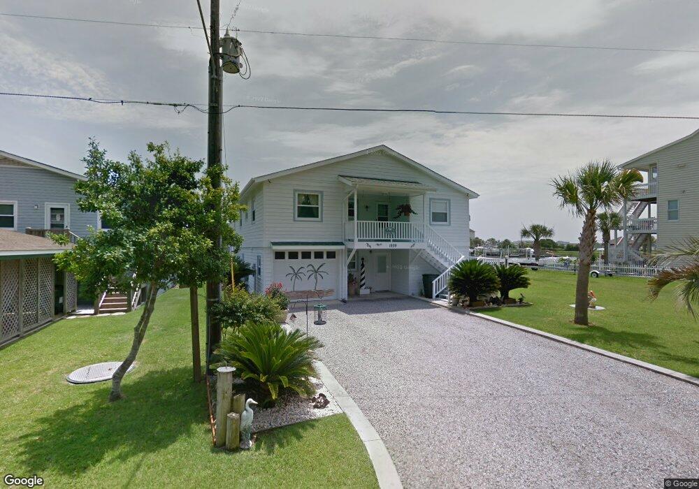
1939 W Sea Aire Canal SW Supply, NC 28462
Estimated Value: $714,000 - $962,000
4
Beds
3
Baths
2,377
Sq Ft
$361/Sq Ft
Est. Value
About This Home
This home is located at 1939 W Sea Aire Canal SW, Supply, NC 28462 and is currently estimated at $859,235, approximately $361 per square foot. 1939 W Sea Aire Canal SW is a home located in Brunswick County with nearby schools including Virginia Williamson Elementary School, Cedar Grove Middle School, and West Brunswick High School.
Ownership History
Date
Name
Owned For
Owner Type
Purchase Details
Closed on
Jan 10, 2023
Sold by
Ramey Dale C and Ramey Judith T
Bought by
Ramey Dale C and Ramey Suzanne C
Current Estimated Value
Purchase Details
Closed on
Sep 22, 2017
Sold by
Whitley Stephen G and Whitley Mary Ann
Bought by
Ramey Dale and Ramey Suzanne
Home Financials for this Owner
Home Financials are based on the most recent Mortgage that was taken out on this home.
Original Mortgage
$308,000
Interest Rate
3.9%
Mortgage Type
New Conventional
Purchase Details
Closed on
Mar 5, 2009
Sold by
Causey Freida L
Bought by
Whitley Stephen G and Whitley Mary Ann L
Purchase Details
Closed on
Mar 4, 2009
Sold by
Whitley Stephen G and Whitley Mary Ann L
Bought by
Causey Freida L
Create a Home Valuation Report for This Property
The Home Valuation Report is an in-depth analysis detailing your home's value as well as a comparison with similar homes in the area
Home Values in the Area
Average Home Value in this Area
Purchase History
| Date | Buyer | Sale Price | Title Company |
|---|---|---|---|
| Ramey Dale C | $1,000 | None Listed On Document | |
| Ramey Dale C | $1,000 | None Listed On Document | |
| Ramey Dale | $385,000 | None Available | |
| Whitley Stephen G | -- | None Available | |
| Causey Freida L | $23,000 | None Available |
Source: Public Records
Mortgage History
| Date | Status | Borrower | Loan Amount |
|---|---|---|---|
| Previous Owner | Ramey Dale | $308,000 |
Source: Public Records
Tax History Compared to Growth
Tax History
| Year | Tax Paid | Tax Assessment Tax Assessment Total Assessment is a certain percentage of the fair market value that is determined by local assessors to be the total taxable value of land and additions on the property. | Land | Improvement |
|---|---|---|---|---|
| 2025 | $2,384 | $590,860 | $375,000 | $215,860 |
| 2024 | $2,384 | $590,860 | $375,000 | $215,860 |
| 2023 | $2,142 | $590,860 | $375,000 | $215,860 |
| 2022 | $2,142 | $373,550 | $195,000 | $178,550 |
| 2021 | $2,142 | $373,550 | $195,000 | $178,550 |
| 2020 | $2,099 | $373,550 | $195,000 | $178,550 |
| 2019 | $2,099 | $201,770 | $195,000 | $6,770 |
| 2018 | $1,504 | $128,980 | $125,000 | $3,980 |
| 2017 | $1,485 | $128,980 | $125,000 | $3,980 |
| 2016 | $1,460 | $128,980 | $125,000 | $3,980 |
| 2015 | $1,460 | $280,420 | $125,000 | $155,420 |
| 2014 | $1,513 | $319,323 | $140,000 | $179,323 |
Source: Public Records
Map
Nearby Homes
- 1794 E Sea Aire SW
- 2011 Styron's Landing Rd SW Unit 156&157
- 161 High Point St
- 2799 Sea Aire Dr SW
- 126 Fayetteville St
- 188 Greensboro St
- 2830 Abbotts St SW
- 2826 Abbotts St SW
- 117 Salisbury St
- 1912 Triton Dr SW
- 374 Ocean Blvd W
- 406 Ocean Blvd W
- 377 Ocean Blvd W
- 344 Ocean Blvd W
- 342 Ocean W
- 1894 Muriel St SW
- 128 Charlotte St
- 436 Ocean Blvd W
- 433 Ocean Blvd W Unit D
- 2643 Nags Head Rd SW
- 1933 W Sea Aire Canal SW
- 1927 W Sea Aire Canal SW
- 1947 W Sea Aire Canal SW
- 1957 W Sea Aire Canal SW
- 1943 W Sea Aire Canal SW
- 1923 W Sea Aire Canal SW
- 1951 W Sea Aire Canal SW
- 1897 Waterway St SW
- 1919 W Sea Aire Canal SW
- 1915 W Sea Aire Canal SW
- 1963 W Sea Aire Canal SW
- 1911 W Sea Aire Canal SW
- 1905 Waterway St SW
- 1894 Waterway St SW
- 1892 Waterway St SW
- 1901 Waterway St SW
- 1935 Waterway St SW
- 1971 W Sea Aire Canal SW
- 1913 Waterway St SW
- 1907 W Sea Aire Canal SW