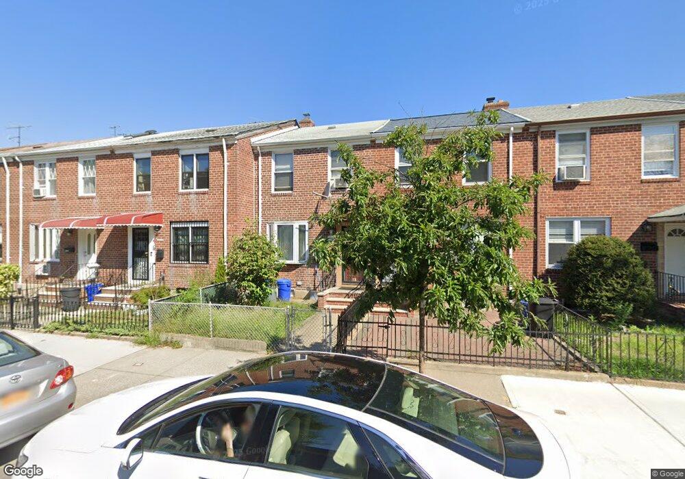
19421 Station Rd Flushing, NY 11358
Auburndale NeighborhoodEstimated Value: $755,000 - $803,000
2
Beds
2
Baths
960
Sq Ft
$811/Sq Ft
Est. Value
About This Home
This home is located at 19421 Station Rd, Flushing, NY 11358 and is currently estimated at $778,944, approximately $811 per square foot. 19421 Station Rd is a home located in Queens County with nearby schools including P.S. 31 - Bayside, I.S. 25 Adrien Block, and Francis Lewis High School.
Ownership History
Date
Name
Owned For
Owner Type
Purchase Details
Closed on
May 22, 2017
Sold by
Ill Brian B
Bought by
Ju Jianming and Zhou Caiyan
Current Estimated Value
Purchase Details
Closed on
Jul 2, 2014
Sold by
Castro Frank J and Castro Daniel F
Bought by
Ill Brian B
Purchase Details
Closed on
Aug 12, 2009
Sold by
Baldwin Marit
Bought by
Castro Daniel F and Castro Frank J
Home Financials for this Owner
Home Financials are based on the most recent Mortgage that was taken out on this home.
Original Mortgage
$355,000
Interest Rate
5.19%
Mortgage Type
Purchase Money Mortgage
Create a Home Valuation Report for This Property
The Home Valuation Report is an in-depth analysis detailing your home's value as well as a comparison with similar homes in the area
Home Values in the Area
Average Home Value in this Area
Purchase History
| Date | Buyer | Sale Price | Title Company |
|---|---|---|---|
| Ju Jianming | $650,000 | -- | |
| Ill Brian B | $499,900 | -- | |
| Castro Daniel F | $415,000 | -- |
Source: Public Records
Mortgage History
| Date | Status | Borrower | Loan Amount |
|---|---|---|---|
| Previous Owner | Castro Daniel F | $355,000 |
Source: Public Records
Tax History Compared to Growth
Tax History
| Year | Tax Paid | Tax Assessment Tax Assessment Total Assessment is a certain percentage of the fair market value that is determined by local assessors to be the total taxable value of land and additions on the property. | Land | Improvement |
|---|---|---|---|---|
| 2025 | $6,381 | $31,769 | $8,229 | $23,540 |
| 2024 | $6,381 | $31,769 | $9,144 | $22,625 |
| 2023 | $6,333 | $31,529 | $7,903 | $23,626 |
| 2022 | $4,144 | $42,480 | $11,640 | $30,840 |
| 2021 | $5,906 | $40,020 | $11,640 | $28,380 |
| 2020 | $5,604 | $39,480 | $11,640 | $27,840 |
| 2019 | $5,538 | $42,000 | $11,640 | $30,360 |
| 2018 | $5,496 | $26,274 | $8,275 | $17,999 |
| 2016 | $1,716 | $23,385 | $9,001 | $14,384 |
| 2015 | $2,820 | $22,062 | $12,776 | $9,286 |
| 2014 | $2,820 | $22,062 | $11,082 | $10,980 |
Source: Public Records
Map
Nearby Homes
- 194-23 Station Rd
- 195-31 39th Ave
- 40-38 194th St Unit A-1
- 37-6 Francis Lewis Blvd
- 37-02 Francis Lewis Blvd
- 37-08 Francis Lewis Blvd
- 4048 194th St Unit A3
- 200-06 39th Ave
- 191-22 39th Ave
- 3617 194th St
- 19112 Station Rd
- 191-08 Station Rd
- 36- 40 201st St Unit A, B, C
- 191-9 39th Ave Unit 164
- 36-20 194th St Unit 3r
- 191-09 39th Ave Unit Lower
- 42-32 196th St
- 196-19 42nd Rd
- 4014 191st St
- 190-05 39th Ave Unit 140
- 19423 Station Rd
- 19425 Station Rd
- 19421 Station Rd
- 194-25 Station Rd
- 19427 Station Rd
- 194-17 Station Rd
- 19419 Station Rd
- 19415 Station Rd
- 19417 Station Rd
- 19501 Station Rd
- 19415 Station Rd
- 19503 Station Rd
- 195-01 Station Rd
- 19413 Station Rd
- 19505 Station Rd
- 19411 Station Rd
- 40-08 195th St
- 19507 Station Rd
- 4004 195th St
- 194-07 Station Rd