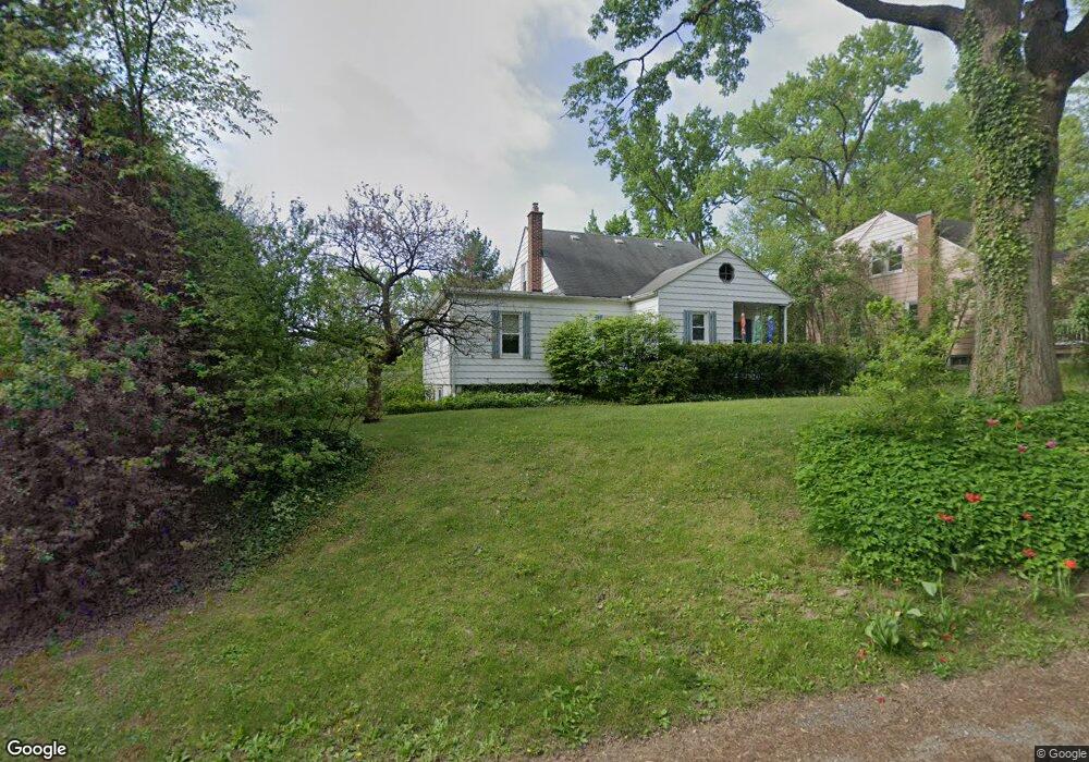
1943 Burns Ave Ypsilanti, MI 48197
Estimated Value: $293,000 - $326,659
3
Beds
3
Baths
1,290
Sq Ft
$241/Sq Ft
Est. Value
About This Home
This home is located at 1943 Burns Ave, Ypsilanti, MI 48197 and is currently estimated at $311,415, approximately $241 per square foot. 1943 Burns Ave is a home located in Washtenaw County with nearby schools including Estabrook Elementary School, Erickson Elementary School, and Holmes Elementary School.
Ownership History
Date
Name
Owned For
Owner Type
Purchase Details
Closed on
Feb 6, 2020
Sold by
Anderson Luke and Anderson Audra K
Bought by
Hewitt Sharon M
Current Estimated Value
Purchase Details
Closed on
May 31, 2018
Sold by
Lavoie Phyllis A
Bought by
Anderosn Luke and Anderosn Audra K
Home Financials for this Owner
Home Financials are based on the most recent Mortgage that was taken out on this home.
Original Mortgage
$164,300
Interest Rate
4.5%
Mortgage Type
New Conventional
Purchase Details
Closed on
Dec 1, 2015
Sold by
Lavoie Phyllis A
Bought by
Lavoie Phyllis A and The Phyllis A Lavoie Trust
Create a Home Valuation Report for This Property
The Home Valuation Report is an in-depth analysis detailing your home's value as well as a comparison with similar homes in the area
Home Values in the Area
Average Home Value in this Area
Purchase History
| Date | Buyer | Sale Price | Title Company |
|---|---|---|---|
| Hewitt Sharon M | $216,500 | None Available | |
| Anderosn Luke | $194,300 | None Available | |
| Lavoie Phyllis A | -- | None Available | |
| Mcrystal Lynda S | -- | None Available |
Source: Public Records
Mortgage History
| Date | Status | Borrower | Loan Amount |
|---|---|---|---|
| Previous Owner | Anderosn Luke | $164,300 |
Source: Public Records
Tax History Compared to Growth
Tax History
| Year | Tax Paid | Tax Assessment Tax Assessment Total Assessment is a certain percentage of the fair market value that is determined by local assessors to be the total taxable value of land and additions on the property. | Land | Improvement |
|---|---|---|---|---|
| 2025 | -- | $140,900 | $0 | $0 |
| 2024 | -- | $132,800 | $0 | $0 |
| 2023 | -- | $114,000 | $0 | $0 |
| 2022 | $0 | $110,000 | $0 | $0 |
| 2021 | $2,963 | $93,800 | $0 | $0 |
| 2020 | $2,963 | $91,200 | $0 | $0 |
| 2019 | $2,963 | $82,600 | $82,600 | $0 |
| 2018 | $0 | $87,000 | $0 | $0 |
| 2017 | $2,971 | $81,600 | $0 | $0 |
| 2016 | $1,787 | $60,257 | $0 | $0 |
| 2015 | $2,753 | $60,077 | $0 | $0 |
| 2014 | $2,753 | $58,200 | $0 | $0 |
| 2013 | -- | $58,200 | $0 | $0 |
Source: Public Records
Map
Nearby Homes
- 2017 Harding Ave
- 2002 Midvale Ave
- 224 N Hewitt Rd
- 2418 Draper Ave
- 259 Elmhurst Ave
- 2434 Harding Ave
- 1307 N Congress St
- 1221 S Congress St
- 95 S Mansfield St
- 1805 S Congress St
- 1133 S Congress St
- 246 Kirk St
- 1636 Washtenaw Ave
- 1621 Whittier Rd
- 1355 Lathers Ave
- 1117 Pearl St
- 550 Brookside St
- 247 Aveline St
- 2180 Ellsworth Rd
- 1211 Washtenaw Ave
- 1943 Burns St
- 1951 Burns St
- 1959 Burns St
- 1927 Burns St
- 1976 Harding Ave
- 1968 Harding Ave
- 1967 Burns St
- 1984 Harding Ave
- 1992 Harding Ave
- 1960 Harding Ave
- 1936 Burns St
- 1944 Burns St
- 1928 Burns St
- 2004 Harding Ave
- 1952 Burns St
- 181 Valley Dr
- 1977 Burns St
- 205 Valley Dr
- 2010 Harding Ave
- 1938 Harding Ave