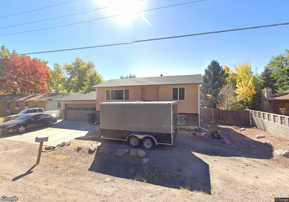
1946 Central Ave Canon City, CO 81212
Estimated Value: $311,552 - $358,000
4
Beds
2
Baths
1,640
Sq Ft
$200/Sq Ft
Est. Value
About This Home
This home is located at 1946 Central Ave, Canon City, CO 81212 and is currently estimated at $327,388, approximately $199 per square foot. 1946 Central Ave is a home located in Fremont County with nearby schools including Harrison School, Canon City High School, and Mount View Core Knowledge Charter School.
Ownership History
Date
Name
Owned For
Owner Type
Purchase Details
Closed on
Apr 15, 2016
Sold by
Jjd Enterprises Llc
Bought by
Repshire Stephanie S and Repshire Lonnie R
Current Estimated Value
Home Financials for this Owner
Home Financials are based on the most recent Mortgage that was taken out on this home.
Original Mortgage
$157,102
Outstanding Balance
$125,580
Interest Rate
3.87%
Mortgage Type
FHA
Estimated Equity
$201,808
Purchase Details
Closed on
Oct 22, 2015
Sold by
Us Bank National Association
Bought by
Jjd Enterprises Llc
Purchase Details
Closed on
Jan 29, 2015
Sold by
Green Eva J
Bought by
U S Bank National Association
Purchase Details
Closed on
Mar 10, 2004
Sold by
Massey Stephen K
Bought by
Cendant Mobility
Purchase Details
Closed on
Mar 1, 2004
Sold by
Cendant Mobility
Bought by
Green Eva J
Create a Home Valuation Report for This Property
The Home Valuation Report is an in-depth analysis detailing your home's value as well as a comparison with similar homes in the area
Home Values in the Area
Average Home Value in this Area
Purchase History
| Date | Buyer | Sale Price | Title Company |
|---|---|---|---|
| Repshire Stephanie S | $160,000 | Fidelity National Title Ins | |
| Jjd Enterprises Llc | $87,500 | Premium Title Services Inc | |
| U S Bank National Association | -- | None Available | |
| Cendant Mobility | $119,000 | -- | |
| Green Eva J | $121,000 | -- |
Source: Public Records
Mortgage History
| Date | Status | Borrower | Loan Amount |
|---|---|---|---|
| Open | Repshire Stephanie S | $157,102 |
Source: Public Records
Tax History Compared to Growth
Tax History
| Year | Tax Paid | Tax Assessment Tax Assessment Total Assessment is a certain percentage of the fair market value that is determined by local assessors to be the total taxable value of land and additions on the property. | Land | Improvement |
|---|---|---|---|---|
| 2024 | $1,248 | $17,770 | $0 | $0 |
| 2023 | $1,248 | $14,085 | $0 | $0 |
| 2022 | $1,322 | $15,230 | $0 | $0 |
| 2021 | $1,325 | $15,668 | $0 | $0 |
| 2020 | $1,070 | $12,735 | $0 | $0 |
| 2019 | $1,056 | $12,735 | $0 | $0 |
| 2018 | $959 | $11,278 | $0 | $0 |
| 2017 | $825 | $11,278 | $0 | $0 |
| 2016 | $693 | $9,470 | $0 | $0 |
| 2015 | $692 | $9,470 | $0 | $0 |
| 2012 | $677 | $9,717 | $2,388 | $7,329 |
Source: Public Records
Map
Nearby Homes
- 725 Yarbrough St
- 1860 Central Ave
- 720 N 19th St
- 785 Harrow Ct
- 709 Oxford Ct
- 815 Della Vista Ln
- 628 Phelps Ave
- 603 N Orchard Ave
- 854 Briarwood St
- 2264 Surrey Ln
- 860 Zona St Unit 2A
- 860 Zona St Unit 32
- 510 N 19th St Unit 19A
- 510 N 19th St Unit 27
- 510 N 19th St Unit 40
- 510 N 19th St Unit 23
- 510 N 19th St Unit 1
- 888 N Orchard Ave Unit 22
- 888 N Orchard Ave Unit 15
- 790 Cone Ave
- 1944 Central Ave
- 1948 Central Ave
- 1945 Pearl St
- 1947 Pearl St
- 1943 Pearl St
- 1950 Central Ave
- 751 Yarbrough St
- 790 N 19th St
- 780 N 19th St
- 1946 Pearl St
- 1945 Central Ave
- 1944 Pearl St
- 2401 Pearl St
- 770 Yarbrough St
- 760 Yarbrough St
- 735 Yarbrough St
- 750 Yarbrough St
- 760 N 19th St
- 1870 Central Ave
- 1875 Central Ave