Estimated Value: $105,300 - $271,000
--
Bed
1
Bath
1,105
Sq Ft
$175/Sq Ft
Est. Value
About This Home
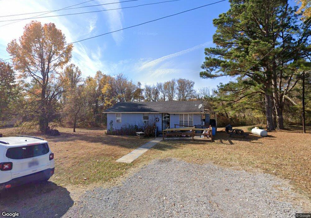
This home is located at 195 Harris Rd, Atoka, TN 38004 and is currently estimated at $192,825, approximately $174 per square foot. 195 Harris Rd is a home located in Tipton County with nearby schools including Atoka Elementary School, Brighton Middle School, and Brighton High School.
Ownership History
Date
Name
Owned For
Owner Type
Purchase Details
Closed on
Mar 7, 2013
Sold by
Cole Tracy
Bought by
Mckenzie Annie Mae
Current Estimated Value
Purchase Details
Closed on
Jul 26, 2010
Sold by
Mckenzie Annie Mae
Bought by
Cole Tracy
Purchase Details
Closed on
Oct 27, 1992
Bought by
Mckenzie Annie Mae
Purchase Details
Closed on
May 31, 1988
Bought by
Mid State Trust Ii
Purchase Details
Closed on
Apr 9, 1976
Bought by
Mid State Homes Inc
Purchase Details
Closed on
Jun 3, 1972
Create a Home Valuation Report for This Property
The Home Valuation Report is an in-depth analysis detailing your home's value as well as a comparison with similar homes in the area
Home Values in the Area
Average Home Value in this Area
Purchase History
| Date | Buyer | Sale Price | Title Company |
|---|---|---|---|
| Mckenzie Annie Mae | -- | -- | |
| Cole Tracy | -- | -- | |
| Mckenzie Annie Mae | $6,600 | -- | |
| Mid State Trust Ii | -- | -- | |
| Mid State Homes Inc | -- | -- | |
| -- | -- | -- |
Source: Public Records
Tax History Compared to Growth
Tax History
| Year | Tax Paid | Tax Assessment Tax Assessment Total Assessment is a certain percentage of the fair market value that is determined by local assessors to be the total taxable value of land and additions on the property. | Land | Improvement |
|---|---|---|---|---|
| 2024 | $387 | $17,150 | $5,150 | $12,000 |
| 2023 | $261 | $17,150 | $5,150 | $12,000 |
| 2022 | $372 | $12,125 | $3,775 | $8,350 |
| 2021 | $366 | $12,125 | $3,775 | $8,350 |
| 2020 | $366 | $12,125 | $3,775 | $8,350 |
| 2019 | $333 | $9,275 | $3,525 | $5,750 |
| 2018 | $333 | $9,275 | $3,525 | $5,750 |
| 2017 | $293 | $9,100 | $3,525 | $5,575 |
| 2016 | $293 | $9,100 | $3,525 | $5,575 |
| 2015 | $293 | $9,100 | $3,525 | $5,575 |
| 2014 | $270 | $9,101 | $0 | $0 |
Source: Public Records
Map
Nearby Homes
- 29 Merino Dr
- 170 Como Ln
- 125 Columbia Way
- 236 Como Ln
- 35 Drysdale Cove
- 50 Drysdale Cove
- 60 Drysdale Cove
- 61 Como Ln
- 93 Sterling Farm Dr
- 78 Doe Trail
- 284 Merino Dr
- 371 Beverly Dr
- 189 Cotton Fall Dr
- 538 Rosemark Rd
- 249 Mignon Rd
- 46 Walker Pkwy
- 104 Lochmeade Dr
- 128 Loch Haven Cove S
- 420 Trebing Pkwy
- 79 Columbia Way
- 215 Harris Rd
- 175 Harris Rd
- 214 Sterling Farm Dr
- 242 Sterling Farm Dr
- 198 Sterling Farm Dr
- 254 Sterling Farm Dr
- 178 Sterling Farm Dr
- 272 Sterling Farm Dr
- 166 Sterling Farm Dr
- 280 Sterling Farm Dr
- 144 Sterling Farm Dr
- 245 Sterling Farm Dr
- 227 Sterling Farm Dr
- 263 Sterling Farm Dr
- 207 Sterling Farm Dr
- 290 Sterling Farm Dr
- 189 Sterling Farm Dr
- 128 Sterling Farm Dr
- 167 Sterling Farm Dr
- 110 Sterling Farm Dr