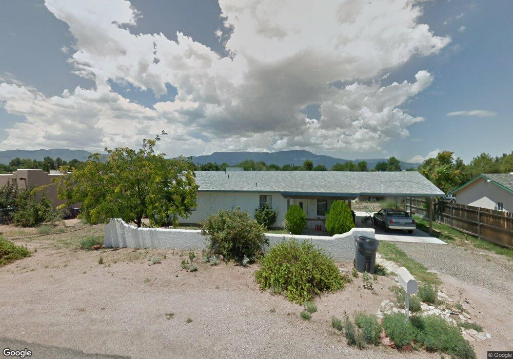
1950 S Michelle Cir Cottonwood, AZ 86326
Estimated Value: $376,543 - $418,000
3
Beds
--
Bath
1,466
Sq Ft
$274/Sq Ft
Est. Value
About This Home
This home is located at 1950 S Michelle Cir, Cottonwood, AZ 86326 and is currently estimated at $401,386, approximately $273 per square foot. 1950 S Michelle Cir is a home located in Yavapai County with nearby schools including Dr Daniel Bright Elementary School, Cottonwood Elementary School, and Cottonwood Community School.
Ownership History
Date
Name
Owned For
Owner Type
Purchase Details
Closed on
Jan 28, 2021
Sold by
Cowan Terry S
Bought by
Cowan Terry S and Cowan Callum P
Current Estimated Value
Purchase Details
Closed on
Jan 19, 2021
Sold by
Reddmann Marsha E
Bought by
Reddmann Marsha E and Maynard Kelli Breeler
Purchase Details
Closed on
May 31, 2018
Sold by
Persons David N and Persons Lorene D
Bought by
Reddmann Donald A and Reddmann Marsha E
Home Financials for this Owner
Home Financials are based on the most recent Mortgage that was taken out on this home.
Original Mortgage
$191,250
Interest Rate
4.5%
Mortgage Type
New Conventional
Purchase Details
Closed on
Nov 15, 2005
Sold by
Turnipseed Tim and Turnipseed Liberty A
Bought by
Persons David N and Persons Lorene D
Home Financials for this Owner
Home Financials are based on the most recent Mortgage that was taken out on this home.
Original Mortgage
$191,900
Interest Rate
5.87%
Mortgage Type
New Conventional
Create a Home Valuation Report for This Property
The Home Valuation Report is an in-depth analysis detailing your home's value as well as a comparison with similar homes in the area
Home Values in the Area
Average Home Value in this Area
Purchase History
| Date | Buyer | Sale Price | Title Company |
|---|---|---|---|
| Cowan Terry S | -- | None Listed On Document | |
| Baggett Diana L | -- | None Listed On Document | |
| Reddmann Marsha E | -- | None Listed On Document | |
| Reddmann Donald A | $225,000 | Yavapai Title | |
| Persons David N | $241,900 | Pioneer Title Agency Inc |
Source: Public Records
Mortgage History
| Date | Status | Borrower | Loan Amount |
|---|---|---|---|
| Previous Owner | Reddmann Donald A | $191,250 | |
| Previous Owner | Persons David N | $191,900 |
Source: Public Records
Tax History Compared to Growth
Tax History
| Year | Tax Paid | Tax Assessment Tax Assessment Total Assessment is a certain percentage of the fair market value that is determined by local assessors to be the total taxable value of land and additions on the property. | Land | Improvement |
|---|---|---|---|---|
| 2026 | $1,192 | $32,517 | -- | -- |
| 2024 | $1,135 | $32,092 | -- | -- |
| 2023 | $1,135 | $25,575 | $2,527 | $23,048 |
| 2022 | $1,113 | $20,941 | $1,947 | $18,994 |
| 2021 | $1,148 | $19,772 | $2,164 | $17,608 |
| 2020 | $1,580 | $0 | $0 | $0 |
| 2019 | $1,552 | $0 | $0 | $0 |
| 2018 | $1,489 | $0 | $0 | $0 |
| 2017 | $1,650 | $0 | $0 | $0 |
| 2016 | $1,605 | $0 | $0 | $0 |
| 2015 | -- | $0 | $0 | $0 |
| 2014 | -- | $0 | $0 | $0 |
Source: Public Records
Map
Nearby Homes
- 4197 E Sabino Trail
- 4027 E Sabino Trail
- 4506 E Silver Leaf Trail
- 4593 E Silver Leaf Trail
- 4547 E Diablo Dr
- 2042 S Puma Cir
- 4586 E Diablo Dr
- 2234 S Eastern Dr
- 4000 E Mustang Dr
- 2306 S Eastern Dr
- 3732 E Comanche Dr
- 4887 E Comanche Dr
- 2366 Eastern Dr
- 2319 S Eastern Dr Unit 670
- 2320 S Eastern Dr Unit 669
- 3461 Tower Dr
- 4253 E Mission Ln
- 0000 Caitlin Ln
- 3568 Hogan Cir
- 1945 S State Route 260 --
- 1970 S Michelle Cir
- 1964 S Spanish Rowel Tr
- 1936 Spanish Rowell
- 1936 S Spanish Rowel Trail
- 4149 E Sabino Trail
- 4200 E Del Rio Dr
- 2140 Spanish Rowel Trail
- 1900 S Michelle Cir
- 1922 S Spanish Rowel Trail
- 4113 E Sabino Trail
- 4161 E Sabino Trail
- 4133 E Pueblo Rd Unit 1
- 4133 E Pueblo Rd
- 4291 E Silver Leaf Trail Unit 1
- 1985 S Manzanita Trail