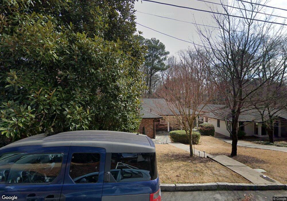
1951 Lebanon Dr NE Atlanta, GA 30324
Morningside NeighborhoodEstimated Value: $704,689 - $1,023,000
3
Beds
2
Baths
1,476
Sq Ft
$550/Sq Ft
Est. Value
About This Home
This home is located at 1951 Lebanon Dr NE, Atlanta, GA 30324 and is currently estimated at $812,422, approximately $550 per square foot. 1951 Lebanon Dr NE is a home located in Fulton County with nearby schools including Morningside Elementary School, Midtown High School, and Carlisle Montessori School of Buckhead.
Ownership History
Date
Name
Owned For
Owner Type
Purchase Details
Closed on
Dec 20, 2011
Sold by
Haralson Michael A Family
Bought by
Haralson Michael A
Current Estimated Value
Purchase Details
Closed on
May 3, 2010
Sold by
Haralson Michael
Bought by
Michael A Haralson Family Lp
Purchase Details
Closed on
Jun 14, 2002
Sold by
Dunn Phillip K
Bought by
Haralson Michael
Home Financials for this Owner
Home Financials are based on the most recent Mortgage that was taken out on this home.
Original Mortgage
$219,000
Interest Rate
4.88%
Mortgage Type
New Conventional
Create a Home Valuation Report for This Property
The Home Valuation Report is an in-depth analysis detailing your home's value as well as a comparison with similar homes in the area
Home Values in the Area
Average Home Value in this Area
Purchase History
| Date | Buyer | Sale Price | Title Company |
|---|---|---|---|
| Haralson Michael A | -- | -- | |
| Michael A Haralson Family Lp | -- | -- | |
| Haralson Michael | $273,800 | -- |
Source: Public Records
Mortgage History
| Date | Status | Borrower | Loan Amount |
|---|---|---|---|
| Previous Owner | Haralson Michael | $219,000 |
Source: Public Records
Tax History Compared to Growth
Tax History
| Year | Tax Paid | Tax Assessment Tax Assessment Total Assessment is a certain percentage of the fair market value that is determined by local assessors to be the total taxable value of land and additions on the property. | Land | Improvement |
|---|---|---|---|---|
| 2025 | $4,163 | $247,440 | $93,680 | $153,760 |
| 2023 | $9,118 | $220,240 | $73,360 | $146,880 |
| 2022 | $5,769 | $220,240 | $73,360 | $146,880 |
| 2021 | $4,745 | $177,200 | $87,200 | $90,000 |
| 2020 | $4,748 | $177,200 | $87,200 | $90,000 |
| 2019 | $487 | $177,200 | $87,200 | $90,000 |
| 2018 | $5,274 | $167,200 | $37,200 | $130,000 |
| 2017 | $3,818 | $117,200 | $26,080 | $91,120 |
| 2016 | $3,828 | $117,200 | $26,080 | $91,120 |
| 2015 | $5,564 | $117,160 | $26,080 | $91,080 |
| 2014 | $3,903 | $117,160 | $26,080 | $91,080 |
Source: Public Records
Map
Nearby Homes
- 1835 Rock Springs Ln NE
- 1803 White Oak Hollow NE
- 534 Allen Rd NE
- 502 Ansley Villa Dr NE
- 1822 N Rock Springs Rd NE Unit 24
- 618 NE Morning Glory Place NE
- 1993 Rockledge Rd NE
- 1761 Monroe Dr NE
- 518 Bismark Rd NE
- 2013 Rockledge Rd NE
- 1845 Windemere Dr NE
- 1821 N Rock Springs Rd NE
- 1779 Beckham Place NE
- 558 Bismark Rd NE
- 1905 Windemere Dr NE
- 590 Bismark Rd NE
- 1945 Lebanon Dr NE
- 1939 Lebanon Dr NE Unit 1
- 1939 Lebanon Dr NE
- 1963 Lebanon Dr NE
- 0 Lebanon Dr NE Unit 8977700
- 0 Lebanon Dr NE Unit 7391910
- 0 Lebanon Dr NE Unit 7187210
- 0 Lebanon Dr NE Unit 8344837
- 0 Lebanon Dr NE Unit 8502088
- 0 Lebanon Dr NE Unit 8541185
- 0 Lebanon Dr NE Unit 8192173
- 0 Lebanon Dr NE Unit 8552679
- 0 Lebanon Dr NE
- 1933 Lebanon Dr NE
- 1969 Lebanon Dr NE
- 1950 Lebanon Dr NE
- 1950 Lebanon Dr NE Unit 1950
- 1944 Lebanon Dr NE
- 1956 Lebanon Dr NE
- 1946 Gotham Way NE