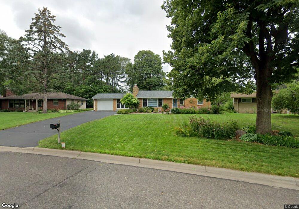
1959 Oak Knoll Dr Saint Paul, MN 55110
Estimated Value: $392,000 - $445,000
4
Beds
3
Baths
784
Sq Ft
$532/Sq Ft
Est. Value
About This Home
This home is located at 1959 Oak Knoll Dr, Saint Paul, MN 55110 and is currently estimated at $416,769, approximately $531 per square foot. 1959 Oak Knoll Dr is a home located in Ramsey County with nearby schools including Lakeaires Elementary School, Sunrise Park Middle School, and Liberty Classical Academy.
Ownership History
Date
Name
Owned For
Owner Type
Purchase Details
Closed on
Apr 7, 2025
Sold by
Frye Erik and Frye Sheila
Bought by
Erik L Frye And Sheila M Mcloone Frye Revocab
Current Estimated Value
Purchase Details
Closed on
Aug 14, 2015
Sold by
Odegaard Kathleen R and Odegaard Robert Wayne
Bought by
Frye Erik and Frye Sheila
Home Financials for this Owner
Home Financials are based on the most recent Mortgage that was taken out on this home.
Original Mortgage
$165,000
Interest Rate
3.97%
Mortgage Type
New Conventional
Create a Home Valuation Report for This Property
The Home Valuation Report is an in-depth analysis detailing your home's value as well as a comparison with similar homes in the area
Home Values in the Area
Average Home Value in this Area
Purchase History
| Date | Buyer | Sale Price | Title Company |
|---|---|---|---|
| Erik L Frye And Sheila M Mcloone Frye Revocab | $500 | None Listed On Document | |
| Frye Erik | $246,242 | Home Title Inc |
Source: Public Records
Mortgage History
| Date | Status | Borrower | Loan Amount |
|---|---|---|---|
| Previous Owner | Frye Erik | $165,000 |
Source: Public Records
Tax History Compared to Growth
Tax History
| Year | Tax Paid | Tax Assessment Tax Assessment Total Assessment is a certain percentage of the fair market value that is determined by local assessors to be the total taxable value of land and additions on the property. | Land | Improvement |
|---|---|---|---|---|
| 2025 | $5,122 | $435,500 | $92,300 | $343,200 |
| 2023 | $5,122 | $389,400 | $92,300 | $297,100 |
| 2022 | $4,432 | $380,700 | $92,300 | $288,400 |
| 2021 | $4,182 | $336,000 | $92,300 | $243,700 |
| 2020 | $4,270 | $326,300 | $92,300 | $234,000 |
| 2019 | $3,648 | $312,500 | $92,300 | $220,200 |
| 2018 | $3,442 | $288,800 | $92,300 | $196,500 |
| 2017 | $2,922 | $280,900 | $92,300 | $188,600 |
| 2016 | $2,628 | $0 | $0 | $0 |
| 2015 | $1,292 | $207,500 | $86,800 | $120,700 |
| 2014 | $3,752 | $0 | $0 | $0 |
Source: Public Records
Map
Nearby Homes
- 4035 Highland Ave
- 1795 Cheri Ct
- 1794 Cheri Ct
- 1792 Cheri Ct
- 4107 White Bear Ave N
- 3823 Linden Ave
- 3750 Van Dyke St
- 2075 Dorothy Ave
- 1778 Linden Cove
- 4181 White Bear Ave N
- 2086 Dorothy Ave
- 3620 Highland Ave
- 1827 County Road E E Unit 18
- 2184 Floral Dr
- 3915 Mcknight Rd N
- 3644 Linden Ave Unit 11
- 3979 Mcknight Rd N
- 3743 Kenny Ln
- 3982 Mcknight Rd N
- 3714 Kenny Ln
- 1957 Oak Knoll Dr
- 1963 Oak Knoll Dr
- 3924 Highland Ave
- 3930 Highland Ave
- 1953 Oak Knoll Dr
- 3916 Highland Ave
- 1967 Oak Knoll Dr
- 3938 Highland Ave
- 1958 Oak Knoll Dr
- 3908 Highland Ave
- 1914 Birch St
- 3946 Highland Ave
- 1922 Birch St
- 1952 Oak Knoll Dr
- 1971 Oak Knoll Dr
- 1964 Oak Knoll Dr
- 1943 Oak Knoll Dr
- 3900 Highland Ave
- 1906 Birch St
- 1970 Oak Knoll Dr