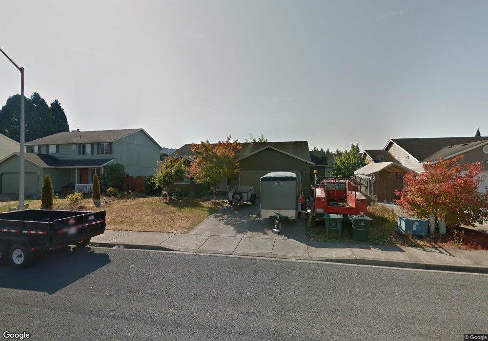
1960 Blacktail Ln Woodland, WA 98674
Estimated Value: $389,582 - $501,000
3
Beds
2
Baths
1,548
Sq Ft
$285/Sq Ft
Est. Value
About This Home
This home is located at 1960 Blacktail Ln, Woodland, WA 98674 and is currently estimated at $441,646, approximately $285 per square foot. 1960 Blacktail Ln is a home located in Cowlitz County with nearby schools including Woodland High School.
Ownership History
Date
Name
Owned For
Owner Type
Purchase Details
Closed on
Aug 3, 2006
Sold by
Lee Justin
Bought by
Moore Patrick and Moore Claudia
Current Estimated Value
Home Financials for this Owner
Home Financials are based on the most recent Mortgage that was taken out on this home.
Original Mortgage
$40,700
Interest Rate
6.34%
Mortgage Type
Unknown
Purchase Details
Closed on
Aug 4, 2005
Sold by
Toops Elmer Ray and Toops Christy
Bought by
Lee Justin
Home Financials for this Owner
Home Financials are based on the most recent Mortgage that was taken out on this home.
Original Mortgage
$164,610
Interest Rate
7.75%
Mortgage Type
Fannie Mae Freddie Mac
Create a Home Valuation Report for This Property
The Home Valuation Report is an in-depth analysis detailing your home's value as well as a comparison with similar homes in the area
Home Values in the Area
Average Home Value in this Area
Purchase History
| Date | Buyer | Sale Price | Title Company |
|---|---|---|---|
| Moore Patrick | $203,500 | Stewart Title Of Wes | |
| Lee Justin | $182,900 | Cowlitz County Title |
Source: Public Records
Mortgage History
| Date | Status | Borrower | Loan Amount |
|---|---|---|---|
| Closed | Moore Patrick | $40,700 | |
| Open | Moore Patrick | $162,800 | |
| Previous Owner | Lee Justin | $164,610 |
Source: Public Records
Tax History Compared to Growth
Tax History
| Year | Tax Paid | Tax Assessment Tax Assessment Total Assessment is a certain percentage of the fair market value that is determined by local assessors to be the total taxable value of land and additions on the property. | Land | Improvement |
|---|---|---|---|---|
| 2024 | $2,967 | $301,250 | $53,460 | $247,790 |
| 2023 | $2,776 | $294,440 | $53,460 | $240,980 |
| 2022 | $2,579 | $279,100 | $53,460 | $225,640 |
| 2021 | $2,737 | $244,070 | $48,600 | $195,470 |
| 2020 | $2,445 | $240,470 | $48,600 | $191,870 |
| 2019 | $2,102 | $211,200 | $48,600 | $162,600 |
| 2018 | $2,192 | $209,590 | $48,600 | $160,990 |
| 2017 | $1,850 | $188,350 | $48,600 | $139,750 |
| 2016 | $1,715 | $164,510 | $45,000 | $119,510 |
| 2015 | $1,675 | $149,840 | $45,000 | $104,840 |
| 2013 | -- | $139,950 | $36,810 | $103,140 |
Source: Public Records
Map
Nearby Homes
- 369 Gun Club Rd Unit 48
- 369 Gun Club Rd Unit 101
- 369 Gun Club Rd Unit 70
- 369 Gun Club Rd Unit 53
- 369 Gun Club Rd Unit 117
- 369 Gun Club Rd Unit 114
- 336 York St
- 284 Gun Club Rd
- 2216 Statesman Dr Unit Lot 46
- 2210 Statesman Dr Unit 44
- 2220 Ash St Unit Lot 24
- 2229 Ash St Unit Lot 83
- 1786 Clatsop St
- 2233 Ash St Unit Lot 84
- 1833 Hawthorne Ct
- 2185 Dahlia St
- 605 Gun Club Rd
- 2271 Ash St Unit Lot 92
- 3060 Spruce Ave
- 3040 Spruce Ave
- 1970 Blacktail Ln
- 1950 Blacktail Ln
- 1965 Whitetail Ln
- 1975 Whitetail Ln
- 1980 Blacktail Ln
- 1940 Blacktail Ln
- 1955 Whitetail Ln
- 1985 Whitetail Ln
- 1965 Blacktail Ln
- 1975 Blacktail Ln
- 1625 A Street 3 0 Bac
- 1955 Blacktail Ln
- 1930 Blacktail Ln
- 1995 Whitetail Ln
- 1945 Whitetail Ln
- 1945 Blacktail Ln
- 1985 Blacktail Ln
- 1960 Whitetail Ln
- 1990 Blacktail Ln
- 1950 Whitetail Ln