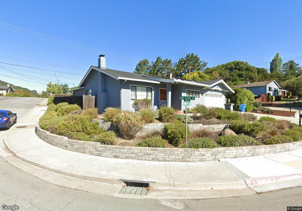
1964 Parrott Dr San Mateo, CA 94402
Baywood Park NeighborhoodEstimated Value: $2,296,000 - $2,515,000
3
Beds
2
Baths
1,750
Sq Ft
$1,368/Sq Ft
Est. Value
About This Home
This home is located at 1964 Parrott Dr, San Mateo, CA 94402 and is currently estimated at $2,393,394, approximately $1,367 per square foot. 1964 Parrott Dr is a home located in San Mateo County with nearby schools including Highlands Elementary School, Borel Middle School, and Aragon High School.
Ownership History
Date
Name
Owned For
Owner Type
Purchase Details
Closed on
Nov 19, 2010
Sold by
Lee Steve and Lee Yin King
Bought by
Chuei Nao S and Chuei Warren
Current Estimated Value
Home Financials for this Owner
Home Financials are based on the most recent Mortgage that was taken out on this home.
Original Mortgage
$540,000
Outstanding Balance
$354,464
Interest Rate
4.17%
Mortgage Type
New Conventional
Estimated Equity
$2,038,930
Create a Home Valuation Report for This Property
The Home Valuation Report is an in-depth analysis detailing your home's value as well as a comparison with similar homes in the area
Home Values in the Area
Average Home Value in this Area
Purchase History
| Date | Buyer | Sale Price | Title Company |
|---|---|---|---|
| Chuei Nao S | $885,000 | North American Title Co Inc |
Source: Public Records
Mortgage History
| Date | Status | Borrower | Loan Amount |
|---|---|---|---|
| Open | Chuei Nao S | $540,000 |
Source: Public Records
Tax History Compared to Growth
Tax History
| Year | Tax Paid | Tax Assessment Tax Assessment Total Assessment is a certain percentage of the fair market value that is determined by local assessors to be the total taxable value of land and additions on the property. | Land | Improvement |
|---|---|---|---|---|
| 2025 | $14,861 | $1,133,834 | $566,917 | $566,917 |
| 2023 | $14,861 | $1,089,806 | $544,903 | $544,903 |
| 2022 | $14,371 | $1,068,438 | $534,219 | $534,219 |
| 2021 | $14,106 | $1,047,490 | $523,745 | $523,745 |
| 2020 | $13,630 | $1,036,750 | $518,375 | $518,375 |
| 2019 | $13,257 | $1,016,422 | $508,211 | $508,211 |
| 2018 | $12,687 | $996,494 | $498,247 | $498,247 |
| 2017 | $12,497 | $976,956 | $488,478 | $488,478 |
| 2016 | $12,475 | $957,800 | $478,900 | $478,900 |
| 2015 | $12,219 | $943,414 | $471,707 | $471,707 |
| 2014 | $11,945 | $924,934 | $462,467 | $462,467 |
Source: Public Records
Map
Nearby Homes
- 2005 Parrott Dr
- 1712 Los Altos Dr
- 2371 Ticonderoga Dr
- 2369 Ticonderoga Dr
- 1657 Sugarloaf Dr
- 2224 Bunker Hill Dr
- 62 Lyonridge Ln
- 1521 Cherrywood Dr
- 2219 Allegheny Way
- 38 Weepingridge Ct
- 1575 Parrott Dr
- 1685 Bayridge Way Unit 204
- 1764 Lexington Ave
- 1418 Crestwood Ct
- 1485 Ascension Dr
- 1426 Bel Aire Rd
- 3400 Douglas Ct
- 38 Bel Aire Rd
- 28 Bel Aire Rd
- 8 Bel Aire Rd
- 1956 Parrott Dr
- 2117 Los Altos Dr
- 11 Los Altos Place
- 1952 Parrott Dr
- 2111 Los Altos Dr
- 21 Los Altos Place
- 1943 Parrott Dr
- 2005 Parrott Dr Unit C
- 2005 Parrott Dr Unit A
- 2005 Parrott Dr Unit B
- 31 Los Altos Place
- 2105 Los Altos Dr
- 1944 Parrott Dr
- 65 Mountain View Place
- 10 Los Altos Place
- 55 Mountain View Place
- 2007 Parrott Dr
- 1935 Parrott Dr
- 41 Los Altos Place
- 1989 Los Altos Dr