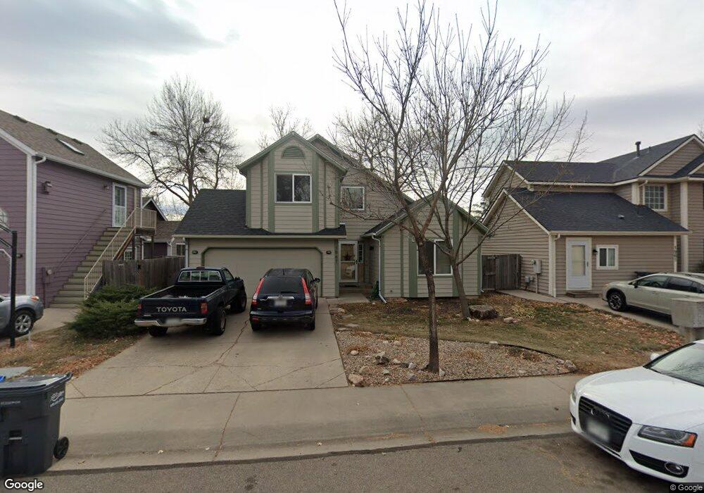
1967 Massachusetts St Fort Collins, CO 80525
Estimated Value: $446,469 - $464,000
3
Beds
2
Baths
1,144
Sq Ft
$398/Sq Ft
Est. Value
About This Home
This home is located at 1967 Massachusetts St, Fort Collins, CO 80525 and is currently estimated at $455,367, approximately $398 per square foot. 1967 Massachusetts St is a home located in Larimer County with nearby schools including Shepardson Elementary School, Lesher Middle School, and Fort Collins High School.
Ownership History
Date
Name
Owned For
Owner Type
Purchase Details
Closed on
Sep 3, 2024
Sold by
Hoch David J
Bought by
Holzwart Judith T
Current Estimated Value
Purchase Details
Closed on
Jul 16, 2009
Sold by
Coomes Dustin and Allgeier Chrissy
Bought by
Hoch David
Home Financials for this Owner
Home Financials are based on the most recent Mortgage that was taken out on this home.
Original Mortgage
$135,100
Interest Rate
5.39%
Mortgage Type
Unknown
Purchase Details
Closed on
Nov 30, 2004
Sold by
Roden Martha and Braley David
Bought by
Coomes Dustin and Allgeier Chrissy
Home Financials for this Owner
Home Financials are based on the most recent Mortgage that was taken out on this home.
Original Mortgage
$140,000
Interest Rate
5.64%
Mortgage Type
Unknown
Purchase Details
Closed on
Sep 1, 1991
Bought by
Roden Martha
Create a Home Valuation Report for This Property
The Home Valuation Report is an in-depth analysis detailing your home's value as well as a comparison with similar homes in the area
Home Values in the Area
Average Home Value in this Area
Purchase History
| Date | Buyer | Sale Price | Title Company |
|---|---|---|---|
| Holzwart Judith T | -- | None Listed On Document | |
| Hoch David | $193,000 | None Available | |
| Coomes Dustin | $175,000 | Land Title Guarantee Company | |
| Roden Martha | -- | -- |
Source: Public Records
Mortgage History
| Date | Status | Borrower | Loan Amount |
|---|---|---|---|
| Previous Owner | Hoch David | $135,100 | |
| Previous Owner | Coomes Dustin | $140,000 |
Source: Public Records
Tax History Compared to Growth
Tax History
| Year | Tax Paid | Tax Assessment Tax Assessment Total Assessment is a certain percentage of the fair market value that is determined by local assessors to be the total taxable value of land and additions on the property. | Land | Improvement |
|---|---|---|---|---|
| 2025 | $2,521 | $29,956 | $2,479 | $27,477 |
| 2024 | $2,398 | $29,956 | $2,479 | $27,477 |
| 2022 | $2,042 | $21,622 | $2,572 | $19,050 |
| 2021 | $2,063 | $22,244 | $2,646 | $19,598 |
| 2020 | $2,035 | $21,751 | $2,646 | $19,105 |
| 2019 | $2,044 | $21,751 | $2,646 | $19,105 |
| 2018 | $1,770 | $19,426 | $2,664 | $16,762 |
| 2017 | $1,764 | $19,426 | $2,664 | $16,762 |
| 2016 | $1,574 | $17,241 | $2,945 | $14,296 |
| 2015 | $1,563 | $17,250 | $2,950 | $14,300 |
| 2014 | $1,304 | $14,290 | $2,950 | $11,340 |
Source: Public Records
Map
Nearby Homes
- 2961 Sagebrush Dr
- 3012 Sombrero Ln
- 3036 Regatta Ln Unit 2
- 3039 Regatta Ln Unit 1
- 1724 Westchester Ln
- 3500 Carlton Ave Unit U49
- 1632 Faraday Cir
- 2750 Illinois Dr Unit 206
- 1621 Alcott St
- 1706 Lakeshore Dr
- 3319 Pepperwood Ln
- 2241 Limon Dr Unit 204
- 2926 Brookwood Place
- 2501 Jadestone Ct
- 3465 Lochwood Dr Unit S91
- 2550 Custer Dr
- 1337 Green Gables Ct
- 2521 Des Moines Dr Unit 104
- 2500 Wapiti Rd
- 3830 Arctic Fox Dr
- 1961 Massachusetts St
- 1973 Massachusetts St
- 1955 Massachusetts St
- 1979 Massachusetts St
- 1968 Massachusetts St
- 1949 Massachusetts St
- 1962 Massachusetts St
- 1974 Massachusetts St
- 1956 Massachusetts St
- 1980 Massachusetts St
- 1943 Massachusetts St
- 1986 Massachusetts St
- 1925 Connecticut Dr
- 1919 Connecticut Dr
- 1931 Connecticut Dr
- 1937 Massachusetts St
- 1931 Massachusetts St
- 1913 Connecticut Dr
- 1937 Connecticut Dr
- 3138 Eastbrook Dr