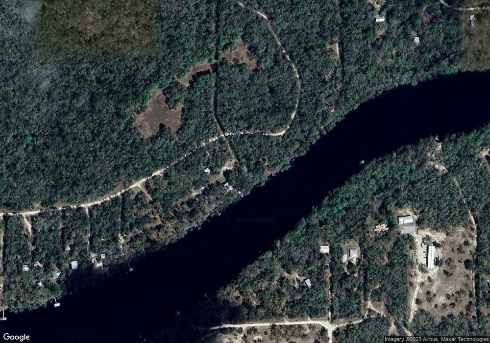
1968 Friendship Ln Branford, FL 32008
Estimated Value: $296,000 - $1,544,000
--
Bed
--
Bath
2,405
Sq Ft
$278/Sq Ft
Est. Value
About This Home
This home is located at 1968 Friendship Ln, Branford, FL 32008 and is currently estimated at $667,667, approximately $277 per square foot. 1968 Friendship Ln is a home with nearby schools including Lafayette Elementary School and Lafayette High School.
Ownership History
Date
Name
Owned For
Owner Type
Purchase Details
Closed on
Dec 30, 2011
Sold by
Malecot Mary Gail and Malecot Family Trust
Bought by
Malecot Mary Gail
Current Estimated Value
Home Financials for this Owner
Home Financials are based on the most recent Mortgage that was taken out on this home.
Original Mortgage
$97,400
Outstanding Balance
$67,030
Interest Rate
4.06%
Mortgage Type
New Conventional
Estimated Equity
$600,637
Purchase Details
Closed on
Aug 12, 2002
Sold by
Malecot Mary Gail
Bought by
Malecot Mary Gail
Purchase Details
Closed on
Aug 1, 1985
Sold by
Unknown
Bought by
Malecot Mary Gail
Create a Home Valuation Report for This Property
The Home Valuation Report is an in-depth analysis detailing your home's value as well as a comparison with similar homes in the area
Home Values in the Area
Average Home Value in this Area
Purchase History
| Date | Buyer | Sale Price | Title Company |
|---|---|---|---|
| Malecot Mary Gail | -- | East Lake Title Inc | |
| Malecot Mary Gail | $100 | -- | |
| Malecot Mary Gail | $15,000 | -- |
Source: Public Records
Mortgage History
| Date | Status | Borrower | Loan Amount |
|---|---|---|---|
| Open | Malecot Mary Gail | $97,400 |
Source: Public Records
Tax History Compared to Growth
Tax History
| Year | Tax Paid | Tax Assessment Tax Assessment Total Assessment is a certain percentage of the fair market value that is determined by local assessors to be the total taxable value of land and additions on the property. | Land | Improvement |
|---|---|---|---|---|
| 2024 | $5,903 | $298,500 | $52,500 | $246,000 |
| 2023 | $5,520 | $263,099 | $0 | $0 |
| 2022 | $5,100 | $270,000 | $52,500 | $217,500 |
| 2021 | $4,616 | $238,400 | $42,800 | $195,600 |
| 2020 | $4,020 | $198,500 | $42,800 | $155,700 |
| 2019 | $3,694 | $179,700 | $42,800 | $136,900 |
| 2018 | $3,719 | $179,700 | $0 | $0 |
| 2017 | $3,581 | $179,700 | $0 | $0 |
| 2016 | $3,834 | $179,700 | $42,800 | $136,900 |
| 2015 | $3,914 | $179,700 | $42,800 | $136,900 |
| 2014 | $3,914 | $179,700 | $0 | $0 |
Source: Public Records
Map
Nearby Homes
- 0 SE Earl Blvd Unit 794929
- 12 SE Earl Blvd (13 14 15)
- 0 NW 55th St
- 17 SE Elisha Blvd Lot 55
- 00 NW 57th Place
- 1254 SE Earl Blvd
- 0 NW 57th Place
- TBD NW 50th Terrace
- 4700 NW 55th Ave
- 0 NW 42nd Ct
- 6780 NW 41st Cir
- 4654 NW 45th Ave
- TBD NW 42nd Ct
- 250 NE 937th Ave
- 0 NW 38th Place
- 4700 County Road 340
- 102 NE 931st St
- Lot 52 NW 36th Ln
- 0 NW 73rd Trail
- 6669 NW 36th Ln
- 5760 NW 57th Ct
- 5840 NW 57th Ct
- 5814 NW 57th Ct
- 5880 NW 57th Ct
- 5750 NW 57th Ct
- 1772 Friendship Ln
- 5929 NW 57th Ct
- 950 SE Earl Blvd
- 0 SE Earl Blvd Unit MFRTB8321736
- 0 SE Earl Blvd Unit MFRU8255076
- 0 SE Earl Blvd Unit MFRU8250945
- 0 SE Earl Blvd Unit 786542
- 0 SE Earl Blvd Unit MFRGC513614
- 0 SE Earl Blvd Unit 119795
- 0 SE Earl Blvd Unit 786163
- 0 SE Earl Blvd Unit 110790
- 0 SE Earl Blvd Unit 95430
- 0 SE Earl Blvd Unit GC329846
- 0 SE Earl Blvd Unit OM299366
- 0 SE Earl Blvd
