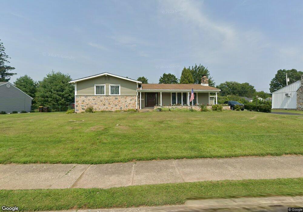
1969 Hemlock Rd Norristown, PA 19403
West Norriton Township NeighborhoodEstimated Value: $504,000 - $608,000
3
Beds
4
Baths
2,142
Sq Ft
$254/Sq Ft
Est. Value
About This Home
This home is located at 1969 Hemlock Rd, Norristown, PA 19403 and is currently estimated at $543,235, approximately $253 per square foot. 1969 Hemlock Rd is a home located in Montgomery County with nearby schools including Charles Blockson Middle School, Paul V Fly Elementary School, and East Norriton Middle School.
Ownership History
Date
Name
Owned For
Owner Type
Purchase Details
Closed on
May 26, 2011
Sold by
Shelikoff Dan and Shelikoff Joan
Bought by
Haegele Kathleen and Haegele Henry F
Current Estimated Value
Home Financials for this Owner
Home Financials are based on the most recent Mortgage that was taken out on this home.
Original Mortgage
$215,000
Outstanding Balance
$147,309
Interest Rate
4.5%
Mortgage Type
FHA
Estimated Equity
$395,926
Create a Home Valuation Report for This Property
The Home Valuation Report is an in-depth analysis detailing your home's value as well as a comparison with similar homes in the area
Home Values in the Area
Average Home Value in this Area
Purchase History
| Date | Buyer | Sale Price | Title Company |
|---|---|---|---|
| Haegele Kathleen | $235,000 | None Available |
Source: Public Records
Mortgage History
| Date | Status | Borrower | Loan Amount |
|---|---|---|---|
| Open | Haegele Kathleen | $215,000 |
Source: Public Records
Tax History Compared to Growth
Tax History
| Year | Tax Paid | Tax Assessment Tax Assessment Total Assessment is a certain percentage of the fair market value that is determined by local assessors to be the total taxable value of land and additions on the property. | Land | Improvement |
|---|---|---|---|---|
| 2025 | $7,414 | $151,750 | $34,880 | $116,870 |
| 2024 | $7,414 | $151,750 | $34,880 | $116,870 |
| 2023 | $7,330 | $151,750 | $34,880 | $116,870 |
| 2022 | $7,283 | $151,750 | $34,880 | $116,870 |
| 2021 | $7,239 | $151,750 | $34,880 | $116,870 |
| 2020 | $7,022 | $151,750 | $34,880 | $116,870 |
| 2019 | $6,866 | $151,750 | $34,880 | $116,870 |
| 2018 | $5,356 | $151,750 | $34,880 | $116,870 |
| 2017 | $6,482 | $151,750 | $34,880 | $116,870 |
| 2016 | $6,423 | $151,750 | $34,880 | $116,870 |
| 2015 | $5,950 | $151,750 | $34,880 | $116,870 |
| 2014 | $5,950 | $151,750 | $34,880 | $116,870 |
Source: Public Records
Map
Nearby Homes
- 1924 Juniata Rd
- 533 Brandon Rd
- 402 Brandon Rd
- 307 Brandon Rd
- 440 Rittenhouse Blvd
- 167 Woodstream Dr Unit CONDO 167
- 1905 Yorktown N
- 37 Burnside Ave
- 1914 Yorktown S
- 526 Bassett Ln
- 121 Woodstream Dr Unit CONDO 121
- 176 Riversedge Dr
- 143 Riversedge Dr Unit CONDO 143
- 2017 Yorktown S
- 2012 Yorktown S
- 1633 Williams Way
- 1749 W Marshall St
- 2044 Mill Rd
- 709 Middleton Place
- 1635 W Marshall W Marshall St
- 1977 Hemlock Rd
- 1961 Hemlock Rd
- 1968 Berkley Rd
- 1960 Berkley Rd
- 1976 Berkley Rd
- 125 S Schuylkill Ave
- 1968 Hemlock Rd
- 1951 Hemlock Rd
- 1985 Hemlock Rd
- 1976 Hemlock Rd
- 1950 Berkley Rd
- 1984 Berkley Rd
- 1950 Hemlock Rd
- 1969 Berkley Rd
- 1941 Hemlock Rd
- 2003 Hemlock Rd
- 1984 Hemlock Rd
- 1961 Berkley Rd
- 1977 Berkley Rd
- 1940 Berkley Rd