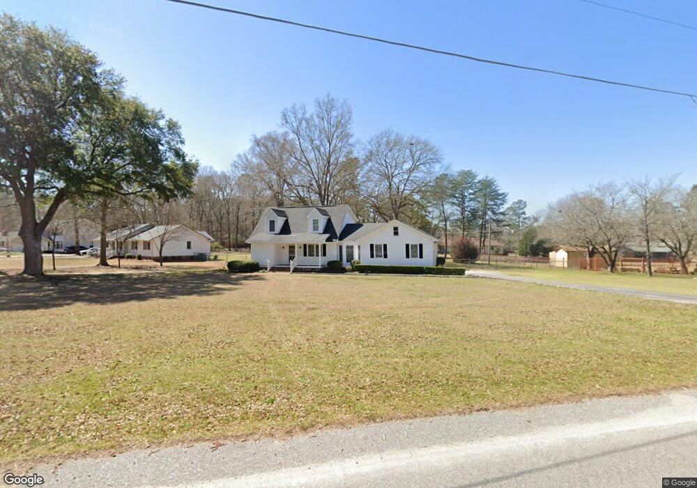
1969 Mcqueen Blvd Orangeburg, SC 29118
Estimated Value: $228,000 - $266,000
3
Beds
2
Baths
1,677
Sq Ft
$149/Sq Ft
Est. Value
About This Home
This home is located at 1969 Mcqueen Blvd, Orangeburg, SC 29118 and is currently estimated at $249,401, approximately $148 per square foot. 1969 Mcqueen Blvd is a home located in Orangeburg County with nearby schools including Marshall Elementary School, Marshall Elementary, and William J. Clark Middle School.
Ownership History
Date
Name
Owned For
Owner Type
Purchase Details
Closed on
Feb 16, 2021
Sold by
Investors Real Estate Sales Llc
Bought by
Frazier Roshonda Lynn
Current Estimated Value
Home Financials for this Owner
Home Financials are based on the most recent Mortgage that was taken out on this home.
Original Mortgage
$153,000
Outstanding Balance
$136,842
Interest Rate
2.7%
Mortgage Type
New Conventional
Estimated Equity
$112,559
Create a Home Valuation Report for This Property
The Home Valuation Report is an in-depth analysis detailing your home's value as well as a comparison with similar homes in the area
Home Values in the Area
Average Home Value in this Area
Purchase History
| Date | Buyer | Sale Price | Title Company |
|---|---|---|---|
| Frazier Roshonda Lynn | $170,000 | None Available |
Source: Public Records
Mortgage History
| Date | Status | Borrower | Loan Amount |
|---|---|---|---|
| Open | Frazier Roshonda Lynn | $153,000 |
Source: Public Records
Tax History Compared to Growth
Tax History
| Year | Tax Paid | Tax Assessment Tax Assessment Total Assessment is a certain percentage of the fair market value that is determined by local assessors to be the total taxable value of land and additions on the property. | Land | Improvement |
|---|---|---|---|---|
| 2024 | $1,346 | $6,788 | $1,056 | $5,732 |
| 2023 | $1,255 | $6,790 | $1,390 | $5,400 |
| 2022 | $3,047 | $6,790 | $1,390 | $5,400 |
| 2021 | $3,047 | $7,641 | $1,185 | $6,456 |
| 2020 | $2,802 | $5,094 | $790 | $4,304 |
| 2019 | $2,711 | $5,094 | $790 | $4,304 |
| 2018 | $512 | $5,074 | $790 | $4,284 |
| 2017 | $503 | $5,074 | $0 | $0 |
| 2016 | $503 | $5,074 | $0 | $0 |
| 2015 | $460 | $5,074 | $0 | $0 |
| 2014 | $460 | $5,074 | $790 | $4,284 |
| 2013 | -- | $4,610 | $790 | $3,820 |
Source: Public Records
Map
Nearby Homes
- 4098 Slaughter Dr
- 113 Ginger Unit Subdivision
- 2042 Clifton Cir
- 408 Grasshopper Ct
- 104 Knollwood Ct
- 4057 Creekmoor Dr
- 4265 Columbia Rd
- 4405 Cricket Dr
- 1501 Harris Dr
- 4480 Deerfield Dr
- 1357 Macon Dr
- 1039 Berkeley Dr
- 3236 Hart St
- 0 Ramsgate Dr Unit 24022640
- 4414 Ramsgate Dr
- 3265 Hunter Dr
- 783 Patriots Way
- 3210 Hunter Dr
- 1332 Dogwood Dr
- 0 Columbia Rd Unit 24022676
- 4183 Cedric St
- 1995 Mcqueen Blvd
- 4194 Cedric St
- 1970 Mcqueen Blvd
- 4082 Slaughter Dr
- 4167 Cedric St
- 4118 Slaughter Dr
- 1996 Mcqueen Blvd
- 4172 Cedric St
- 1944 Mcqueen Blvd
- 4066 Slaughter Dr
- 2030 Clifton Cir
- 4153 Cedric St
- 4146 Cedric St
- 4146 Cedric St
- 2020 Mcqueen Blvd
- 4185 Brown St
- 4185 Brown St
- 4185 Brown St
- 4185 Brown St