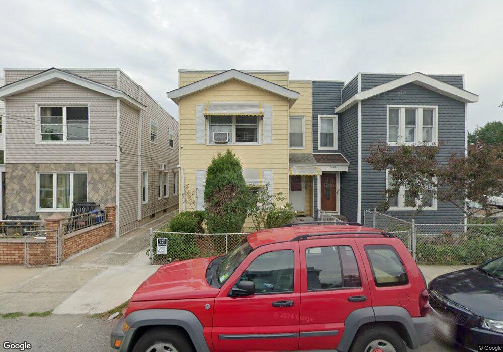
19704 91st Rd Hollis, NY 11423
Hollis NeighborhoodEstimated Value: $967,000 - $1,066,000
--
Bed
--
Bath
1,904
Sq Ft
$537/Sq Ft
Est. Value
About This Home
This home is located at 19704 91st Rd, Hollis, NY 11423 and is currently estimated at $1,022,667, approximately $537 per square foot. 19704 91st Rd is a home located in Queens County with nearby schools including P.S. 35 Nathaniel Woodhull, I.S. 238 Susan B Anthony Academy, and Wellspring Elementary & Middle.
Ownership History
Date
Name
Owned For
Owner Type
Purchase Details
Closed on
Jul 23, 2019
Sold by
Leroy Eline A
Bought by
Leroy Eline A and Leroy Marjorie
Current Estimated Value
Home Financials for this Owner
Home Financials are based on the most recent Mortgage that was taken out on this home.
Original Mortgage
$490,000
Interest Rate
3.5%
Mortgage Type
Purchase Money Mortgage
Purchase Details
Closed on
Jul 29, 2011
Sold by
Leroy Eline A and Leroy Paul-Pierre
Bought by
Leroy Eline A
Create a Home Valuation Report for This Property
The Home Valuation Report is an in-depth analysis detailing your home's value as well as a comparison with similar homes in the area
Home Values in the Area
Average Home Value in this Area
Purchase History
| Date | Buyer | Sale Price | Title Company |
|---|---|---|---|
| Leroy Eline A | -- | -- | |
| Leroy Eline A | -- | -- |
Source: Public Records
Mortgage History
| Date | Status | Borrower | Loan Amount |
|---|---|---|---|
| Previous Owner | Leroy Eline A | $490,000 |
Source: Public Records
Tax History Compared to Growth
Tax History
| Year | Tax Paid | Tax Assessment Tax Assessment Total Assessment is a certain percentage of the fair market value that is determined by local assessors to be the total taxable value of land and additions on the property. | Land | Improvement |
|---|---|---|---|---|
| 2025 | $6,457 | $35,558 | $11,810 | $23,748 |
| 2024 | $6,469 | $33,546 | $11,718 | $21,828 |
| 2023 | $6,076 | $31,649 | $10,387 | $21,262 |
| 2022 | $5,674 | $45,120 | $16,620 | $28,500 |
| 2021 | $5,988 | $38,580 | $16,620 | $21,960 |
| 2020 | $5,976 | $41,100 | $16,620 | $24,480 |
| 2019 | $2,265 | $45,300 | $16,620 | $28,680 |
| 2018 | $2,029 | $26,374 | $10,986 | $15,388 |
| 2017 | $3,158 | $24,883 | $10,975 | $13,908 |
| 2016 | $3,110 | $24,883 | $10,975 | $13,908 |
| 2015 | $2,831 | $24,693 | $13,753 | $10,940 |
| 2014 | $2,831 | $23,296 | $15,364 | $7,932 |
Source: Public Records
Map
Nearby Homes
- 90-35 198th St
- 89-48 196th St
- 9317 197th St
- 197-21 Carpenter Ave Unit 1G
- 197-31 Carpenter Ave
- 9051 201st St
- 94-72 199th St
- 92-22 195th Place
- 93-17 201st St
- 9302 202nd St
- 19515 Woodhull Ave
- 19511 Woodhull Ave
- 9141 195th St
- 8925 201st St
- 9048 204th St
- 90-62 204th St
- 88-27 196th St
- 93-45 202nd St
- 88-38 201st St
- 88-44 202nd St
- 197-06 91st Rd Unit 2nd Fl
- 197-06 91st Rd
- 19702 91st Rd
- 19706 91st Rd
- 19710 91st Rd
- 9131 197th St
- 19712 91st Rd
- 19714 91st Rd
- 19709 Jamaica Ave
- 19707 Jamaica Ave
- 9115 197th St
- 19715 Jamaica Ave
- 19711 Jamaica Ave
- 19716 91st Rd
- 19717 Jamaica Ave
- 197-11 Jamaica Ave
- 197-11 Jamaica Ave Unit 2nd Fl
- 19713 Jamaica Ave
- 9124 197th St
- 19713 Jamaica Ave Unit A