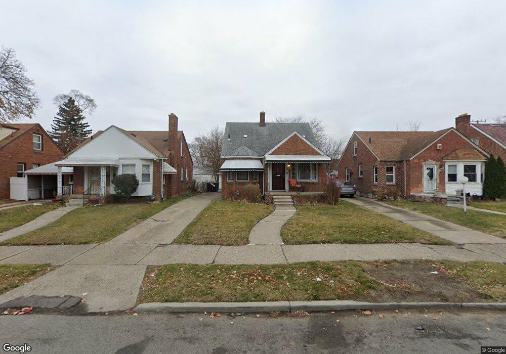
19718 Freeland St Detroit, MI 48235
Schaefer 7-8 Lodge NeighborhoodEstimated Value: $113,029 - $137,000
--
Bed
1
Bath
1,010
Sq Ft
$124/Sq Ft
Est. Value
About This Home
This home is located at 19718 Freeland St, Detroit, MI 48235 and is currently estimated at $124,757, approximately $123 per square foot. 19718 Freeland St is a home located in Wayne County with nearby schools including Vernor Elementary School, Charles L. Spain Elementary-Middle School, and Edward 'Duke' Ellington Conservatory of Music and Art.
Ownership History
Date
Name
Owned For
Owner Type
Purchase Details
Closed on
Oct 18, 2022
Sold by
City Of Detroit
Bought by
United Cmnty Housing Coalition
Current Estimated Value
Purchase Details
Closed on
Aug 25, 2022
Sold by
Sabree Eric R
Bought by
City Of Detroit
Purchase Details
Closed on
May 29, 2018
Sold by
Tapley Alan
Bought by
Young Arthur
Purchase Details
Closed on
Apr 29, 2014
Sold by
Powell S J
Bought by
Tapley Allan
Purchase Details
Closed on
Jan 24, 2013
Sold by
Powell S J
Bought by
Powell S J
Create a Home Valuation Report for This Property
The Home Valuation Report is an in-depth analysis detailing your home's value as well as a comparison with similar homes in the area
Home Values in the Area
Average Home Value in this Area
Purchase History
| Date | Buyer | Sale Price | Title Company |
|---|---|---|---|
| United Cmnty Housing Coalition | $236,565 | None Listed On Document | |
| United Cmnty Housing Coalition | $236,565 | None Listed On Document | |
| City Of Detroit | $19,628 | -- | |
| Young Arthur | -- | None Available | |
| Tapley Allan | -- | None Available | |
| Powell S J | -- | None Available |
Source: Public Records
Tax History Compared to Growth
Tax History
| Year | Tax Paid | Tax Assessment Tax Assessment Total Assessment is a certain percentage of the fair market value that is determined by local assessors to be the total taxable value of land and additions on the property. | Land | Improvement |
|---|---|---|---|---|
| 2025 | $2,851 | $61,500 | $0 | $0 |
| 2024 | $2,851 | $52,800 | $0 | $0 |
| 2023 | $1,250 | $42,300 | $0 | $0 |
| 2022 | $1,117 | $32,700 | $0 | $0 |
| 2021 | $1,090 | $22,600 | $0 | $0 |
| 2020 | $1,079 | $20,600 | $0 | $0 |
| 2019 | $1,063 | $16,500 | $0 | $0 |
| 2018 | $912 | $14,500 | $0 | $0 |
| 2017 | $212 | $13,600 | $0 | $0 |
| 2016 | $1,026 | $13,100 | $0 | $0 |
| 2015 | $1,310 | $13,100 | $0 | $0 |
| 2013 | $1,933 | $19,325 | $0 | $0 |
| 2010 | -- | $28,334 | $1,020 | $27,314 |
Source: Public Records
Map
Nearby Homes
- 19757 Freeland St
- 14250 Vassar Ave
- 14024 Pembroke Ave
- 19490 Hubbell St
- 19505 Tracey St
- 19476 Hubbell St
- 19335 Ardmore St
- 19360 Strathmoor St
- 20032 Stansbury St
- 19733 Schaefer Hwy
- 13645 Vassar Ave
- 19925 Schaefer Hwy
- 19978 Tracey St
- 19721 Hartwell St
- 13517 Pembroke Ave
- 19483 Hartwell St
- 19193 Lesure St
- 19341 Schaefer Hwy
- 20110 Lesure St
- 19909 Hartwell St
- 19710 Freeland St
- 19726 Freeland St
- 19719 Ardmore St
- 19729 Ardmore St
- 19700 Freeland St
- 19700 Freeland St
- 19734 Freeland St
- 19742 Freeland St
- 19711 Ardmore St
- 19711 Ardmore St
- 19703 Ardmore St
- 19735 Ardmore St
- 19750 Freeland St
- 19506 Freeland St
- 19743 Ardmore St
- 19719 Freeland St
- 19725 Freeland St
- 19709 Freeland St
- 19759 Ardmore St
- 19735 Freeland St