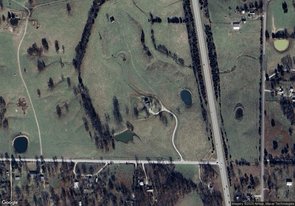
19803 Independence Rd Lebanon, MO 65536
Estimated Value: $309,000 - $395,000
--
Bed
1
Bath
3,272
Sq Ft
$108/Sq Ft
Est. Value
About This Home
This home is located at 19803 Independence Rd, Lebanon, MO 65536 and is currently estimated at $352,885, approximately $107 per square foot. 19803 Independence Rd is a home located in Laclede County with nearby schools including Joe D. Esther Elementary School, Boswell Elementary School, and Maplecrest Elementary School.
Ownership History
Date
Name
Owned For
Owner Type
Purchase Details
Closed on
Mar 14, 2013
Sold by
Reed Mariann L
Bought by
Fox Donald D and Fox Stacey L
Current Estimated Value
Home Financials for this Owner
Home Financials are based on the most recent Mortgage that was taken out on this home.
Original Mortgage
$262,029
Outstanding Balance
$185,158
Interest Rate
3.57%
Mortgage Type
Future Advance Clause Open End Mortgage
Estimated Equity
$167,727
Create a Home Valuation Report for This Property
The Home Valuation Report is an in-depth analysis detailing your home's value as well as a comparison with similar homes in the area
Home Values in the Area
Average Home Value in this Area
Purchase History
| Date | Buyer | Sale Price | Title Company |
|---|---|---|---|
| Fox Donald D | -- | None Available |
Source: Public Records
Mortgage History
| Date | Status | Borrower | Loan Amount |
|---|---|---|---|
| Open | Fox Donald D | $262,029 |
Source: Public Records
Tax History Compared to Growth
Tax History
| Year | Tax Paid | Tax Assessment Tax Assessment Total Assessment is a certain percentage of the fair market value that is determined by local assessors to be the total taxable value of land and additions on the property. | Land | Improvement |
|---|---|---|---|---|
| 2025 | $1,619 | $32,980 | $0 | $0 |
| 2024 | $1,619 | $29,350 | $0 | $0 |
| 2023 | $1,610 | $29,350 | $0 | $0 |
| 2022 | $1,610 | $29,350 | $0 | $0 |
| 2021 | $1,568 | $29,355 | $1,102 | $28,253 |
| 2020 | $1,574 | $29,355 | $1,102 | $28,253 |
| 2019 | $1,499 | $29,350 | $1,100 | $28,250 |
| 2018 | $1,343 | $29,350 | $1,100 | $28,250 |
| 2017 | $1,266 | $29,350 | $0 | $0 |
| 2016 | $1,266 | $29,350 | $0 | $0 |
| 2015 | $1,266 | $29,350 | $0 | $0 |
| 2014 | $1,266 | $29,410 | $0 | $0 |
| 2013 | -- | $29,410 | $0 | $0 |
Source: Public Records
Map
Nearby Homes
- 19954 Ironwood Ln
- 30117 Orange Blossom Ln
- 30445 Orchard Dr
- 30274 State Highway Bb
- 30274 Highway Bb
- 30420 State Highway Bb
- 19277 Jewell Rd
- 31201 Osborn Dr
- 30672 Highway Bb
- 31 Ontario Dr
- 17 Grandlake Cir
- 2 Grandlake Cir
- 10 Grandlake Cir
- TBD County Road Vv-225
- 20193 SW Oakwood Dr
- 20150 SW Oakwood Dr
- 20448 Oakway Dr
- 1 Grandlake Cir
- 31514 Old Highway 5
- 31625 Old Highway 5
- 19887 Independence Rd
- 19688 Independence Rd
- 19688 Independence Rd
- 28943 Orchard Dr
- 19564 Independence Rd
- 30197 Pelican Dr
- 29122 Orchard Dr
- 29090 Orchard Dr
- 19488 Independence Rd
- 29150 Orchard Dr
- 29499 Orchard Dr
- 29002 Orchard Dr
- 19498 Independence Rd
- 29727 Orchard Dr
- 20030 Kenyon Ln
- 0 Ironwood Ln
- 20070 Kenyon Ln
- 20023 Kenyon Ln
- 19123 Independence Rd
- 20152 Kenyon Ln
