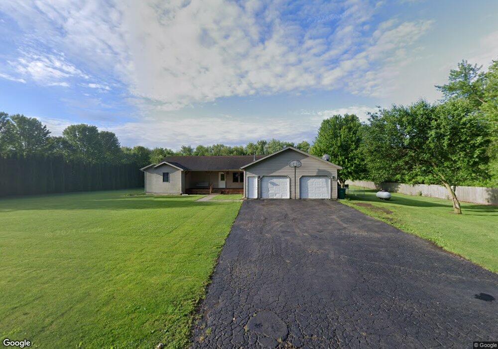
1988 E 500 S La Porte, IN 46350
Estimated Value: $262,000 - $338,000
3
Beds
3
Baths
1,804
Sq Ft
$174/Sq Ft
Est. Value
About This Home
This home is located at 1988 E 500 S, La Porte, IN 46350 and is currently estimated at $314,071, approximately $174 per square foot. 1988 E 500 S is a home located in LaPorte County with nearby schools including Kingsford Heights Elementary School, La Porte High School, and Dunkerton High School.
Ownership History
Date
Name
Owned For
Owner Type
Purchase Details
Closed on
Oct 23, 2015
Sold by
Campbell Stephen J and Fletcher Christy
Bought by
Campbell Stephen J
Current Estimated Value
Purchase Details
Closed on
Oct 1, 2015
Sold by
Campbell Stephen J
Bought by
Campbell Stephen J and Fletcher Christy
Purchase Details
Closed on
Jul 9, 2014
Sold by
Jeffers Thomas Eugene
Bought by
Campbell Stephen J
Purchase Details
Closed on
Jan 31, 2006
Sold by
Jeffers Thomas Eugene
Bought by
Bissonnette Brenda Kay
Create a Home Valuation Report for This Property
The Home Valuation Report is an in-depth analysis detailing your home's value as well as a comparison with similar homes in the area
Home Values in the Area
Average Home Value in this Area
Purchase History
| Date | Buyer | Sale Price | Title Company |
|---|---|---|---|
| Campbell Stephen J | -- | None Available | |
| Campbell Stephen J | -- | None Available | |
| Campbell Stephen J | -- | Fidelity Natl Title Ins Co | |
| Campbell Stephen J | -- | None Available | |
| Bissonnette Brenda Kay | -- | None Available |
Source: Public Records
Tax History Compared to Growth
Tax History
| Year | Tax Paid | Tax Assessment Tax Assessment Total Assessment is a certain percentage of the fair market value that is determined by local assessors to be the total taxable value of land and additions on the property. | Land | Improvement |
|---|---|---|---|---|
| 2024 | $4,231 | $199,500 | $30,000 | $169,500 |
| 2022 | $2,088 | $204,400 | $30,000 | $174,400 |
| 2021 | $1,990 | $192,400 | $30,000 | $162,400 |
| 2020 | $1,929 | $192,400 | $30,000 | $162,400 |
| 2019 | $1,855 | $183,800 | $21,100 | $162,700 |
| 2018 | $1,898 | $184,400 | $21,100 | $163,300 |
| 2017 | $1,683 | $173,200 | $21,100 | $152,100 |
| 2016 | $3,347 | $188,700 | $30,000 | $158,700 |
| 2014 | $1,188 | $142,900 | $21,100 | $121,800 |
Source: Public Records
Map
Nearby Homes
- 2208 E 450 S
- 0 Pinoak Dr
- 0 E Aspen Ln
- 7808 S 1st Line Rd
- 307 N Main St
- 0 Oakwood Dr Unit NRA812783
- 0 W 500 S
- Lot 17 S Morgan Rd
- Lot 16 S Morgan Rd
- Lot 37 S Morgan Rd
- 64 Green Lawn Dr
- 0 S Arrowhead Ln
- 242 W Powell Dr
- 577 W Nowak Dr
- 40 W Nowak Dr
- 41 W Nowak Dr
- 3466 S State Road 104
- 2721 S 75 W
- 3727 Nordway
- 0 E State Road 4