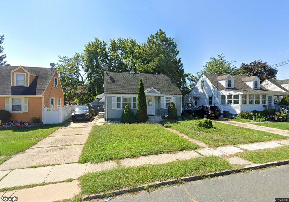
199 Atlantic Ave Trenton, NJ 08609
Estimated Value: $308,617 - $396,000
--
Bed
--
Bath
1,008
Sq Ft
$346/Sq Ft
Est. Value
About This Home
This home is located at 199 Atlantic Ave, Trenton, NJ 08609 and is currently estimated at $348,404, approximately $345 per square foot. 199 Atlantic Ave is a home located in Mercer County with nearby schools including Greenwood Elementary School, Richard C. Crockett Middle School, and Nottingham High School - North.
Ownership History
Date
Name
Owned For
Owner Type
Purchase Details
Closed on
May 14, 2007
Sold by
Retana Manuel
Bought by
Boyce Robert and Weah Beatrice
Current Estimated Value
Home Financials for this Owner
Home Financials are based on the most recent Mortgage that was taken out on this home.
Original Mortgage
$205,770
Outstanding Balance
$125,232
Interest Rate
6.18%
Mortgage Type
FHA
Estimated Equity
$223,172
Purchase Details
Closed on
Jul 24, 2001
Sold by
Halley Allen
Bought by
Retana Manuel
Home Financials for this Owner
Home Financials are based on the most recent Mortgage that was taken out on this home.
Original Mortgage
$86,400
Interest Rate
7.18%
Mortgage Type
Purchase Money Mortgage
Create a Home Valuation Report for This Property
The Home Valuation Report is an in-depth analysis detailing your home's value as well as a comparison with similar homes in the area
Home Values in the Area
Average Home Value in this Area
Purchase History
| Date | Buyer | Sale Price | Title Company |
|---|---|---|---|
| Boyce Robert | $209,000 | -- | |
| Retana Manuel | $108,000 | -- |
Source: Public Records
Mortgage History
| Date | Status | Borrower | Loan Amount |
|---|---|---|---|
| Open | Boyce Robert | $205,770 | |
| Previous Owner | Retana Manuel | $86,400 |
Source: Public Records
Tax History Compared to Growth
Tax History
| Year | Tax Paid | Tax Assessment Tax Assessment Total Assessment is a certain percentage of the fair market value that is determined by local assessors to be the total taxable value of land and additions on the property. | Land | Improvement |
|---|---|---|---|---|
| 2025 | $4,461 | $126,600 | $33,400 | $93,200 |
| 2024 | $4,182 | $126,600 | $33,400 | $93,200 |
| 2023 | $4,182 | $126,600 | $33,400 | $93,200 |
| 2022 | $4,116 | $126,600 | $33,400 | $93,200 |
| 2021 | $4,865 | $126,600 | $33,400 | $93,200 |
| 2020 | $4,409 | $126,600 | $33,400 | $93,200 |
| 2019 | $4,298 | $126,600 | $33,400 | $93,200 |
| 2018 | $4,188 | $126,600 | $33,400 | $93,200 |
| 2017 | $4,079 | $126,600 | $33,400 | $93,200 |
| 2016 | $3,423 | $126,600 | $33,400 | $93,200 |
| 2015 | $4,434 | $88,000 | $15,100 | $72,900 |
| 2014 | $4,348 | $88,000 | $15,100 | $72,900 |
Source: Public Records
Map
Nearby Homes
- 194 Atlantic Ave
- 151 S Logan Ave
- 116 Cleveland Ave
- 43 1/2 S Logan Ave
- 224 Garfield Ave
- 63 Garfield Ave
- 82-84 Ward Ave
- 254 S Olden Ave
- 365 Cleveland Ave
- 448 Lynwood Ave
- 19 Scammel Ave
- 238 S Walter Ave
- 1524 Elizabeth Ave
- 66 N Olden Ave
- 121 Parker Place
- 812 E State St
- 251 S Walter Ave
- 618 Atlantic Ave
- 1335 Nottingham Way
- 235 Darcy Ave
- 193 Atlantic Ave
- 205 Atlantic Ave
- 187 Atlantic Ave
- 211 Atlantic Ave
- 200 Atlantic Ave
- 206 Atlantic Ave
- 217 Atlantic Ave
- 188 Atlantic Ave
- 223 Atlantic Ave
- 218 Atlantic Ave
- 217 Connecticut Ave
- 223 Connecticut Ave
- 229 Atlantic Ave
- 224 Atlantic Ave
- 207 Connecticut Ave
- 237 Connecticut Ave
- 241 Connecticut Ave
- 230 Atlantic Ave
- 235 Atlantic Ave
- 249 Connecticut Ave