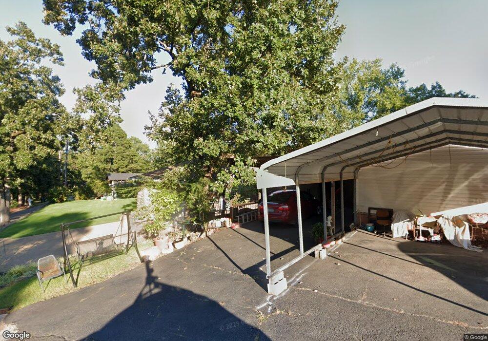
199 Warpath Dr Hot Springs National Park, AR 71913
Estimated Value: $601,331 - $803,000
--
Bed
3
Baths
3,060
Sq Ft
$223/Sq Ft
Est. Value
About This Home
This home is located at 199 Warpath Dr, Hot Springs National Park, AR 71913 and is currently estimated at $682,110, approximately $222 per square foot. 199 Warpath Dr is a home located in Garland County with nearby schools including Lake Hamilton Primary School, Lake Hamilton Elementary School, and Lake Hamilton Interm. School.
Ownership History
Date
Name
Owned For
Owner Type
Purchase Details
Closed on
Sep 21, 2012
Bought by
Hosier Walter and Revocable Trust
Current Estimated Value
Purchase Details
Closed on
Aug 30, 2012
Bought by
Hosier Walter and Revocable Trust
Purchase Details
Closed on
Jun 28, 2004
Sold by
Not Provided
Bought by
Hosier Walter L and Hosier Janet
Purchase Details
Closed on
Jan 1, 1901
Bought by
Altenburger Thelma M and 9 Leeward Ct
Create a Home Valuation Report for This Property
The Home Valuation Report is an in-depth analysis detailing your home's value as well as a comparison with similar homes in the area
Home Values in the Area
Average Home Value in this Area
Purchase History
| Date | Buyer | Sale Price | Title Company |
|---|---|---|---|
| Hosier Walter | -- | -- | |
| Walter & Janet Hosier Revocable Trust | -- | -- | |
| Hosier Walter | -- | -- | |
| Hosier Walter L | $35,000 | -- | |
| Altenburger Thelma M | -- | -- |
Source: Public Records
Tax History Compared to Growth
Tax History
| Year | Tax Paid | Tax Assessment Tax Assessment Total Assessment is a certain percentage of the fair market value that is determined by local assessors to be the total taxable value of land and additions on the property. | Land | Improvement |
|---|---|---|---|---|
| 2025 | $2,501 | $121,260 | $12,600 | $108,660 |
| 2024 | $2,559 | $121,260 | $12,600 | $108,660 |
| 2023 | $2,634 | $121,260 | $12,600 | $108,660 |
| 2022 | $3,134 | $121,260 | $12,600 | $108,660 |
| 2021 | $2,994 | $66,370 | $11,340 | $55,030 |
| 2020 | $2,559 | $66,370 | $11,340 | $55,030 |
| 2019 | $2,559 | $66,370 | $11,340 | $55,030 |
| 2018 | $2,559 | $66,370 | $11,340 | $55,030 |
| 2017 | $2,584 | $66,370 | $11,340 | $55,030 |
| 2016 | $2,410 | $62,450 | $8,400 | $54,050 |
| 2015 | $2,410 | $62,450 | $8,400 | $54,050 |
| 2014 | $2,760 | $62,450 | $8,400 | $54,050 |
Source: Public Records
Map
Nearby Homes
- 126 Southshore Dr
- 208 Southshore Dr
- TBD Warpath Dr
- 531 Northshore Dr
- 188 Carl Finch Rd
- 120 Silverwood Terrace
- 000 Geronimo St
- Lot 4 Wampum Cir
- Lot 3 Wampum Cir
- 108 Silverwood Terrace
- 105 Lu Juan Point
- 128 Waterview Dr
- 112 Kathy Ln
- 2850 Marion Anderson Rd
- 117 Gregory Dr
- 128 Bender Point
- 119 Bluebird Ln
- 215 Osprey Dr
- 112 Bluebird Ln
- 000 Osprey Point
- 114 Indian Lodge Point
- 116 Indian Lodge Point
- 118 Indian Lodge Point
- 111 Indian Lodge Point
- 180 Warpath Dr
- 120 Indian Lodge Point
- 219 Warpath Dr
- 122 Indian Lodge Point
- 170 Warpath Dr
- 109 Indian Lodge Point
- 107 Indian Lodge Point
- 0 Warpath Dr Unit 16034443
- 0 Warpath Dr Unit 17017669
- 102 Indian Lodge Point
- 102 Indian Lodge
- 399 Geronimo St
- 239 Warpath Dr
- 118 Southshore Dr
- 206 Southshore Dr
- 212 Southshore Dr