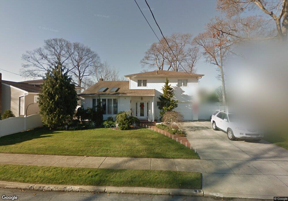
2 Bonnie Ln Massapequa, NY 11758
Estimated Value: $736,550 - $821,000
--
Bed
3
Baths
1,372
Sq Ft
$568/Sq Ft
Est. Value
About This Home
This home is located at 2 Bonnie Ln, Massapequa, NY 11758 and is currently estimated at $778,775, approximately $567 per square foot. 2 Bonnie Ln is a home located in Nassau County with nearby schools including Berner Middle School, Massapequa High School - Ames Campus, and Massapequa High School.
Ownership History
Date
Name
Owned For
Owner Type
Purchase Details
Closed on
Apr 11, 1997
Sold by
Tricarcio Charles J
Bought by
Comstock Joseph C and Comstock Annmarie
Current Estimated Value
Purchase Details
Closed on
May 24, 1995
Sold by
Rafferty Kenneth
Bought by
Tricarico Charles
Home Financials for this Owner
Home Financials are based on the most recent Mortgage that was taken out on this home.
Original Mortgage
$179,200
Interest Rate
8.2%
Create a Home Valuation Report for This Property
The Home Valuation Report is an in-depth analysis detailing your home's value as well as a comparison with similar homes in the area
Home Values in the Area
Average Home Value in this Area
Purchase History
| Date | Buyer | Sale Price | Title Company |
|---|---|---|---|
| Comstock Joseph C | $265,000 | -- | |
| Tricarico Charles | $224,000 | -- |
Source: Public Records
Mortgage History
| Date | Status | Borrower | Loan Amount |
|---|---|---|---|
| Previous Owner | Tricarico Charles | $179,200 |
Source: Public Records
Tax History Compared to Growth
Tax History
| Year | Tax Paid | Tax Assessment Tax Assessment Total Assessment is a certain percentage of the fair market value that is determined by local assessors to be the total taxable value of land and additions on the property. | Land | Improvement |
|---|---|---|---|---|
| 2025 | $12,660 | $478 | $171 | $307 |
| 2024 | $4,147 | $501 | $179 | $322 |
| 2023 | $13,234 | $566 | $204 | $362 |
| 2022 | $13,234 | $571 | $204 | $367 |
| 2021 | $12,684 | $551 | $197 | $354 |
| 2020 | $11,649 | $653 | $652 | $1 |
| 2019 | $10,300 | $699 | $583 | $116 |
| 2018 | $10,242 | $884 | $0 | $0 |
| 2017 | $7,363 | $884 | $578 | $306 |
| 2016 | $11,663 | $1,128 | $737 | $391 |
| 2015 | $4,925 | $1,128 | $737 | $391 |
| 2014 | $4,925 | $1,128 | $737 | $391 |
| 2013 | $4,479 | $1,128 | $737 | $391 |
Source: Public Records
Map
Nearby Homes
- 7 Amherst Place
- 9 Rugby Rd
- 115 Primrose Ave
- 9 Suzanne B Ct
- 110 Kinsella Ave
- 136 Reiss Ave
- 32 Massapequa Ave
- 37 Lakeshore Blvd
- 31 Morton Ave
- 55 Laurel Dr
- 38 Abbey St
- 200 Saint Regis Dr
- 280 Carol Dr
- 53 Glengariff Rd
- 91 Harbor Ln
- 43 Seabreeze Rd
- 4 Sutton Place
- 100 Biltmore Blvd
- 5675 Merrick Rd
- 321 Brendan Ave