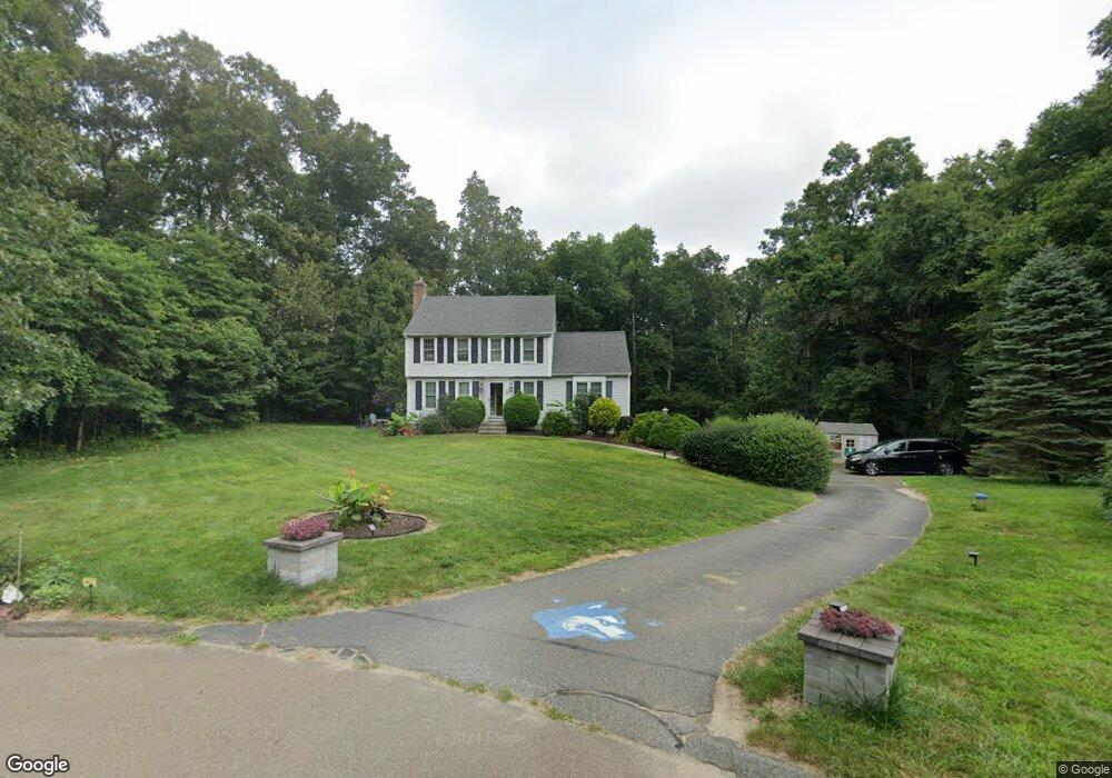
2 Davis Farm Rd Clinton, CT 06413
Estimated Value: $499,684 - $581,000
3
Beds
3
Baths
1,610
Sq Ft
$331/Sq Ft
Est. Value
About This Home
This home is located at 2 Davis Farm Rd, Clinton, CT 06413 and is currently estimated at $532,921, approximately $331 per square foot. 2 Davis Farm Rd is a home located in Middlesex County with nearby schools including Lewin G. Joel Jr. School and The Morgan School.
Ownership History
Date
Name
Owned For
Owner Type
Purchase Details
Closed on
Aug 31, 2007
Sold by
Damon Shawn and Damon Kathryn
Bought by
Supik Christopher and Supik Mary
Current Estimated Value
Home Financials for this Owner
Home Financials are based on the most recent Mortgage that was taken out on this home.
Original Mortgage
$290,000
Outstanding Balance
$184,921
Interest Rate
6.71%
Estimated Equity
$348,000
Purchase Details
Closed on
May 4, 2004
Sold by
Onofrio Gary R and Onofrio Joan K
Bought by
Damon Shawn and Cole Kathryn J
Purchase Details
Closed on
Jun 29, 2001
Sold by
Dasinger Andrew M and Dasinger Sue B
Bought by
Onofrio Gary R and Onofrio Joan K
Purchase Details
Closed on
Aug 22, 1996
Sold by
Bjorkdahl Roger C and Bjorkdahl Betty J
Bought by
Dasinger Andrew M and Dasinger Sue B
Purchase Details
Closed on
Apr 1, 1996
Sold by
Dahlem Michael H and Dahlem Terri K
Bought by
Bjorkdahl Roger C and Bjorkdahl Betty J
Create a Home Valuation Report for This Property
The Home Valuation Report is an in-depth analysis detailing your home's value as well as a comparison with similar homes in the area
Home Values in the Area
Average Home Value in this Area
Purchase History
| Date | Buyer | Sale Price | Title Company |
|---|---|---|---|
| Supik Christopher | $362,500 | -- | |
| Supik Christopher | $362,500 | -- | |
| Damon Shawn | $285,000 | -- | |
| Damon Shawn | $285,000 | -- | |
| Onofrio Gary R | $242,900 | -- | |
| Onofrio Gary R | $242,900 | -- | |
| Dasinger Andrew M | $168,500 | -- | |
| Dasinger Andrew M | $168,500 | -- | |
| Bjorkdahl Roger C | $167,189 | -- | |
| Bjorkdahl Roger C | $167,189 | -- |
Source: Public Records
Mortgage History
| Date | Status | Borrower | Loan Amount |
|---|---|---|---|
| Closed | Bjorkdahl Roger C | $0 | |
| Open | Bjorkdahl Roger C | $290,000 |
Source: Public Records
Tax History Compared to Growth
Tax History
| Year | Tax Paid | Tax Assessment Tax Assessment Total Assessment is a certain percentage of the fair market value that is determined by local assessors to be the total taxable value of land and additions on the property. | Land | Improvement |
|---|---|---|---|---|
| 2025 | $6,792 | $218,100 | $79,400 | $138,700 |
| 2024 | $6,600 | $218,100 | $79,400 | $138,700 |
| 2023 | $6,506 | $218,100 | $79,400 | $138,700 |
| 2022 | $6,506 | $218,100 | $79,400 | $138,700 |
| 2021 | $5,659 | $189,700 | $73,100 | $116,600 |
| 2020 | $5,928 | $189,700 | $73,100 | $116,600 |
| 2019 | $5,928 | $189,700 | $73,100 | $116,600 |
| 2018 | $5,793 | $189,700 | $73,100 | $116,600 |
| 2017 | $5,674 | $189,700 | $73,100 | $116,600 |
| 2016 | $5,148 | $189,700 | $73,100 | $116,600 |
| 2015 | $5,603 | $209,300 | $85,700 | $123,600 |
| 2014 | $5,498 | $209,300 | $85,700 | $123,600 |
Source: Public Records
Map
Nearby Homes
- 23 Egypt Ln
- 7 Rocky Ledge Dr
- 131 Cow Hill Rd
- 21 Stonewall Ln
- 246 Cow Hill Rd
- 14 Blaine Ave
- 148 Glenwood Rd
- 7 Taylor Ridge Rd
- 25 Olde Orchard Rd
- 5 Kings Grant Rd
- 47 Brickyard Rd
- 6 Hemlock Hill Rd
- 36 Silver Birch Ln
- 26 Ninety Rod Rd
- 3 Circle Dr
- 76 Fairy Dell Rd
- 0 Fairy Dell Rd
- 15 Alden Dr
- 4 Laurel Ln
- 48A Ironworks Rd
- 16 Colonial Dr
- 18 Colonial Dr
- 14 Colonial Dr
- 6 Davis Farm Rd
- 27 Rocky Ledge Dr
- 1 Davis Farm Rd
- 12 Colonial Dr
- 3 Davis Farm Rd
- 8 Davis Farm Rd
- 5 Davis Farm Rd
- 19 Colonial Dr
- 21 Colonial Dr
- 17 Colonial Dr
- 29 Rocky Ledge Dr
- 15 Colonial Dr
- 25 Rocky Ledge Dr
- 116 Killingworth Turnpike
- 7 Davis Farm Rd
- 10 Davis Farm Rd
- 31 Rocky Ledge Dr