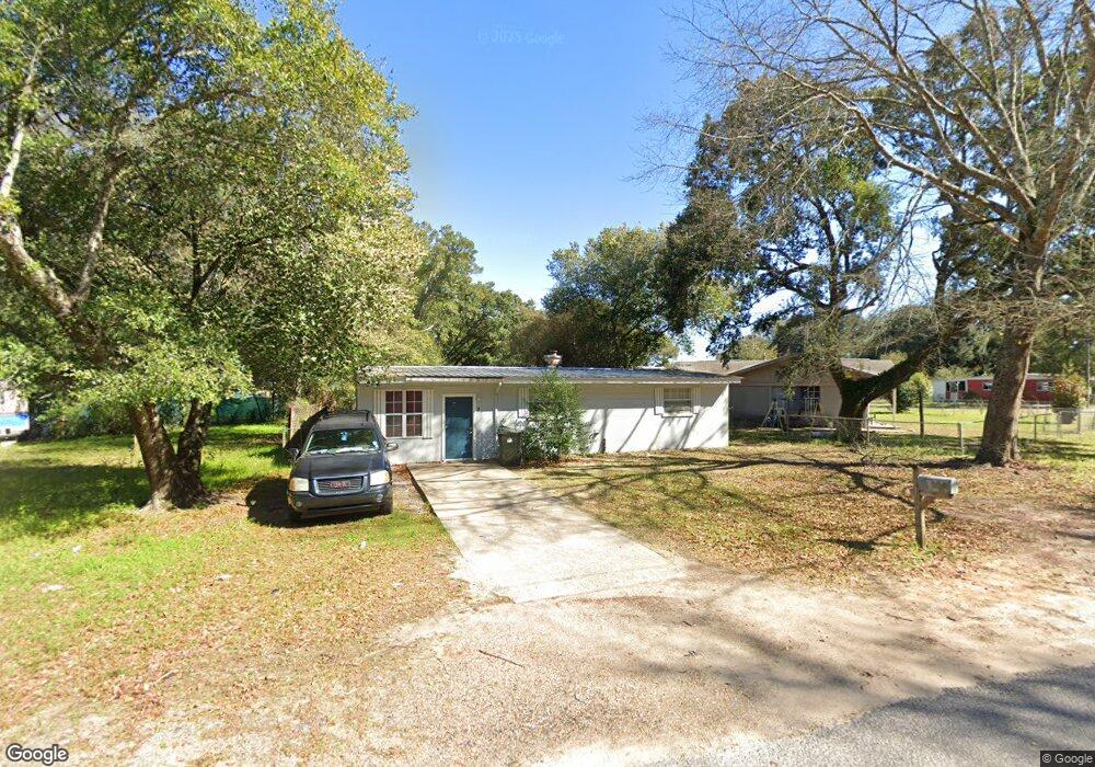
2 Nevada Cir Pensacola, FL 32505
Estimated Value: $71,000 - $108,000
--
Bed
1
Bath
968
Sq Ft
$99/Sq Ft
Est. Value
About This Home
This home is located at 2 Nevada Cir, Pensacola, FL 32505 and is currently estimated at $95,499, approximately $98 per square foot. 2 Nevada Cir is a home located in Escambia County with nearby schools including Oakcrest Elementary School, Warrington Middle School, and Escambia High School.
Ownership History
Date
Name
Owned For
Owner Type
Purchase Details
Closed on
Oct 11, 2019
Sold by
Gray Michael A and Gray Jean A
Bought by
Seaside 1882 Llc
Current Estimated Value
Purchase Details
Closed on
Feb 18, 2000
Sold by
Norwest Bk Mn
Bought by
Gray Michael A and Gray Jean A
Home Financials for this Owner
Home Financials are based on the most recent Mortgage that was taken out on this home.
Original Mortgage
$19,500
Interest Rate
8.29%
Purchase Details
Closed on
Dec 19, 1997
Sold by
Roulier Ronald P and Roulier Connie
Bought by
Hayno Dale
Home Financials for this Owner
Home Financials are based on the most recent Mortgage that was taken out on this home.
Original Mortgage
$31,500
Interest Rate
7.26%
Purchase Details
Closed on
Oct 25, 1996
Sold by
Hillis Arthur F and Hillis Margaret
Bought by
Roulier Ronald P and Roulier Connie
Create a Home Valuation Report for This Property
The Home Valuation Report is an in-depth analysis detailing your home's value as well as a comparison with similar homes in the area
Home Values in the Area
Average Home Value in this Area
Purchase History
| Date | Buyer | Sale Price | Title Company |
|---|---|---|---|
| Seaside 1882 Llc | $37,000 | Achieve Title Services Llc | |
| Gray Michael A | $27,500 | -- | |
| Hayno Dale | $44,400 | -- | |
| Roulier Ronald P | $18,000 | -- |
Source: Public Records
Mortgage History
| Date | Status | Borrower | Loan Amount |
|---|---|---|---|
| Previous Owner | Gray Michael A | $19,500 | |
| Previous Owner | Hayno Dale | $31,500 |
Source: Public Records
Tax History Compared to Growth
Tax History
| Year | Tax Paid | Tax Assessment Tax Assessment Total Assessment is a certain percentage of the fair market value that is determined by local assessors to be the total taxable value of land and additions on the property. | Land | Improvement |
|---|---|---|---|---|
| 2024 | $895 | $79,393 | $20,000 | $59,393 |
| 2023 | $895 | $42,509 | $0 | $0 |
| 2022 | $755 | $53,841 | $8,000 | $45,841 |
| 2021 | $672 | $40,688 | $0 | $0 |
| 2020 | $603 | $31,939 | $0 | $0 |
| 2019 | $512 | $27,326 | $0 | $0 |
| 2018 | $490 | $25,695 | $0 | $0 |
| 2017 | $441 | $19,138 | $0 | $0 |
| 2016 | $503 | $23,249 | $0 | $0 |
| 2015 | $518 | $25,690 | $0 | $0 |
| 2014 | $494 | $24,725 | $0 | $0 |
Source: Public Records
Map
Nearby Homes
- 213 Emerald Ave
- 200 Georgia Dr
- 901 S Madison Dr
- 102 Tennessee Dr
- 837 S Madison Dr
- 6 Georgia Dr
- 2208 Oakwood Ave
- 835 S Madison Dr
- 1014 Kearny Dr
- 823 S Madison Dr
- 1020 E Madison Dr
- 245 Aquamarine Ave
- 814 S Madison Dr
- 112 Saint Regis Dr
- 1005 Revere Dr
- 3905 W Avery St
- 3917 W Mallory St
- 1414 Clio Dr
- 305 N Madison Dr
- 4639 Wabash Ave